As the weekend neared, it looked like there was a chance for some good boating. I had missed all the fun the previous weekend when there was some good rain, but it left the area primed. Watching the snow that came on Thursday, I more and more felt like it would be good for a mission. There was a decent amount of precipitation, all frozen, and it would be warming up. I had a decent amount of interest as well. As Friday progressed I started focusing in on the Tygart and Buckhannon basin. Both were high, at the very top of the runable level. Closer runs were still trending downward and didn’t look like this would change by Saturday morning. Eventually I focused in on Teter Creek and announced the call. With a decision made people started dropping out, due to the distance. A number decided to head to the Top Yough. The evening rolled around and it looked like it would just be Bob, Ken, and myself. After some calls around I determined that everyone was ok with the small group size and the mission was on.
Teter Creek
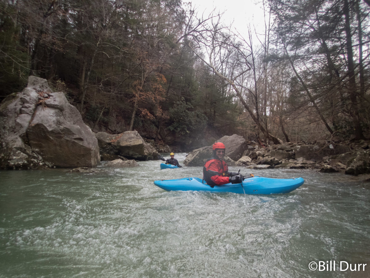
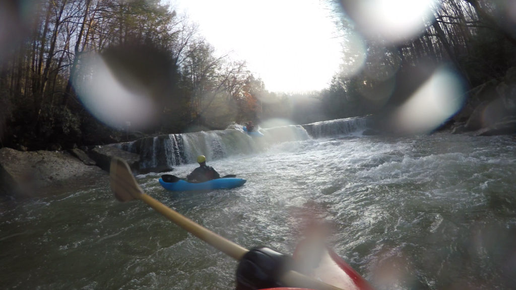
The chosen run was Teter Creek. From what I could tell, this was the one that would fall out first. We met up at the Gaithersburg park and ride to start the journey and I volunteered to be the driver of the alone car. When we got to the river, the water looked low but enough to scrape down. We decided it was a go. The shuttle down through Moatsville to the Tygart was short, maybe 10 minutes to run the whole thing and gave a decent overview of the run. Where we put in the gradient was low and the dogs many. About 10 dogs followed us for a short distance, barking all the way. The first few miles were twisting and mostly flat. It made its way through some farms and the quality of the scenery was not great. There was lots trash in the trees.
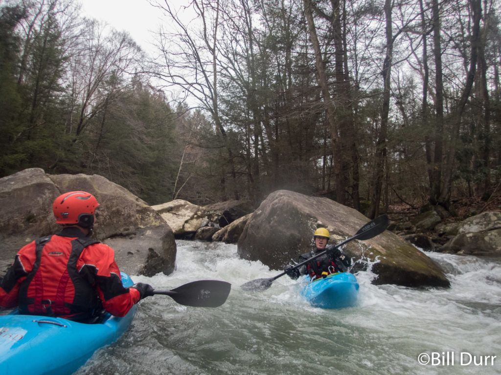
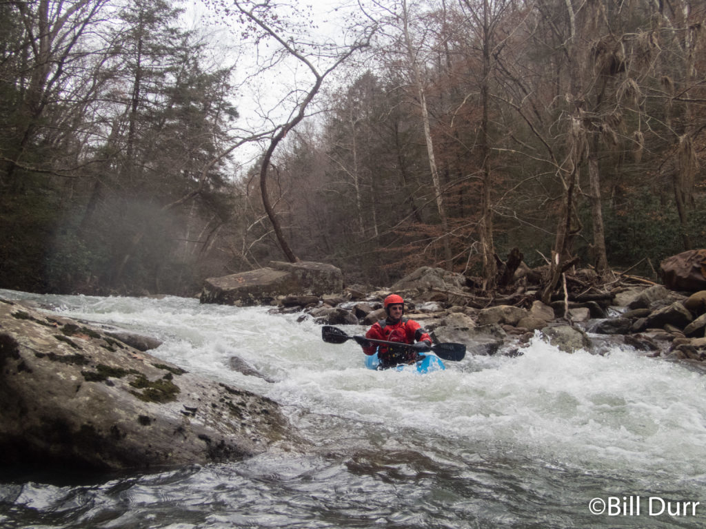
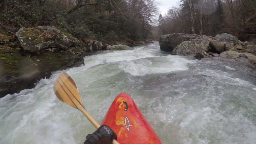
There were a couple smaller rapids, class 1-2ish stuff and things didn’t pick up until we came to Moatsville. The water was low thus there was only one route through the rapid there. As we got towards the edge of the village the rapids picked up. It constricted a bit, and in places there was only a boat width between the rocks. In one place there was a log in the main flow that may have been more problematic if the water was moving a bit faster. Eventually we got to the main event of the run, Suck Pop. This was a cool little rapid that ended with boof opportunity. Unfortunately I missed it, got flipped, and did a little underwater surveying. Next up was a slide. After a little we came to the Tygart.
Laurel Creek
We finished up relatively early and had to choose what to do next. There was plenty of time for a second lap and we decided to head over to Laurel Creek and leave the car at the bottom of Teter and get in some high level Tygart in as well. The drive up to put in Laurel was pretty short, maybe 15 minutes. Laurel starts off similar to Teter, relatively flat for a while and then drops off once it gets to the Tygart Valley. The scenery was however much better and was more remote. When we got to the rapids we found them to be more difficult than Teter. There was plenty of gradient and the closer to the Tygart we got to the tygart the more difficult things became.
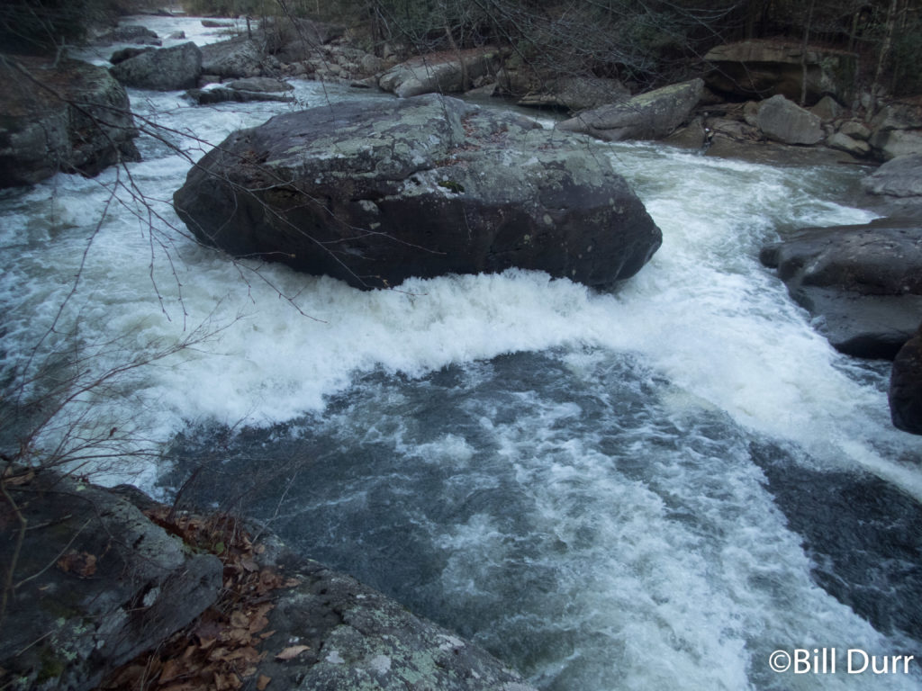
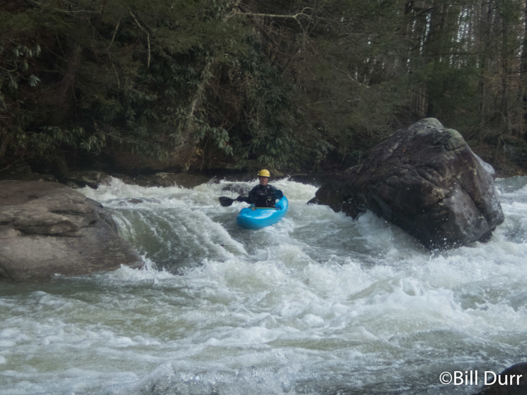
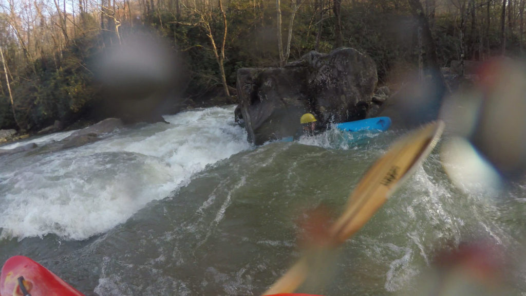
In the meat of the descent is one of the nastiest undercuts I have seen. A big boulder is just hanging out in the middle of the flow and you can see water flowing out the other side. We ended up walking this one as not everyone wanted to run it and it did not seem prudent with such a small group. There was plenty of stout rapid below so this was not an issue. At the bottom of one drop there were a couple of nice flat holes that would make for good spins. Bob ended up in one of them for a bit before spinning his way out. Up next was a decent slide with some maneuvering to be done on the way down. We then came to a horizon line, not remembering any beta for it, I decided to follow the flow. Unfortunately this was not a good line and as soon as I got to the lip I saw some shallow boulders extending towards the landing zone. I tried to signal to Bob and Ken to go further right, but I was too far below the horizon for them to see. I now remembered the name, Ten Foot Falls, and the line. You’re supposed to try to aim for the right hand side and go off by the peak of the horizon. The left/center was not a great place at higher water either, but the rocks were not in play. Bob added a second dent to his bow here. All that was left was the last rapid down to the river. The steepness kept up and it was still decently complex. Unfortunately, Ken swam here and hurt himself.
Tygart, Arden section
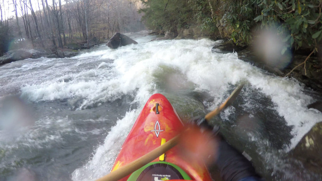
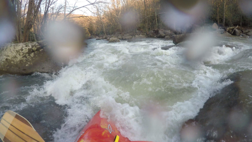
The Tygart was booming and Bob and I had to paddle down to retrieve the car. The road ran along the Tygart and we were going to bring it up to Ken. The waves were huge as were the rapids. Neither of us had paddled the section and the only info we had was that at Moats Falls you want to be on the right, but far right was manky. When we got there I pulled the side to take a look, but Bob was just going. So I followed him down the far right side. It was definitely not manky, not a rock could be seen. There’s a chute you go down to the eddy on the right. Then you have to surf a wave back to the center to avoid going into a hole. Unfortunately I did not go far enough and got caught by the hole. According to Bob I was doing cartwheels in it before I pulled my freedom cord. Luckily the cleanup was quick and I was deposited in an eddy. While collecting, Ken came down to us. He had found a ride downriver. I handed over the key to him since it seems he would get to his car first. There was another big rapid after this, I couldn’t see down it and quickly walked around it. Bob ran down the center on a huge wave train. Saw Ken driving up to get his boat and we soon came to the takeout.