Over the Mountain and Through the Woods to a Drainage Ditch

RunPiney (The Big Piney)
Date12.15.18
Level8in on bridge, ~850cfs on USGS 02027500

Due to some significantly better thought and planning on Todd’s part a trip down south into Virginia was organized. With my car in the shop for a leaking roof, I wasn’t paying much attention to the weather. But he was watching the key storm that was brewing, with lots of rain planned. The trip started of being me leading the group down Johns. Rain started on Friday and by the time we were driving down the gauge for Johns was heading up quickly. I started working on the alternate plan, and getting everyone on the same page. The primary option would be the Maury,  but there were also other creeks in the area that would definitely be running. While looking I stumbled upon the Piney River, one basin down from the Tye. After some dithering in a rest stop parking lot I had the group convinced to do a lap on the Maury and head to Piney to check it out.

When we arrived at the Maury things were big, looking potentially the highest I have run it. Todd estimated it being at around 3000cfs, later to be proven correct. From my previous high level experience there I knew things would be big and any rock gardens would be no more. Took my new preferred line, that I learned from some locals that previous run, through Devil’s Kitchen. The diagonal  across the rapid starting at the top left eddy was nice and smooth and I had one of my best lines through. Overall everyone had good runs, albeit with some minor carnage. A new personal highest level for everyone, and we thoroughly enjoyed the run.

My kind of drainage ditch

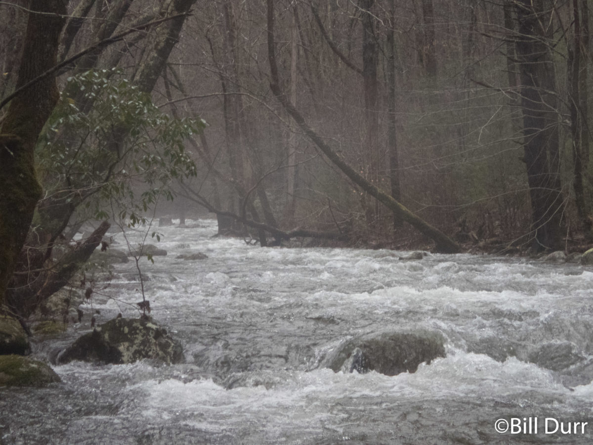
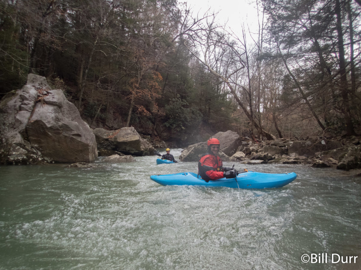
With a good first run for the day we started off to check out the Piney. As we made our way over the mountain the snow on the ground increased and it got foggy. We crossed the ridge that the Blue Ridge Parkway runs on, started down, and turned onto a slightly snowy dirt road. A drainage ditch soon appeared along side the road. It quickly picked up gradient and wood, lots of wood. Almost every other rapid had a log in the crux move about at chest or face height. While the water seemed low, almost everything would have been passable if not for the wood. All of a sudden there was some banging, and I saw Ken’s boat in the window. It apparently was very much in a hurry to get to the river. Luckily it skidded down into an eddy and I was able to quickly grab it before it got away. Talking to everyone while Ken reattached his boat, it was determined that people didn’t share his boats enthusiasm for the section. It seems I was the outlier with my reaction, “this is my kind of drainage ditch.” The gradient and wood continued, but eventually it let up and we started seeing a couple small houses and plenty of Posted signs.  As we continued down we passed some other boaters, confirming that this was the place to be today.

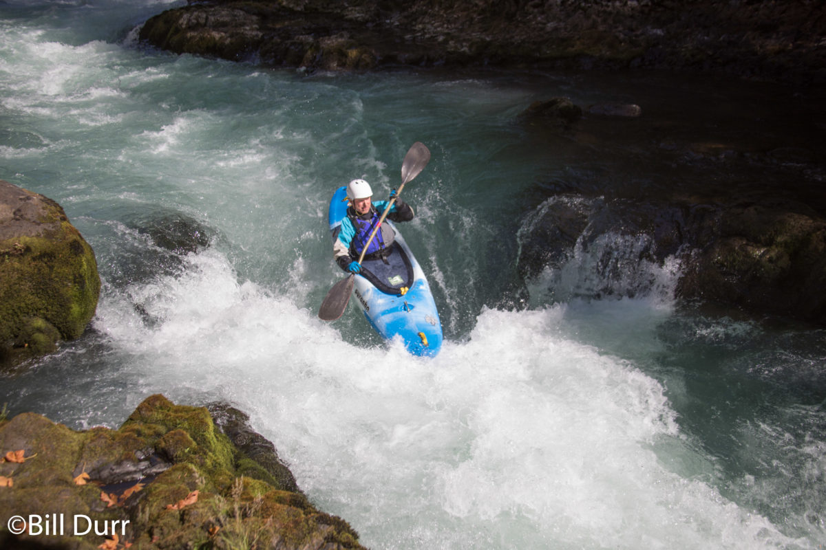
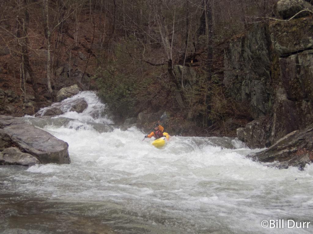
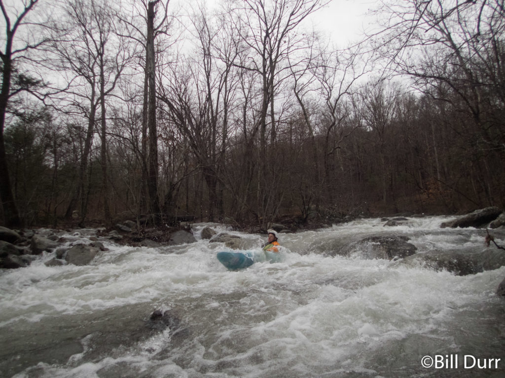
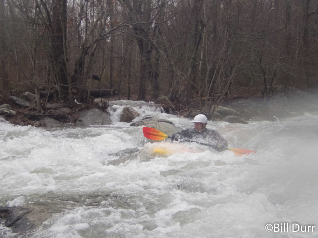
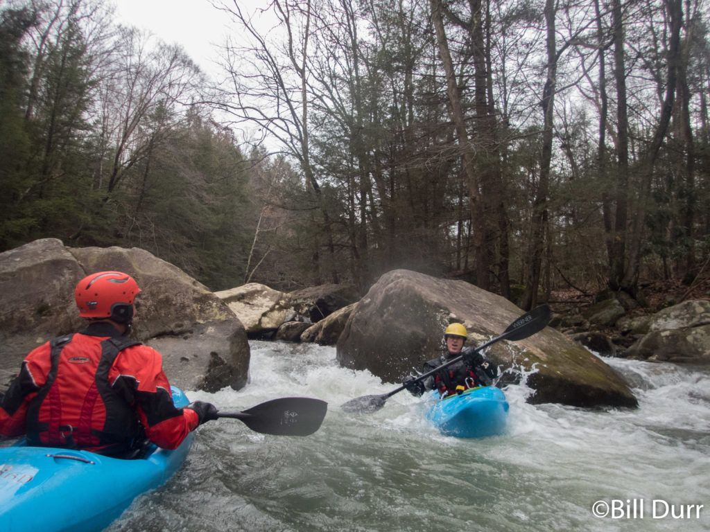
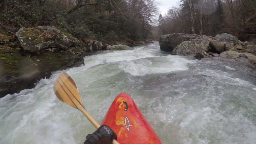
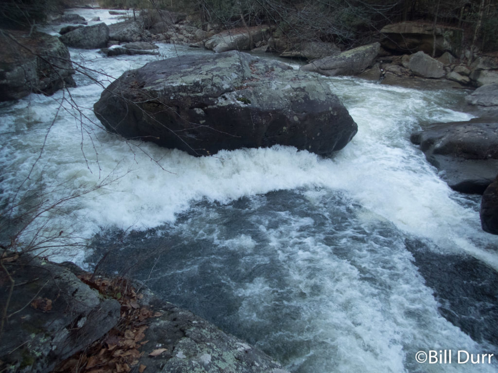
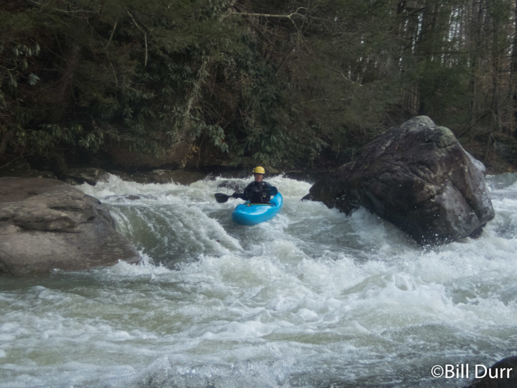
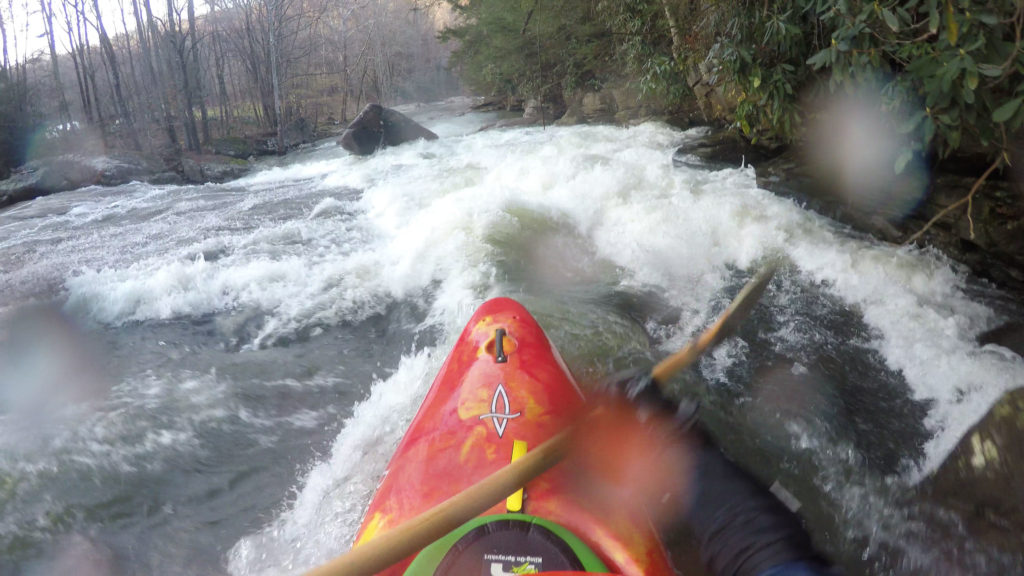
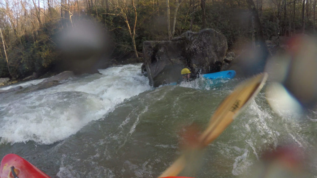
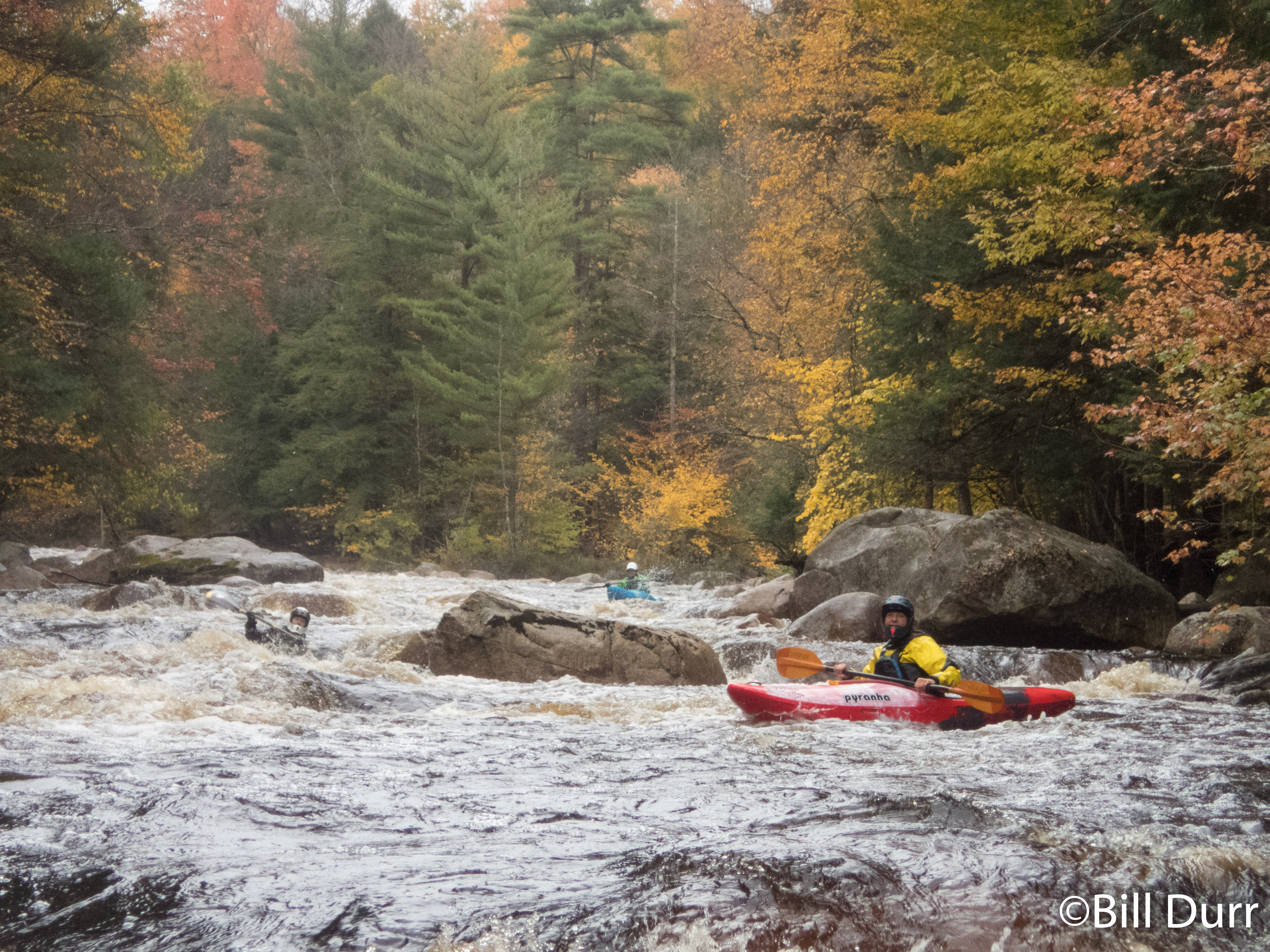
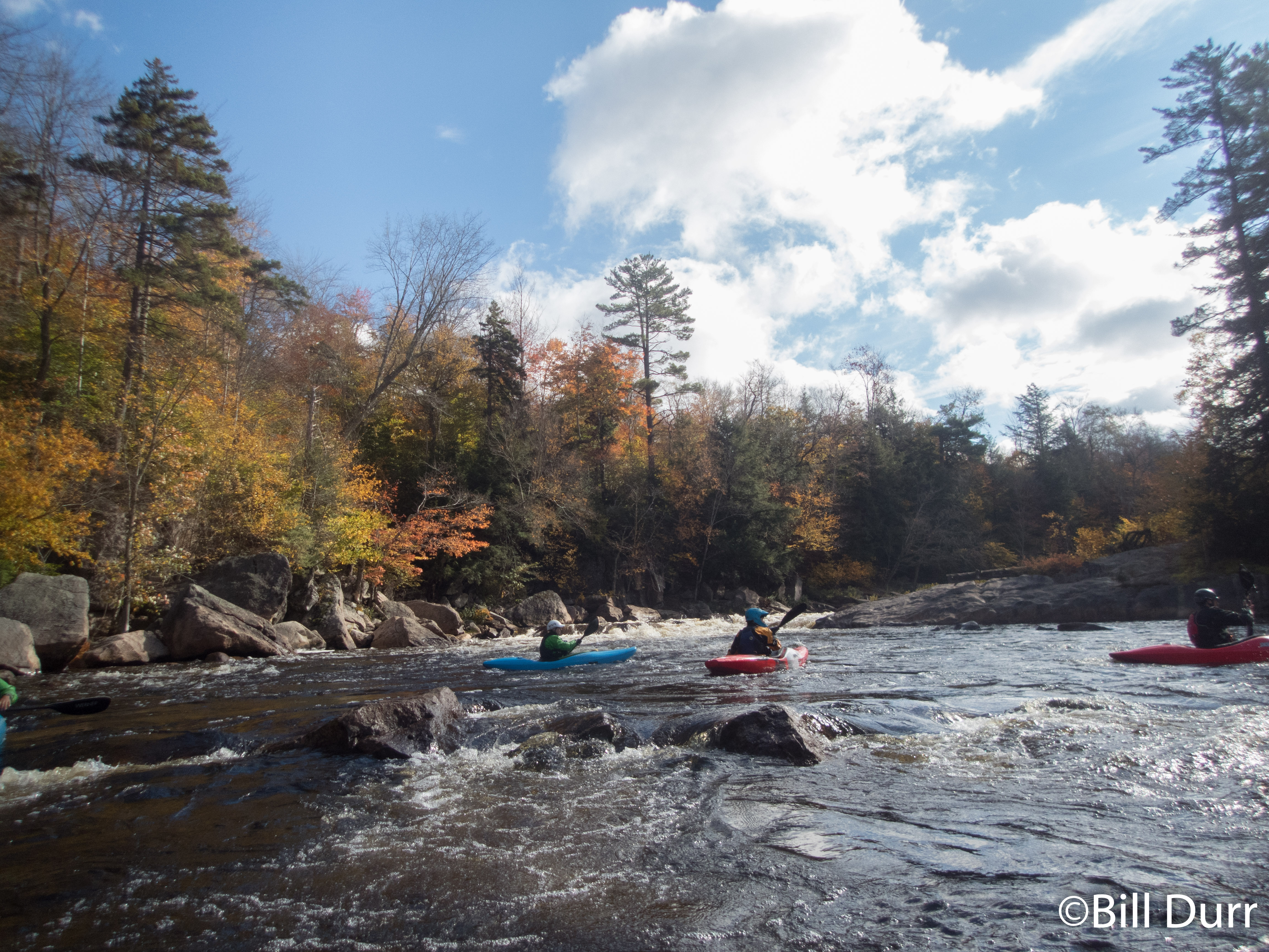
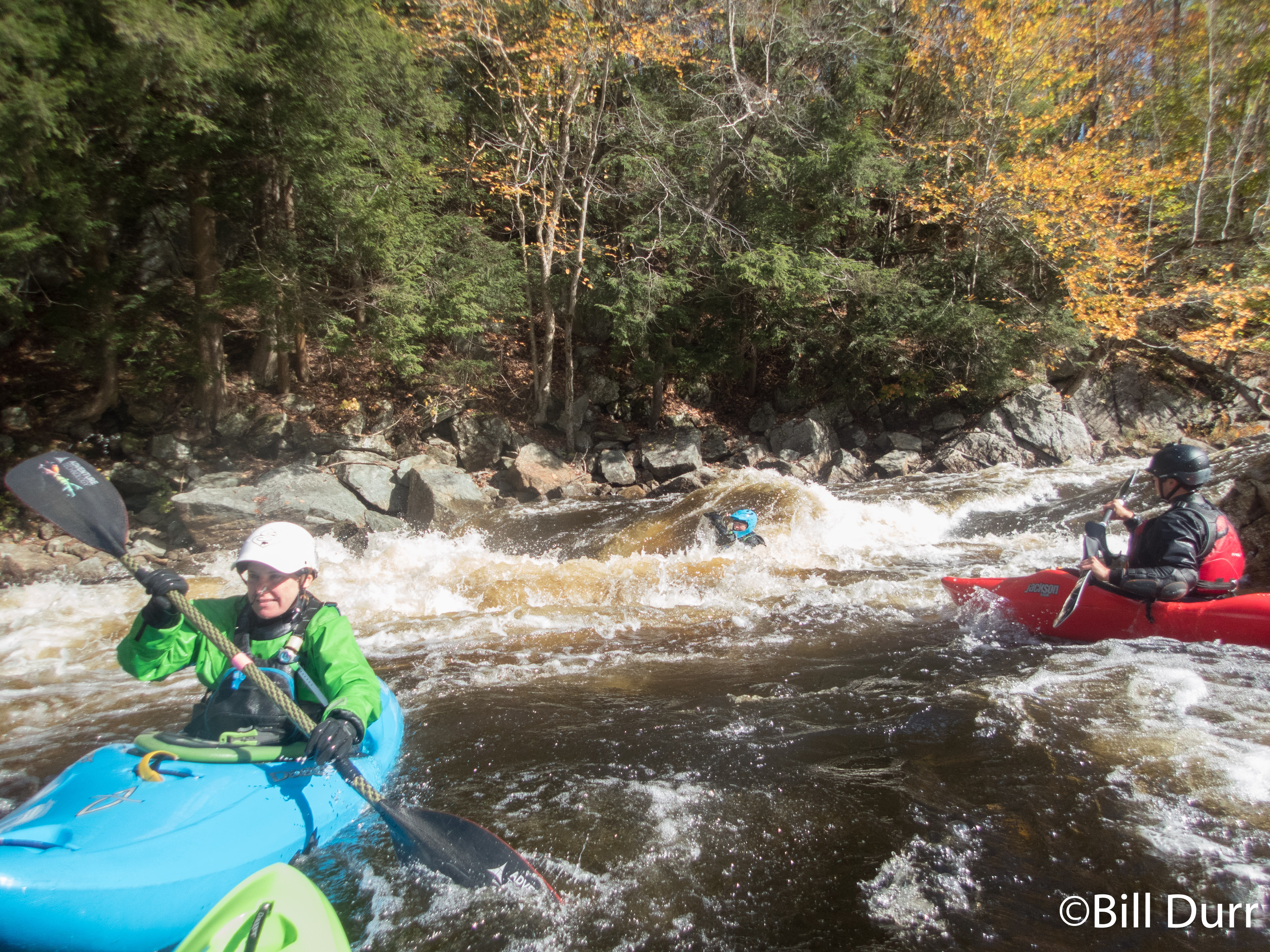
We put on at the standard spot at the national forest boundary and turn around. The fun started quickly and the rapids continued to build. Near the start were a couple low head type features that were a bit sketchy, and definitely would be dangerous at higher levels. They had hazards on both sides. Front causing siphons/strainers, the back being inescapable holes. The rapids throughout the run are boulder gardens all in the class 3 – 4 range. They were all decently complex, and lengthy. Toward the end of one a rock ended up calling to Noah. For some reason he could not break free of its spell and drifted into a nice pin. He was stuck good, but eventually Todd got him free.

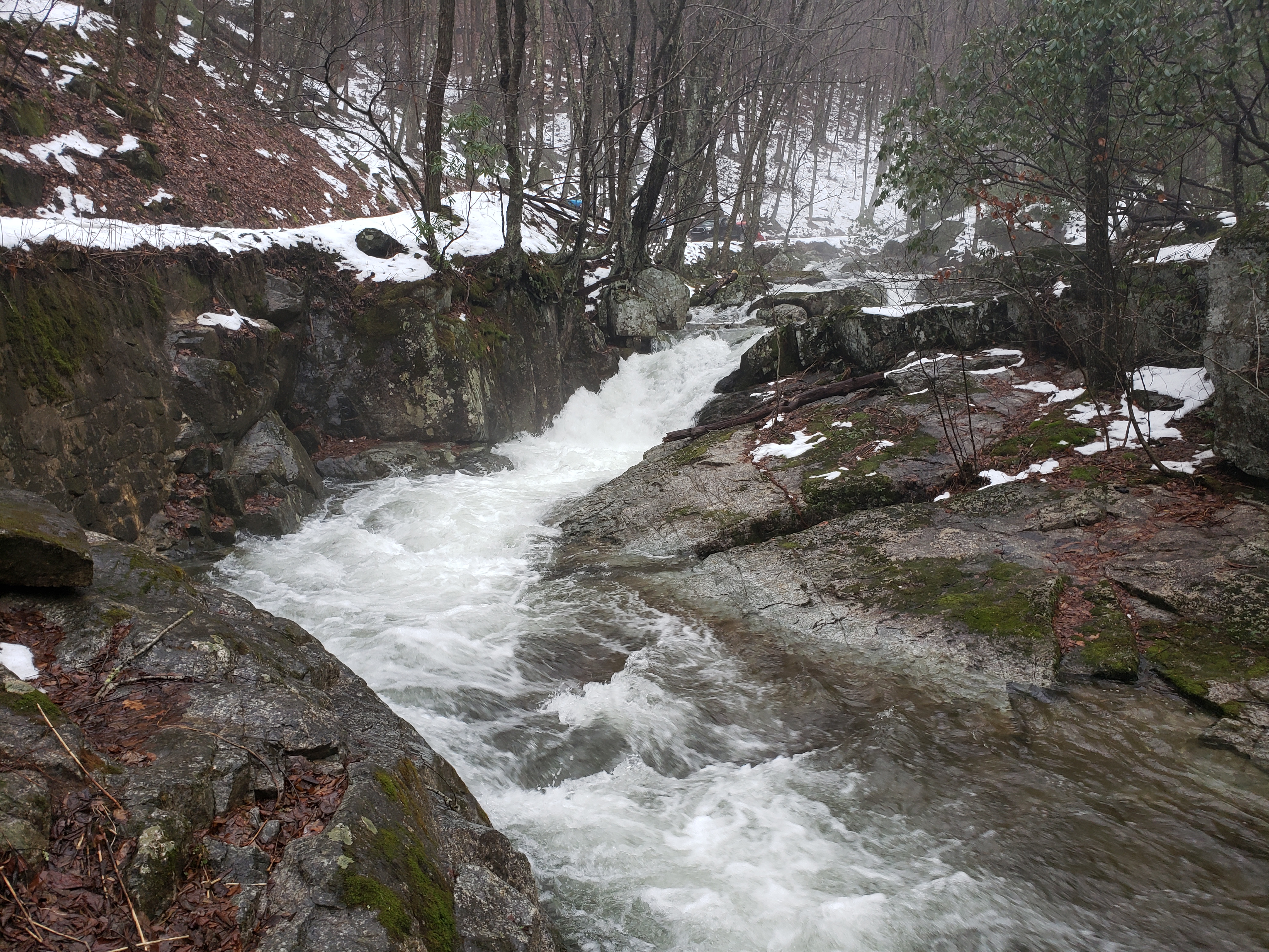
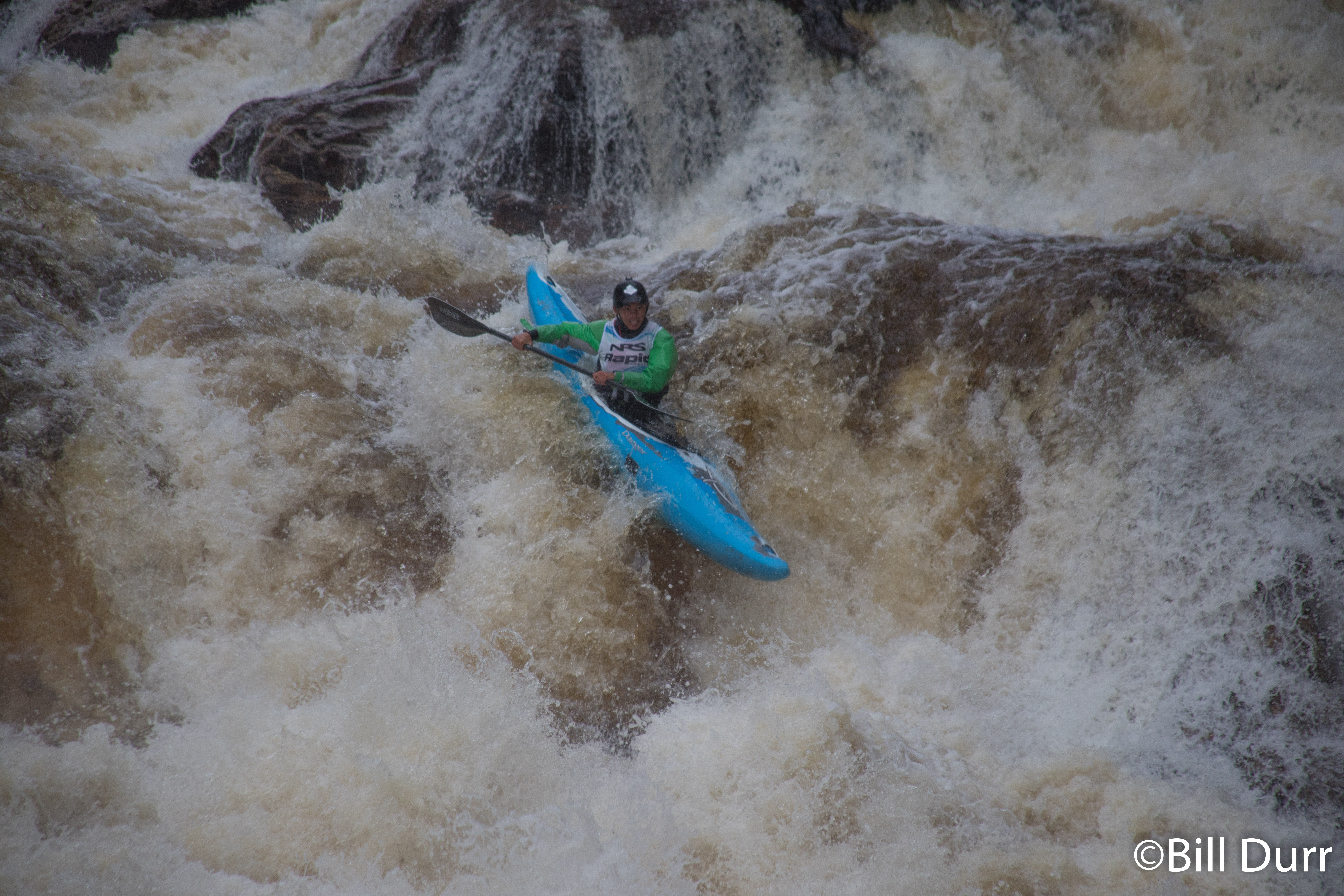
About a third of the way down we came to one of the bigger drops that was visible from the road. While it looked nasty from the road this was more due to distance. It had a nice staging eddy river left set you up well to run it down the tongue that formed. The rapid ended up being much more friendly than it looked form the road. While the run is mostly road scoutable, this was one area it strayed away from the road. Below was a nice pool.

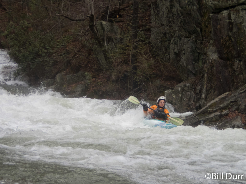
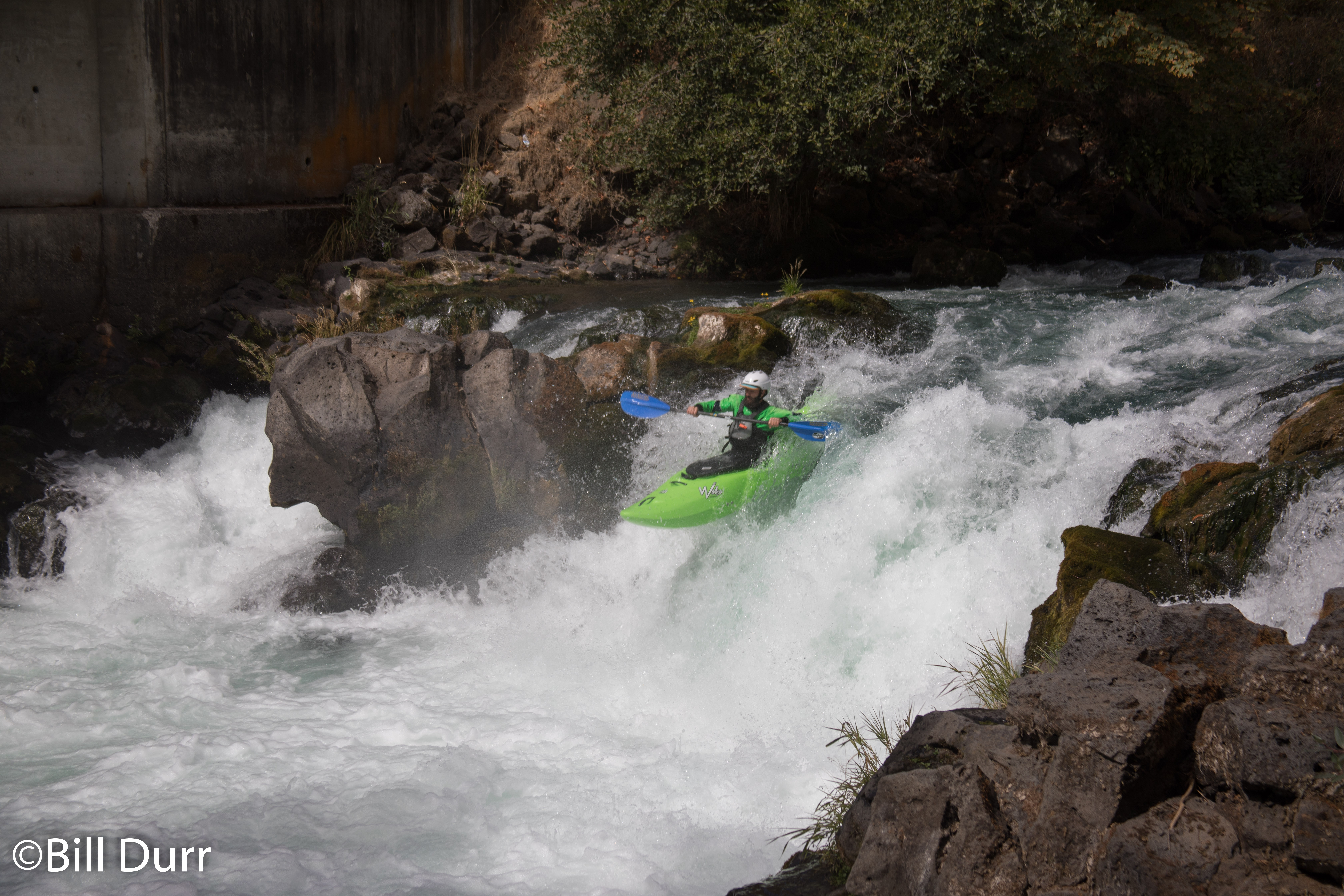
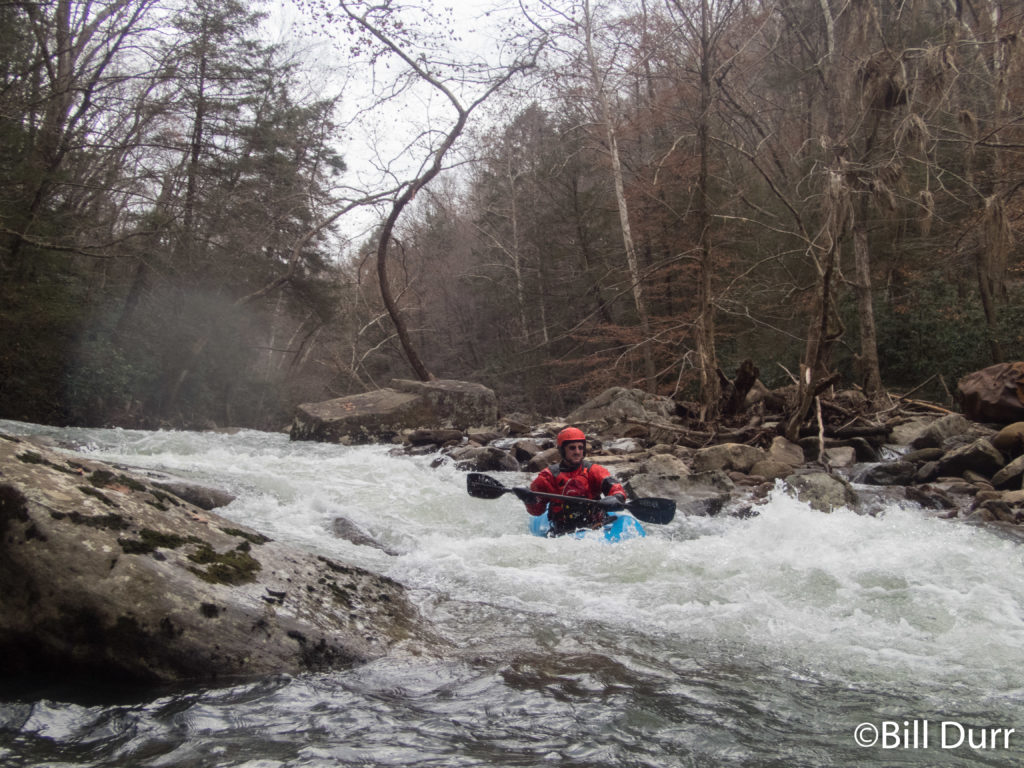
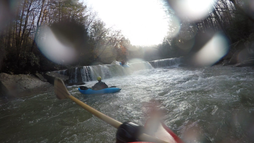
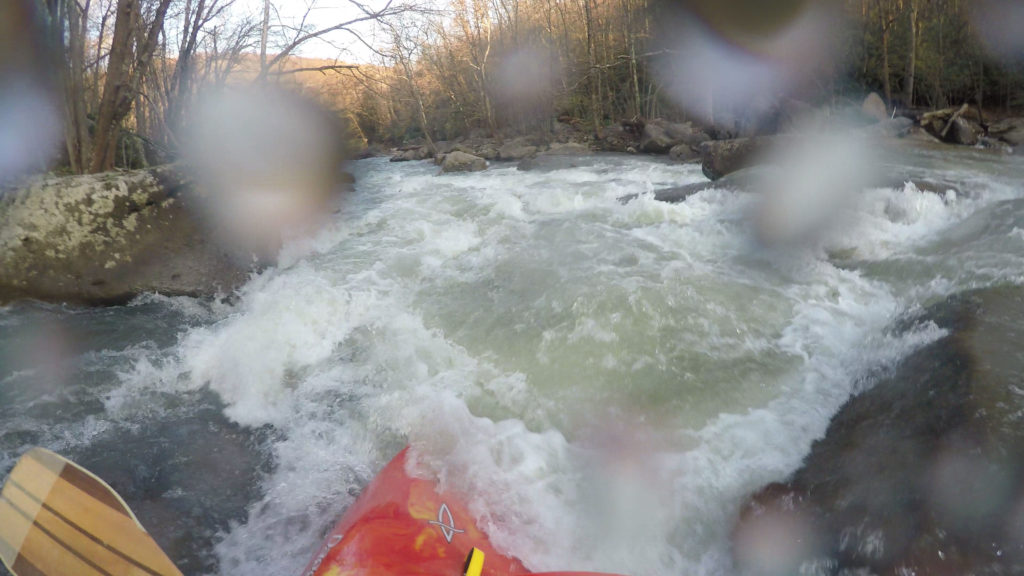
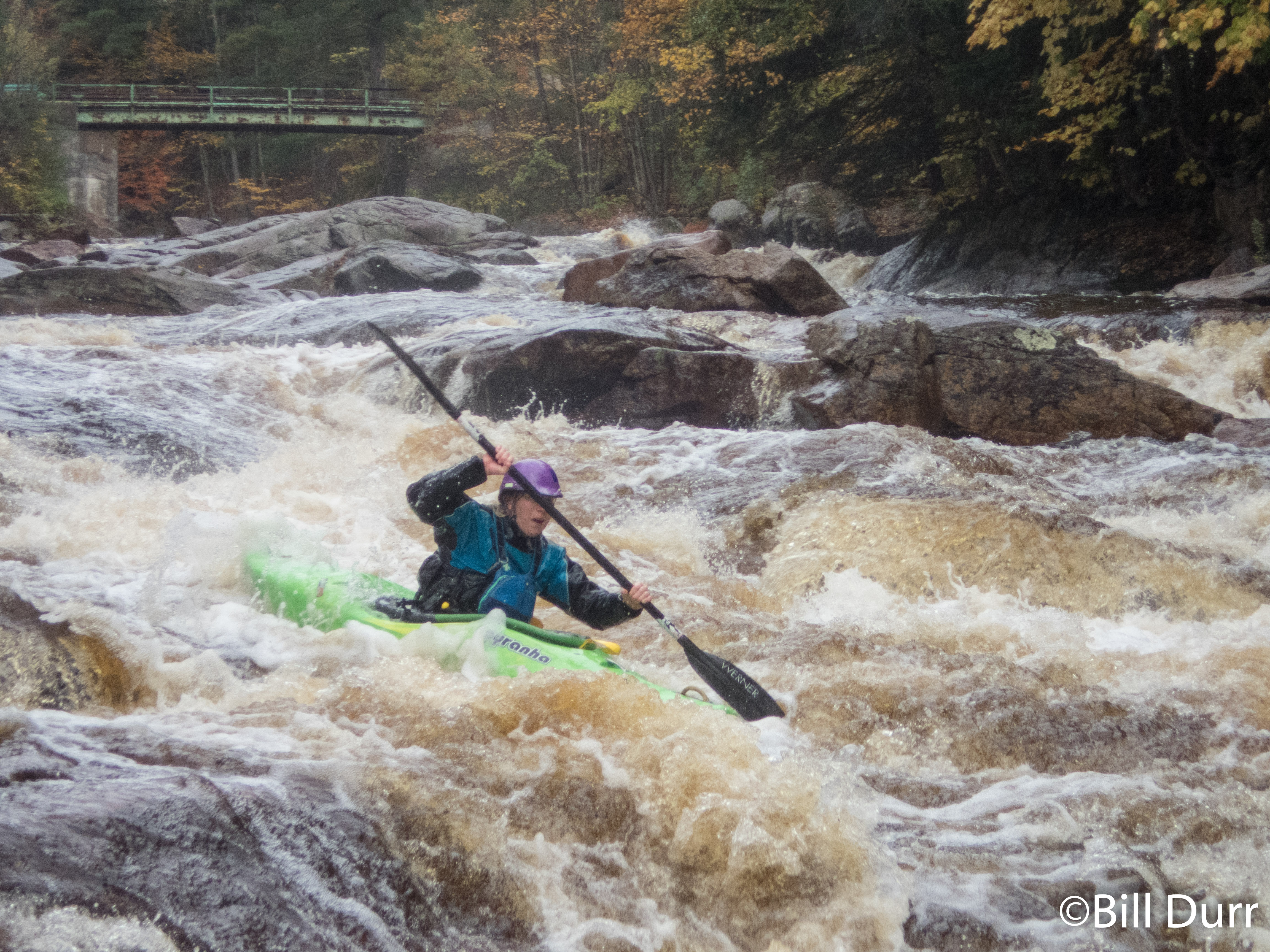
Things picked up as the run moved back towards the road. In a couple places it splits and is worth paying attention during to shuttle to see which side has more water or is tree free. The boulder gardens build and it gets to a nice class IV level with a swift pace. I’d describe it as a similar style to the Savage but a class up in difficulty. One of the more complicated drops had some trees piled up in them. The proper move was to boof off the entrance with left hand angle. That would set you up to continue down with the main flow. Unfortunately most of the group didn’t follow and went straight and caught the eddy that went to the right. They had to then scrape down some mank to get back to the main flow. The run comes to an end at a bridge with take out on the left.
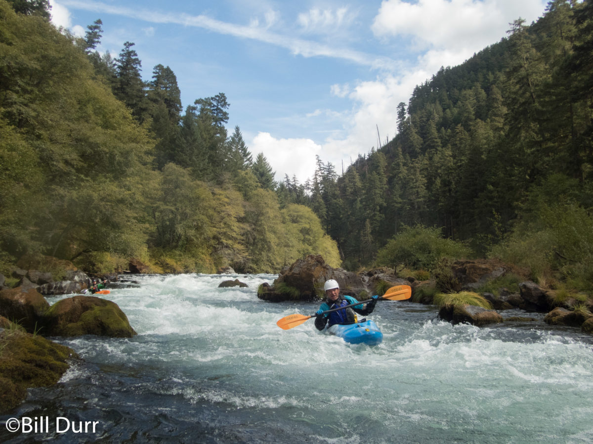
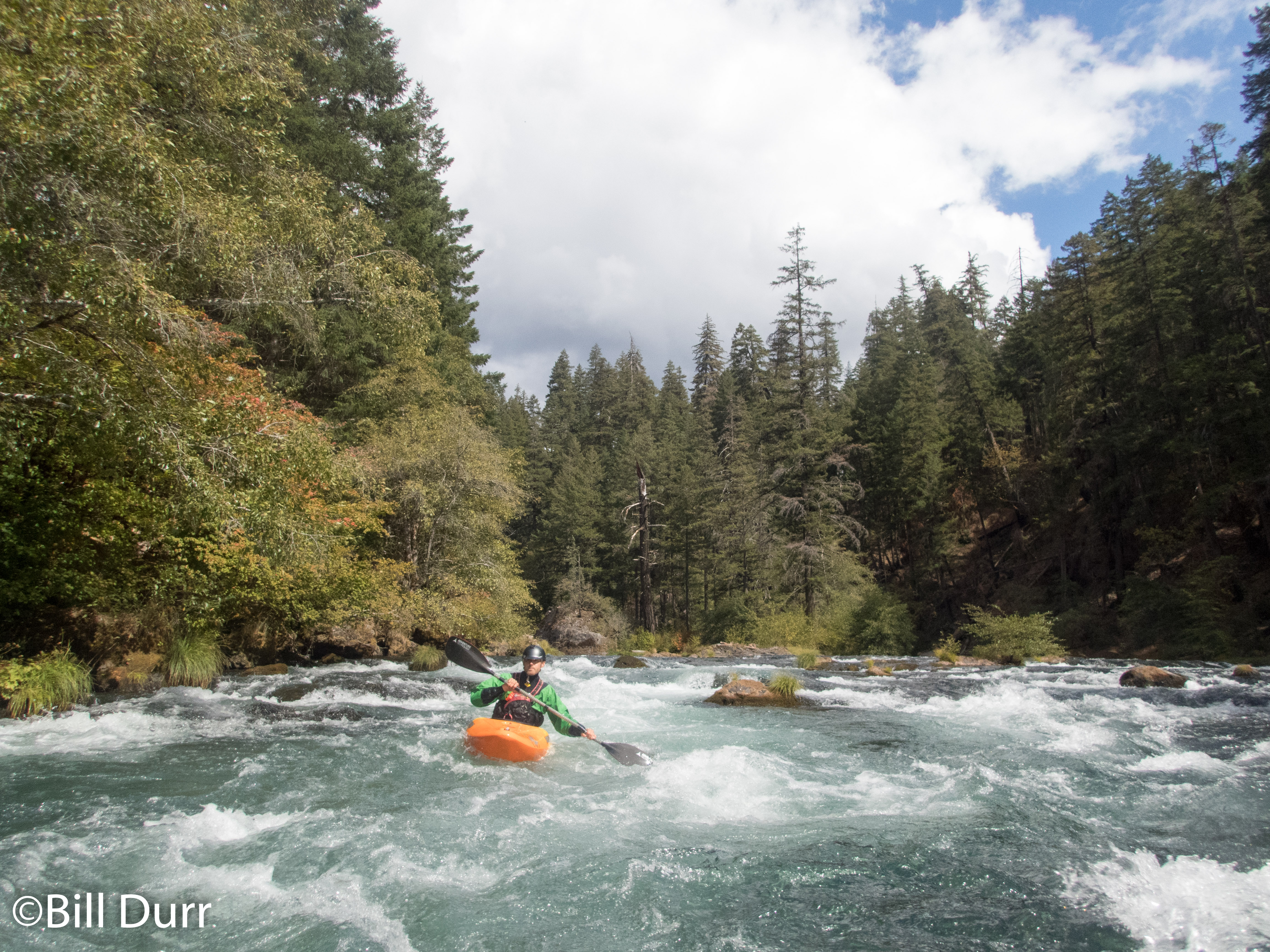
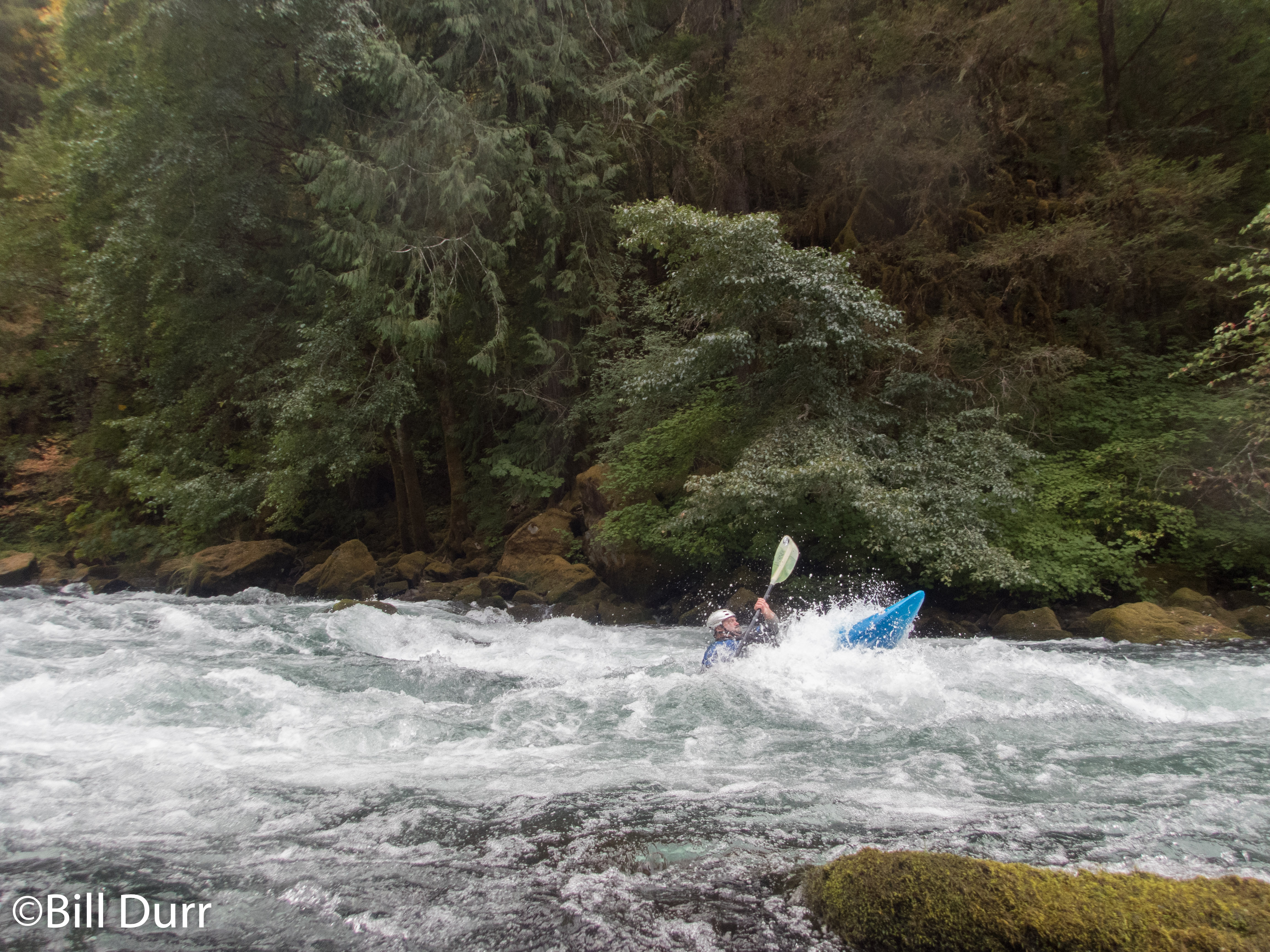
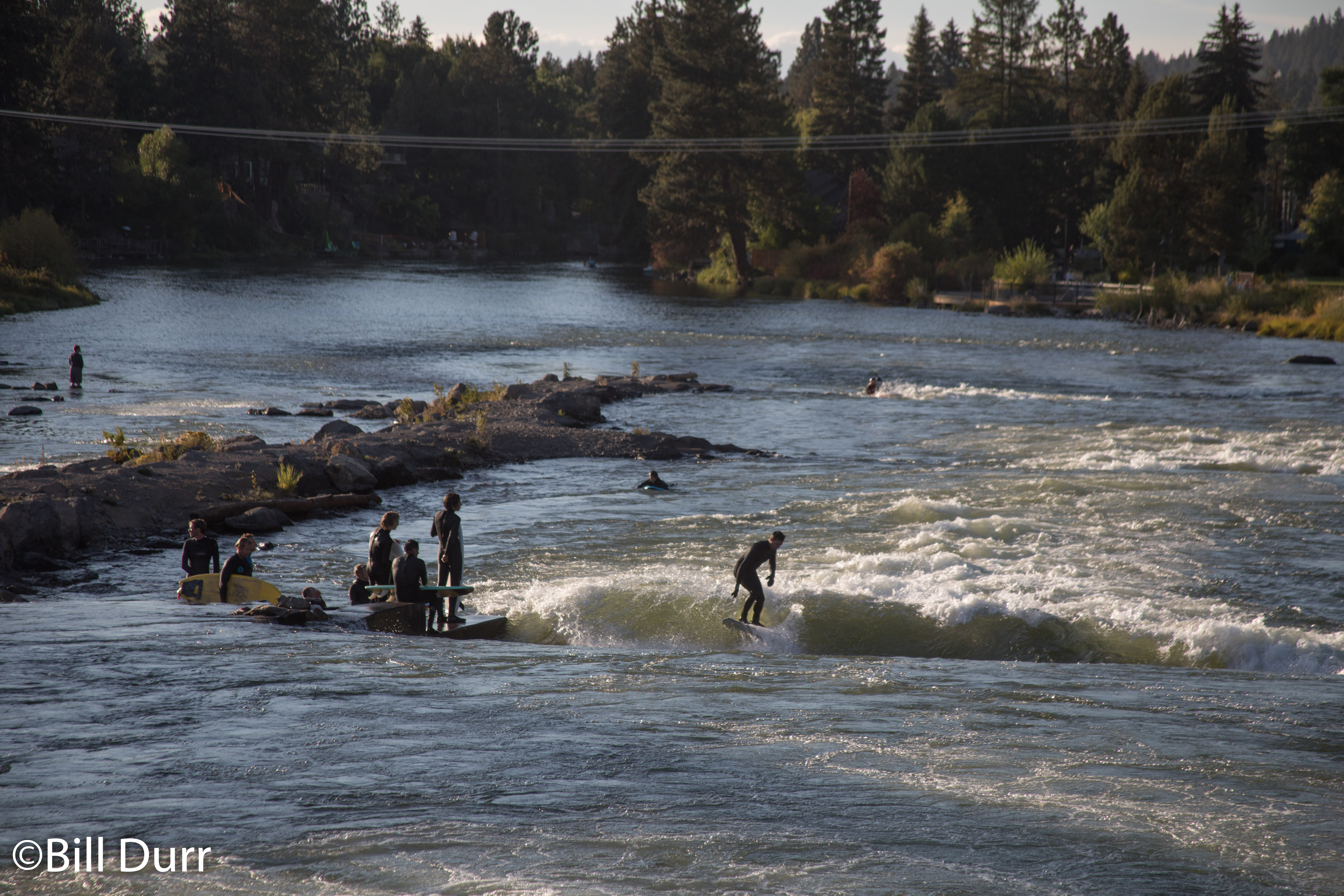
Solo Boating

Over the past year or so I’ve heard a lot of talk about solo boating. Some have referred to it as their guilty pleasure. I will admit to going out truly alone a couple times myself, though I can count that number on one hand. When you get to the nitty gritty of things, I keep coming back to a saying one of my friends has, I might be paraphrasing a bit.

One person is a missing persons report

Two people is a reported drowning

Three people is a successful rescue

This gets me to what has bothered me most about all the talk about solo boating. “Three people is a successful rescue.” That day we had more than three people. Everyone acted to the best of their ability and did the best they could, yet we still lost someone. I have been at near misses, again when there were more than three people.

Just think about that and let it sink in. A group of experienced paddlers had the worst possible outcome when things went sideways. Contemplate the risk of the unknown unknown the next time you decide to go out by yourself. I love kayaking and the outdoors, but is the risk when alone truly worth it?

Teter and Laurel Creek, Tygart Arden

As the weekend neared, it looked like there was a chance for some good boating. I had missed all the fun the previous weekend when there was some good rain, but it left the area primed. Watching the snow that came on Thursday, I more and more felt like it would be good for a mission. There was a decent amount of precipitation, all frozen, and it would be warming up. I had a decent amount of interest as well. As Friday progressed I started focusing in on the Tygart and Buckhannon basin. Both were high, at the very top of the runable level. Closer runs were still trending downward and didn’t look like this would change by Saturday morning. Eventually I focused in on Teter Creek and announced the call. With a decision made people started dropping out, due to the distance. A number decided to head to the Top Yough. The evening rolled around and it looked like it would just be Bob, Ken, and myself. After some calls around I determined that everyone was ok with the small group size and the mission was on.

Teter Creek

The chosen run was Teter Creek. From what I could tell, this was the one that would fall out first. We met up at the Gaithersburg park and  ride to start the journey and I volunteered to be the driver of the alone car. When we got to the river, the water looked low but enough to scrape down. We decided it was a go. The shuttle down through Moatsville to the Tygart was short, maybe 10 minutes to run the whole thing and gave a decent overview of the run. Where we put in the gradient was low and the dogs many. About 10 dogs followed us for a short distance, barking all the way. The first few miles were twisting and mostly flat. It made its way through some farms and the quality of the scenery was not great. There was lots trash in the trees.

There were a couple smaller rapids, class 1-2ish stuff and things didn’t pick up until we came to Moatsville. The water was low thus there was only one route through the rapid there. As we got towards the edge of the village the rapids picked up. It constricted a bit, and in places there was only a boat width between the rocks. In one place there was a log in the main flow that may have been more problematic if the water was moving a bit faster. Eventually we got to the main event of the run, Suck Pop. This was a cool little rapid that ended with boof opportunity. Unfortunately I missed it, got flipped, and did a little underwater surveying. Next up was a slide. After a little we came to the Tygart.

Laurel Creek

We finished up relatively early and had to choose what to do next. There was plenty of time for a second lap and we decided to head over to Laurel Creek and leave the car at the bottom of Teter and get in some high level Tygart in as well. The drive up to put in Laurel was pretty short, maybe 15 minutes. Laurel starts off similar to Teter, relatively flat for a while and then drops off once it gets to the Tygart Valley. The scenery was however much better and was more remote. When we got to the rapids we found them to be more difficult than Teter. There was plenty of gradient and the closer to the Tygart we got to the tygart the more difficult things became.

In the meat of the descent is one of the nastiest undercuts I have seen. A big boulder is just hanging out in the middle of the flow and you can see water flowing out the other side. We ended up walking this one as not everyone wanted to run it and it did not seem prudent with such a small group. There was plenty of stout rapid below so this was not an issue. At the bottom of one drop there were a couple of nice flat holes that would make for good spins. Bob ended up in one of them for a bit before spinning his way out. Up next was a decent slide with some maneuvering to be done on the way down. We then came to a horizon line, not remembering any beta for it, I decided to follow the flow. Unfortunately this was not a good line and as soon as I got to the lip I saw some shallow boulders extending towards the landing zone. I tried to signal to Bob and Ken to go further right, but I was too far below the horizon for them to see. I now remembered the name, Ten Foot Falls, and the line. You’re supposed to try to aim for the right hand side and go off by the peak of the horizon. The left/center was not a great place at higher water either, but the rocks were not in play. Bob added a second dent to his bow here. All that was left was the last rapid down to the river. The steepness kept up and it was still decently complex. Unfortunately, Ken swam here and hurt himself.

Tygart, Arden section

The Tygart was booming and Bob and I had to paddle down to retrieve the car. The road ran along the Tygart and we were going to bring it up to Ken. The waves were huge as were the rapids. Neither of us had paddled the section and the only info we had was that at Moats Falls you want to be on the right, but far right was manky. When we got there I pulled the side to take a look, but Bob was just going. So I followed him down the far right side. It was definitely not manky, not a rock could be seen. There’s a chute you go down to the eddy on the right. Then you have to surf a wave back to the center to avoid going into a hole. Unfortunately I did not go far enough and got caught by the hole. According to Bob I was doing cartwheels in it before I pulled my freedom cord. Luckily the cleanup was quick and I was deposited in an eddy. While collecting, Ken came down to us. He had found a ride downriver. I handed over the key to him since it seems he would get to his car first. There was another big rapid after this, I couldn’t see down it and quickly walked around it. Bob ran down the center on a huge wave train. Saw Ken driving up to get his boat and we soon came to the takeout.

The Big Shoe Halloween at Keegan Ales

Made one of my pilgrimages back up to New York for one of the rare Big Shoe shows. As usual they did not disappoint and put on a great show and the venue is excellent as usual. Keegan Ales opens up the brewery floor for this event and its a pretty cool experience. After a bit of just enjoying the music I finally gave in. The lighting was really good and I could not sit by and not take photos. I had left my camera home, but my backup was in the car. Had a bit of trouble with the 50mm on an APC sensor. It was a bit more cropped than I would have liked, but it’s the best for the low light. I took advantage of my camera to sneak to the front and access areas the general crowd couldn’t.

The choice of song is always good and conducive to dancing. There good crowd on hand, but it was not as packed as other times. A little out of form The Shoe was not in their superhero regalia, much to Rich’s chagrin. At one point in the night the keg of Joe Mama’s Milk was kicked, luckily the side bar still had some. After finishing up the first set, Lara Hope and the Ark-tones took to the stage. Great local rockabilly group that I’m very happy to see playing with The Shoe again. First came across them when they opened for Tri-State Conspiracy at a car show in Wappingers Falls. They looked awesome dressed as the cast of Family Guy. Once done Santa came out to announce the winner of the costume contest. Then back into the brewery for The Big Shoe’s second set.

Fall Moosefest 2018

The weekend after Columbus day is host one of the best kayaking gatherings out there, Moosefest. A week or two before I was watching the levels and it looked like it would be a nice and mellow level, similar to what I had run it before. However, about Wednesday they got a bunch of rain, and by Friday the Moose was at beefy levels. I sat at work, watching level, looking forward to being in New York, but not the drive there. All the time I was wishing I had realized this was happening on Thursday. Had I, I would have called in sick so I could go paddle some of the runs that were in. The end of work rolled around and when I went to unload the cans of soup I had bought for lunch. Much to my dismay I discovered I had forgot my GoPro and would have to drive home to get it. With the added delay I arrived up at Fowlerville around 1am.

With less sleep than I would have liked I headed into Old Forge to grab some breakfast. I’m a fan of Keyes’ Pancake House, so that was the stop. The food is good and service quick. Then it was off to Mountain Man to chat with everyone I have yet to see, which was basically everyone since I arrived so late. The other goal was to grab some beta on the Independence. It was one of the things I had been watching, and there was still water. After a little I determined there were probably some people there. Managed to get Graham to lead me as he was looking for some redemption and knew some people headed there. So it was off to the Indy.

Independence River

The Indy has been on my watch list since I made my first trip to the Adirondacks for whitewater kayaking last year with Kevin. I was excited to catch it and it definitely delivered. When we put on it was about 485cfs, which ended up being slightly scrapey in some places. The run starts of with a nice stretch of class 3 boogie water. In a couple places a bit more padding would have been desirable. As you continue the rapids slowly build and become more complex. The first bigger one you come to is powerline, a ledge with an about five foot drop. It has an undercut on the left. Next is one where the river divides around some boulders. There’s a nice eddy in the middle where you can boat scout. Eventually you start getting towards the end and come to Fat Lady, a series of slides. Graham and I decided we were running it after taking a quick look. I messed up the entrance drop, but just managed to brace through it and make the line upright. I had decided to run the middle line and entered a bit off. At the bottom the hole grabbed me and I had to work a little to get out. We regrouped at the bottom and headed down to the bridge boof and The Wall.

The first bigger one you come to is powerline, a ledge with an about five foot drop. It has an undercut on the left. Next is one where the river divides around some boulders. There’s a nice eddy in the middle where you can boat scout. Eventually you start getting towards the end and come to Fat Lady, a series of slides. Graham and I decided we were running it after taking a quick look. I messed up the entrance drop, but just managed to brace through it and make the line upright. I had decided to run the middle line and entered a bit off. At the bottom the hole grabbed me and I had to work a little to get out. We regrouped at the bottom and headed down to the bridge boof and The Wall.

Left with one rapid before the takeout we got out to take a look. Stared it down and watched a couple other run it. Lines were not always clean, but all came out unscathed and we decided on our line. I started my run, and dropped in, staying to the left at the top. Once down to the half way point, just above the last drop I started to drive to the right. Unfortunately, I came in too hot and dried out. Got spun around, tried to drive across the flow and turn to punch the hole. Just managed to get all the way across, but didn’t get the boat straightened out. Landed in the pocket hole on the far left and started to get a working. Rode it for a little while and eventually managed to get my boat turned and worked my way out. Now that it was clear, Graham was up. As he entered the final drop, he was too far to the center. He hit a rock hard and got thrown to the right. It didn’t look like a painless ride, but he came through quick.

We finished up with enough time to get back to the Moose to see the race. Went to Crystal to spectate and help out with the finish line. This year’s race had a small turn out, probably due to the higher water. I was now feeling cold and decided to call it a day and changed into drys. Then it was off to Mountain Man for the festivities and to find out who won the Emperor’s Cup.

Lower Moose

Hung out for a little in the morning at Mountain Man, people were moving slowly. Jumped in with Alex on his run down the Lower Moose. I was advised to bring the long boat, and it was definitely the correct move. There’s a lot of pool in between the drops. The scenery is nice, with some color still on the trees. Most of the drops were not too complicated, but they were all good class 3 at least. At Mixmaster I blew my line, slammed into the rock shelf,  and ended up getting sucked back in. I rolled up and got windowshaded hard. But it was enough for me to determine that the boat wasn’t coming out easily. Pulled the freedom cord and got some good downtime. I then had a nice bit of exercise after to warm me back up. Greenboats hold a good deal of water. The theme of the weekend seemed to be not to get too much speed.

PNW day 5: McKenzie

We woke up nice and early at Baker Bay and discovered it was a very nice campground. It has good potential for a base camp of another trip. We only rose early because I set an alarm, but it was good I did. Todd had to get to the airport this day as his flight was in the evening. We quickly broke down camp and got on the road, probably before anyone in the campground had even noticed that we were there. We continued north on I-5 and searched for food. David selected Joe’s Diner in Creswell. Everything was tasty and it was a great place to start our day. After much deliberation (this had been going on since yesterday) we decided to paddle the McKenzie. Our original plan had been to be in White Salmon already and paddle the White Salmon again.

The McKenzie offered us a trip that could get Todd to the airport as well as be something new for all of us. Once we got to Eugene we got off the highway and started following the McKenzie upstream. This is another river like the North Umpqua that has many sections for a paddler to choose from. Its a class II-III run, which is what caused some of the reservation for paddling it. While looking at the run we found it would pass another hot spring. However, we weren’t going to have the time to stop and enjoy it. Also it was a commercial hot spring, so there would be some cost associated with it. As we headed to the take out I lost service, which increased my nervousness, since I had to check into my flight on Southwest.

We ended up splitting the run into two about 4 mile sections. For the first, Todd would be with us, then Matt would take him back to his car at the put in so he could go to the airport. David and I would continue downstream. The run ended up being more relaxed than the others and definitely was one you do for the scenery. There was not much flat and there were continuous riffles with some rapids mixed in. We came saw some people from the government out there with special boats counting the different fish.

Once we had finished the run we headed back to White Salmon to collect the rest of our gear and get ready for our flights home the next day. On our way home we went via Government Camp (yes, really creative name) so we would pass by Mount Hood. Unfortunately it was cloudy for us and we were not afforded a good view. It was still interesting to see the base of it and the mostly dry riverbed that came off it.

PNW day 4: North Umpqua

On our forth day after breaking down camp and grabbing breakfast at Black Bear again, we headed north via a different route. Our first stop along the way was at Crater Lake, which worked well as it was on the way to our paddling destination for the day. Since our plans had changed we had not had a chance to see it. The climb up to it was nice and was thoroughly wood with conifers. Once in the park we were shortly greeted with a very impressive view as we joined the rim section of the Volcanic Legacy Scenic Byway. It is a beautiful sight to behold and definitely worth the trip if you are in the area.

Crater Lake

After taking our time and grabbing some photos we continued on into the Umpqua National Forest. Eventually our road came to the North Umpqua and continued alongside until we got to the takeout. The entire run is semi roadside and there are many access points. You can easily choose how much of the river you’d like to do and AW lists it as 25 miles. We ended up doing a little above Horseshoe Bend to Gravel Bin. The run is a good class III section through a pretty canyon. The rapids are nice and the flats between them are moving. This run was definitely a little more relaxed than what we had been paddling up until now. Even though it might not be the most difficult, it makes up for it in beauty. It easily could be something that you paddle just for the view.

There were a couple interesting rapids that definitely would have been more fun with some extra water. We had 833cfs, which seemed to be standard for this time of year. Though all the signage at the takeout talked of flows of 1500-2000 cfs. The real draw of the run is the hot springs afterwards. When we got there we discovered it was very popular even thought it was a weekday evening. The pot we started out in was just luke warm and we had to wait a bit to go to a warmer one. The next to free up was the very top one. The was the hottest and where the water first entered into the system. It was difficult to stay in this one for long. Eventually we were able to sit in the covered pool which was the perfect temperature.

Umpqua Hot Springs

We ended up spending a good amount of time at the hot springs. Because of this we left significantly later than we had wanted to. Our plan had been to drive the 3-4 hours back to White Salmon that evening. However, as time moved on we realized this probably was not realistic. As we left too late to really find food many places, we diverted to Roseburg to find some dinner. Ended up stopping at Elmers Restaurant. Chose it mostly because it would still be open. They stayed open til 10, most closed at 9, and we were getting into Roseburg at about 8:40. The food was good, so things worked out well. We then headed north on I-5 towards Eugene in search of a place to stay the night. Baker Bay Campground and Marina ended up being the location. We set up in the dark and hoped we didn’t make too much noise for the other people there

PNW Day 2: Deschutes [Meadowcamp]

Woke up for day two and packed up for a couple days down through Oregon. The night before we had decided that the best option was to head south to follow the water as it was generally dry where we were. The eventual destination chose was the Klamath with a stop along the was to boat in Bend, Oregon. We were drawn in by the Deschutes which runs through downtown Bend. We had mostly finished up packing and Todd and I headed over to the Outdoorplay warehouse to see if I could find a replacement backband for my boat. They luckily had one in stock and were willing to help me out and sell me one direct from their warehouse. While acquiring the needed supplies a double rainbow appeared over the Columbia River, signs it would be a good day.

Deschutes River south of Warm Springs on US-26

That being done we headed back to the highway to meet back up with Dave and Matt. Once we had gathered them we proceeded to route 97 to head south, through nothingness and on to Bend. We passed through a small town in the desert that was at the upper reaches of the Deschutes. Around this time Todd and I realized we were running low on gas and this was probably the last gas station for a while (about 47 miles). We conferred and Dave though we could make it and the gas would be cheaper so we continued on. As the gauge decreased our apprehension increased.  Relief came when we neared the town but is was short lived as the engine cut out about two miles outside of town. After a short wait Dave and Matt had a gas can and we were mobile again and heading to Bend.

We pulled into Bend and shortly after leaving the highway we got to the take out. The water was flat and there were a multitude of people on SUPs. Upon getting to the put in, we discovered our chosen access point (a park, for the shortcamp variant) had been paved over to build a development along the river. After some deliberation we decided to follow a fence at the edge of the development down to the river. The hike was a bit of a painful traipse through bushes and brambles. Once on the river we were greeted by signs warning of dangerous falls and a trail on the other side of the fence that looked like a proper access point.

The river narrowed to a nice gorge and we came to the entrance rapid which was a series of drops with nice size holes that one could eddy hop down. Our initial impression was that it seemed a little bigger than class IV. After a short bit of moving flat we came to an intake structure and drop. After a bit we decided to go down the left side. I felt it was good to go this route as I could see down it from my boat. I ended up drying out on a rock as I cut my way back to the center. As soon as I hit the main flow I got rocketed forward at full speed. Missed the eddy I wanted to catch below a little tree on a rock and had to run the second half of the rapid. Todd’s line was even less clean. He got hung up on a rock, then flipped by another in the second half.

After this rapid came a fairly busy and difficult boulder garden. Dodged down and the second half was particularly busy. It had a number of holes one after another to weave through. David got flipped towards the end, and during one role attempt got knocked back down by a hole just as he was coming up. After a swim and recovery it was discovered that his paddle had broken. While not in two, it was still less than ideal to use. Todd decided to use it and in the next rapid it broke and he started to C1. At the next rapid it was decided that we should break out the break down. It turned out to be a one of the friendlier rapids, though still probably more than one would want with one blade.

That turned out to be the last rapid and we made our way to the take out where we were once again greeted by a gaggle of SUPers. David ran quickly to get a new paddle at the kayak shop in town. Once we had collected everything, we headed there as well. We asked one of the guys there about the rapids and learned that the line we had take in the second rapid, which we now know is Dammit, was not the standard line. The drop in the middle is clean and people typically boof down the first part and the rest is clean. With this new knowledge we headed to take a peek at the whitewater park. Had a series of waves, one nice and glassy with a number of surfers. A lone kayaker was having fun on the bottom wave.

Whitewater park, lone kayaker in the distance

After grabbing dinner at Zydeco, we continued to head south on US-97. During dinner we decided that it was best to modify our plan and head to Klamath Falls instead of Crater Lake to camp as it would be 10 degrees warmer at night. After some time we rolled into the KOA, set up camp, and headed to sleep.

PNW day 1: White Salmon

This year some friends were going out to the Pacific Northwest to paddle. I dithered for a bit on if I’d go and ended up deciding almost last minute to join. For a bit leading up to the trip the big question was how I’d get a boat out there. A couple days before the trip I did some lurking on craigslist and managed to find a used RPM Max for a good price. The guy was nice and I ended up with a boat waiting for me when I got off the plane.

Flew in too late to get to paddle anything, or really see much on the drive out to the cabin. So I was very impressed the first day, getting to see all the scenery as we drove around to set shuttle for the run of the day. The cabin is on the White Salmon and shuttle was short. After dropping a car at the take out and heading to the putin to start, I realized that I had forgot my dry top at the cabin. People reported that it would be cold, and I decided to go back and get it. Luckily it was a short drive and I was very happy with the decision. The water was some of the coldest end of summer water I’ve been in. Additionally it was a clear aqua color I’ve never seen.

The White Salmon was a beautiful run mostly in the class III realm. This stretches for a few miles until you reach Husum Falls which is about three quarters of the way through the run. This was a nice drop that did not look like a great place to get worked. As I got out to scout, the backband of my boat broke. I hadn’t quite gotten the boat dialed in and had been feeling a little off all the way down to Husum Falls. This seemed like a bit of a bad omen. We had caught up to another group of boaters there and got to watch there lines. Their first member didn’t have a clean line and did a nice back ender, and the rest were clean.

Husum Falls

Todd, Joe, and I decided to run it and all had clean lines. Below Husum Falls things calm back down into the class III range. There was a small surf wave in one spot, and the stream remained mostly secluded until we drew near to the former dam site, where cabins started appearing. The cabins start to thin out and canyon wall start to appear. The rapids start to pick up and rock walls build up on the sides. In this area you eventually pass by the site of the old Condit Dam. Not much is left here. We could only find one cement slab. The canyon walls continue to grow and eventually you get to Steelhead rapid. We all portaged this and it did not look like a great place to be. I definitely did not have the boat to run it and there was decent potential for a nasty swim.

Laptop buying

People keep asking me to help them buy / pick out a laptop. I decided to write up my advice on it so I no longer have to repeat it to people.

First off when buying a laptop, one has to decide between three trade-offs being cost, performance, and build quality. You can only have two, never all three. cost is inversely related to the other two factors. Whenever you increase performance or build quality you will increase cost. I am viewing this as an inverse relationship because people typically want to keep costs down, a higher cost is considered a bad thing. This brings me to how I go about purchasing a laptop. When I start looking around, I start off with the specs and build quality I desire and try to tweak them to bring the cost of the laptop down. What most people seem to do is say “Whats the best laptop I can get for X”. This is the opposite of the process I follow and starts off with choosing a price and seeing the most one can get out of it.

Laptops fall into a couple of different cost brackets that roughly equate to power/build. They start off at around $350, with minimal specs and quality. These are commodity machines that will only really last about a year. Next comes laptops that range from about $450 – $550. Still commodity machines, but they will last you 1.5 – 2 years and be a bit more powerful. This bracket is typically the price range people ask me to recommend a laptop in. Both of the mentioned types of machines are only really good for things like browsing the web or editing documents in office suites. (But not doing data manipulation in them. I’m looking at you, people who use spreadsheet software to manipulate/analyze data.) They will do an ok job of watching videos on youtube or DVDs, however they will have issues with HD content. This will be based on how much you spend, although the lower end systems are getting better at handling HD. These laptops are not meant for doing real work, computation, or playing games. They will be however serve as a fine remote terminal for running software on a power system to do real work. IE something over Citrix, SSH, or some similar technology.

Then we come to the two brackets of machines that are meant for doing actual work (I am not saying that writing papers isn’t actual work, just that its not computationally intensive) and playing games. First we start off with the systems that run from about $700 – $850. These will last you about 1.5 – 2.5 years and will be able to play games, watch HD video, and do work that needs some number crunching power. Then you have the high end machines that range from $1000 – $2000 and will last you about 2 – 3 years. They will be able to run computations quicker and play games on middle to max settings. This bracket is where I typically end up purchasing a laptop from.

Now some notes on buying better hardware and getting better quality. First off stay with Intel chips. While they cost more they have much better performance and are more efficient. AMD chips used to have a better price/performance ratio but it hasn’t been that way in a while. Look for a machine that has a hinge that is the whole length of the clamshell portions or is metal. Get dedicated graphics if you can, they are always better than the integrated stuff. Areas where you can save some money by going with the lesser option and upgrading after the fact are RAM and the disk drive. However price the upgrade cost against the cost the manufacturer has, sometimes it is cheaper to get the part from the manufacturer. A metal laptop will last longer than one made from plastic, however there are not many companies that make these. A good alternative is a machine that meets MIL specs, like the Lenovo ThinkPads.

Laptops can last anywhere from 1 – 5 years, depending on all sorts of factors. Since they are mobile they will undergo more wear and tear. Things that wear out over time are the hinges, disk drive, fans, battery, and cables. Based on usage these will go sooner or later. Backblaze has gathered some good statistics on how long hard drives last http://blog.backblaze.com/2013/11/12/how-long-do-disk-drives-last/. Expect drives to go quicker then they did because the drives will be bounced around.

I am also asked about what brand to purchase. I am currently a fan of Lenovo ThinkPads and Asus, previously I also liked HPs. Lifehacker has some good info comparing build quality and customer service http://lifehacker.com/computer-manufacturers-ranked-how-to-pick-a-laptop-tha-1467145338. If you’re looking for something that will last forever, get a ToughBook. They cost more and have lesser specs, but are build to last. Apple machines have decent quality but cost about twice as much as they should. Avoid things from Dell.