We woke up nice and early at Baker Bay and discovered it was a very nice campground. It has good potential for a base camp of another trip. We only rose early because I set an alarm, but it was good I did. Todd had to get to the airport this day as his flight was in the evening. We quickly broke down camp and got on the road, probably before anyone in the campground had even noticed that we were there. We continued north on I-5 and searched for food. David selected Joe’s Diner in Creswell. Everything was tasty and it was a great place to start our day. After much deliberation (this had been going on since yesterday) we decided to paddle the McKenzie. Our original plan had been to be in White Salmon already and paddle the White Salmon again.
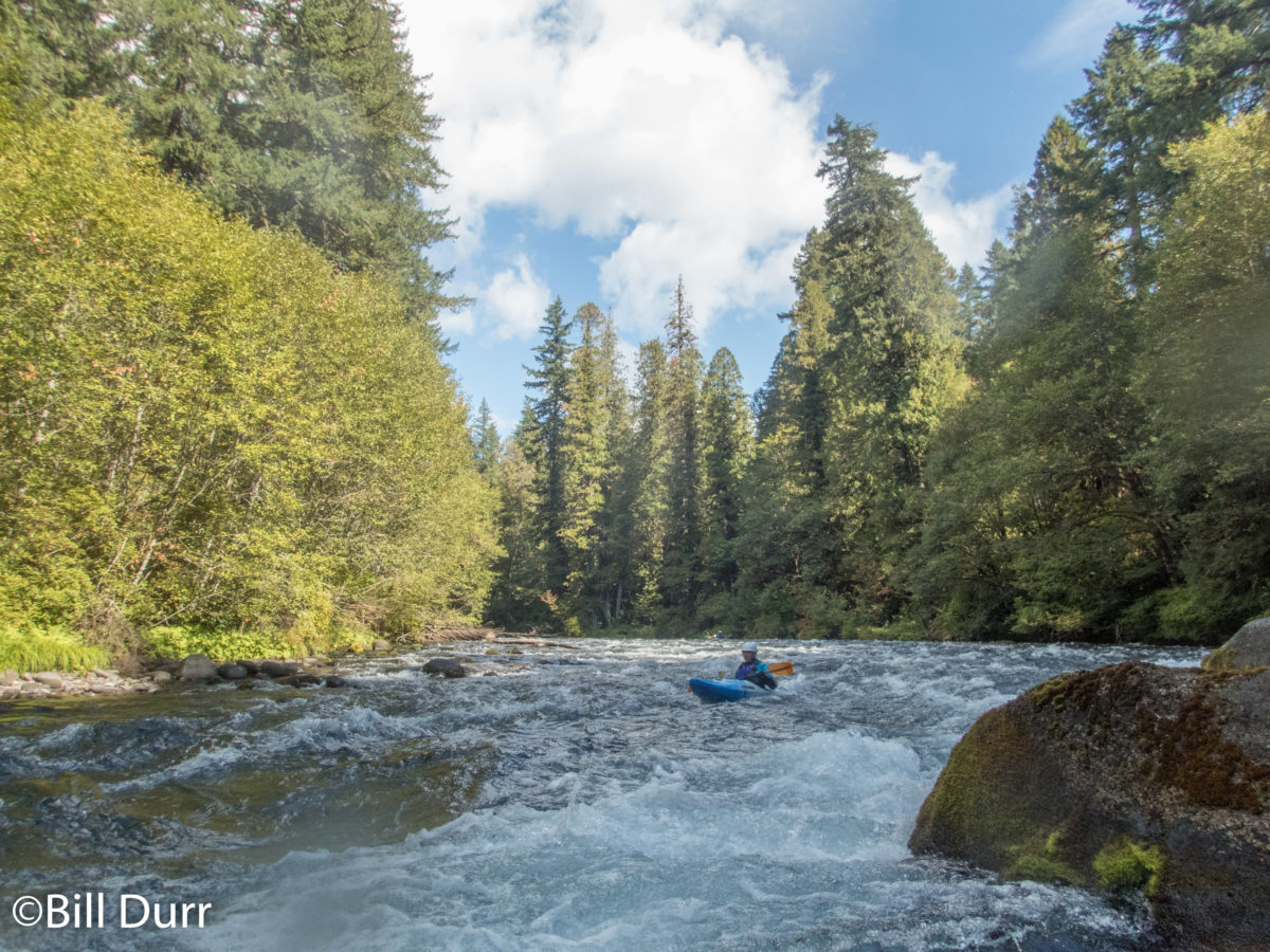
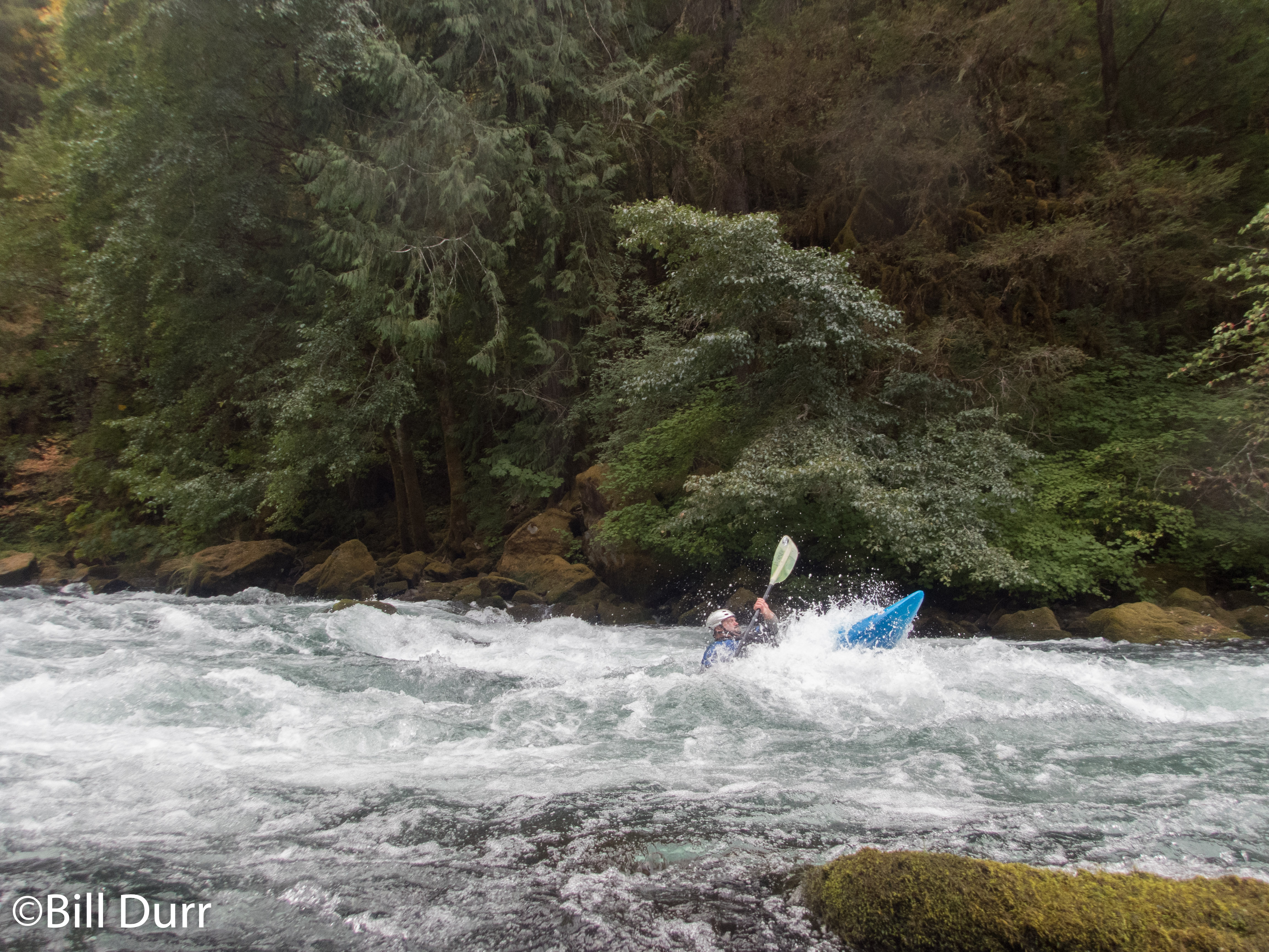
The McKenzie offered us a trip that could get Todd to the airport as well as be something new for all of us. Once we got to Eugene we got off the highway and started following the McKenzie upstream. This is another river like the North Umpqua that has many sections for a paddler to choose from. Its a class II-III run, which is what caused some of the reservation for paddling it. While looking at the run we found it would pass another hot spring. However, we weren’t going to have the time to stop and enjoy it. Also it was a commercial hot spring, so there would be some cost associated with it. As we headed to the take out I lost service, which increased my nervousness, since I had to check into my flight on Southwest.
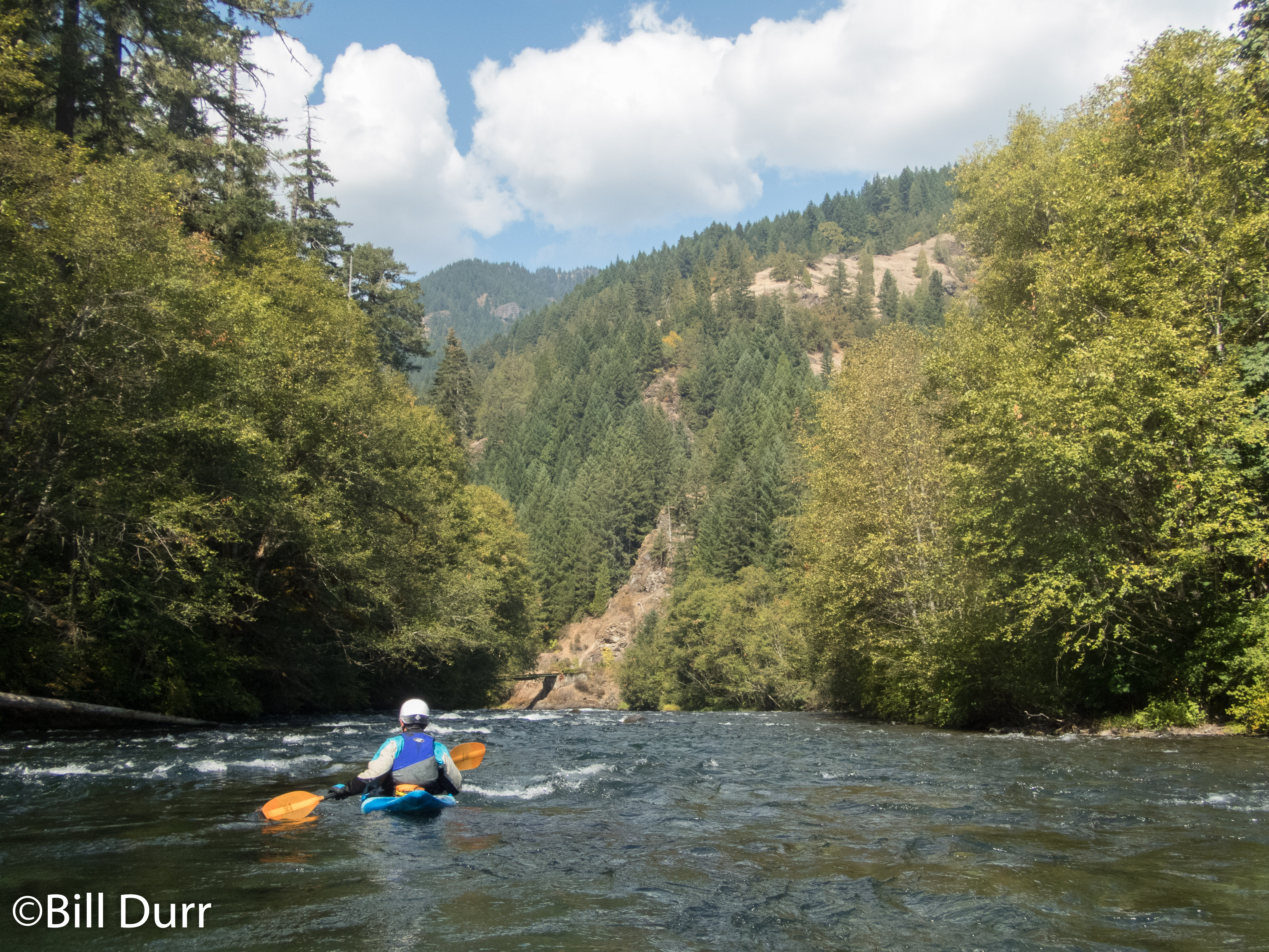
We ended up splitting the run into two about 4 mile sections. For the first, Todd would be with us, then Matt would take him back to his car at the put in so he could go to the airport. David and I would continue downstream. The run ended up being more relaxed than the others and definitely was one you do for the scenery. There was not much flat and there were continuous riffles with some rapids mixed in. We came saw some people from the government out there with special boats counting the different fish.
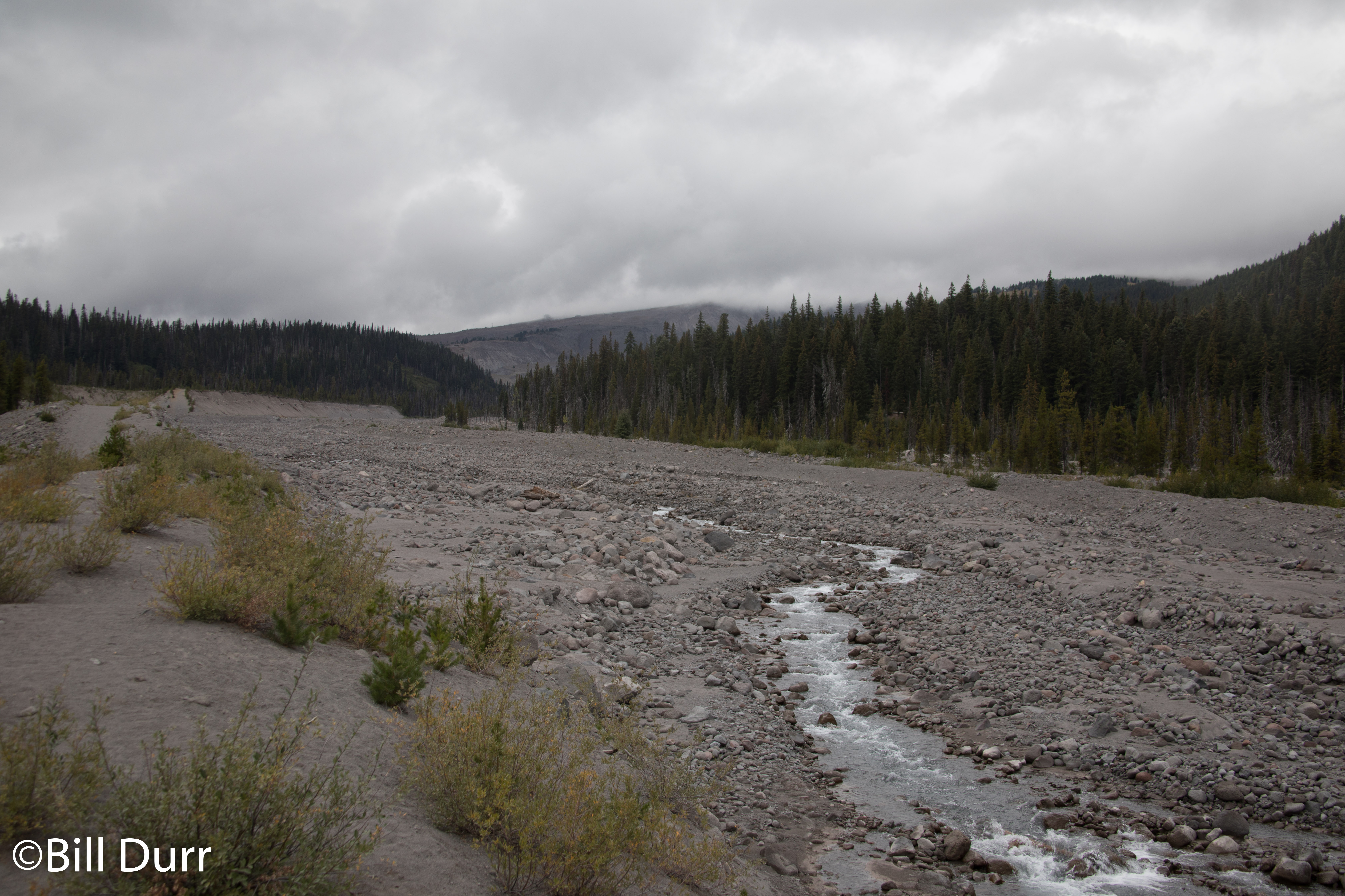
Once we had finished the run we headed back to White Salmon to collect the rest of our gear and get ready for our flights home the next day. On our way home we went via Government Camp (yes, really creative name) so we would pass by Mount Hood. Unfortunately it was cloudy for us and we were not afforded a good view. It was still interesting to see the base of it and the mostly dry riverbed that came off it.
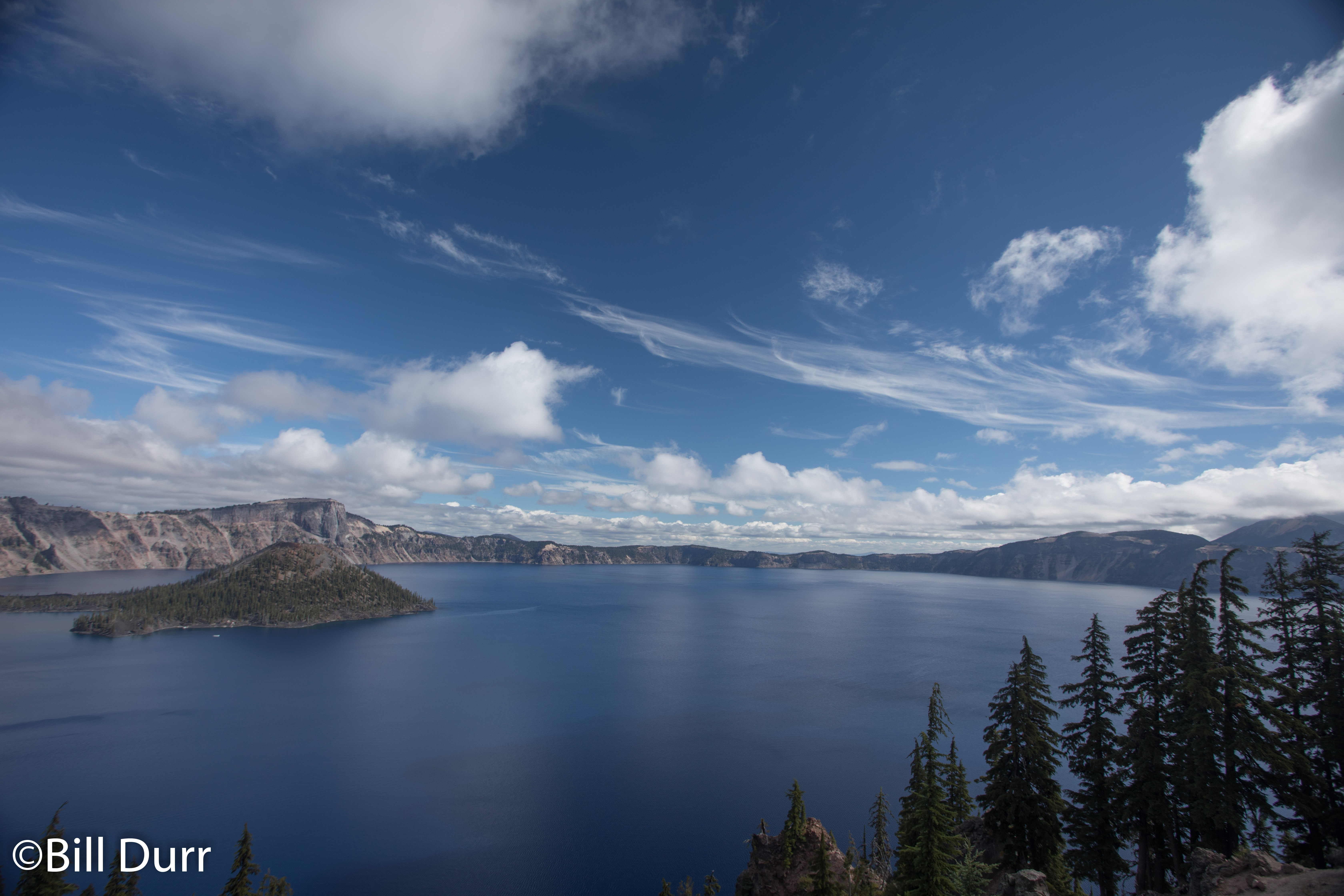
On our forth day after breaking down camp and grabbing breakfast at Black Bear again, we headed north via a different route. Our first stop along the way was at Crater Lake, which worked well as it was on the way to our paddling destination for the day. Since our plans had changed we had not had a chance to see it. The climb up to it was nice and was thoroughly wood with conifers. Once in the park we were shortly greeted with a very impressive view as we joined the rim section of the Volcanic Legacy Scenic Byway. It is a beautiful sight to behold and definitely worth the trip if you are in the area.
Crater Lake
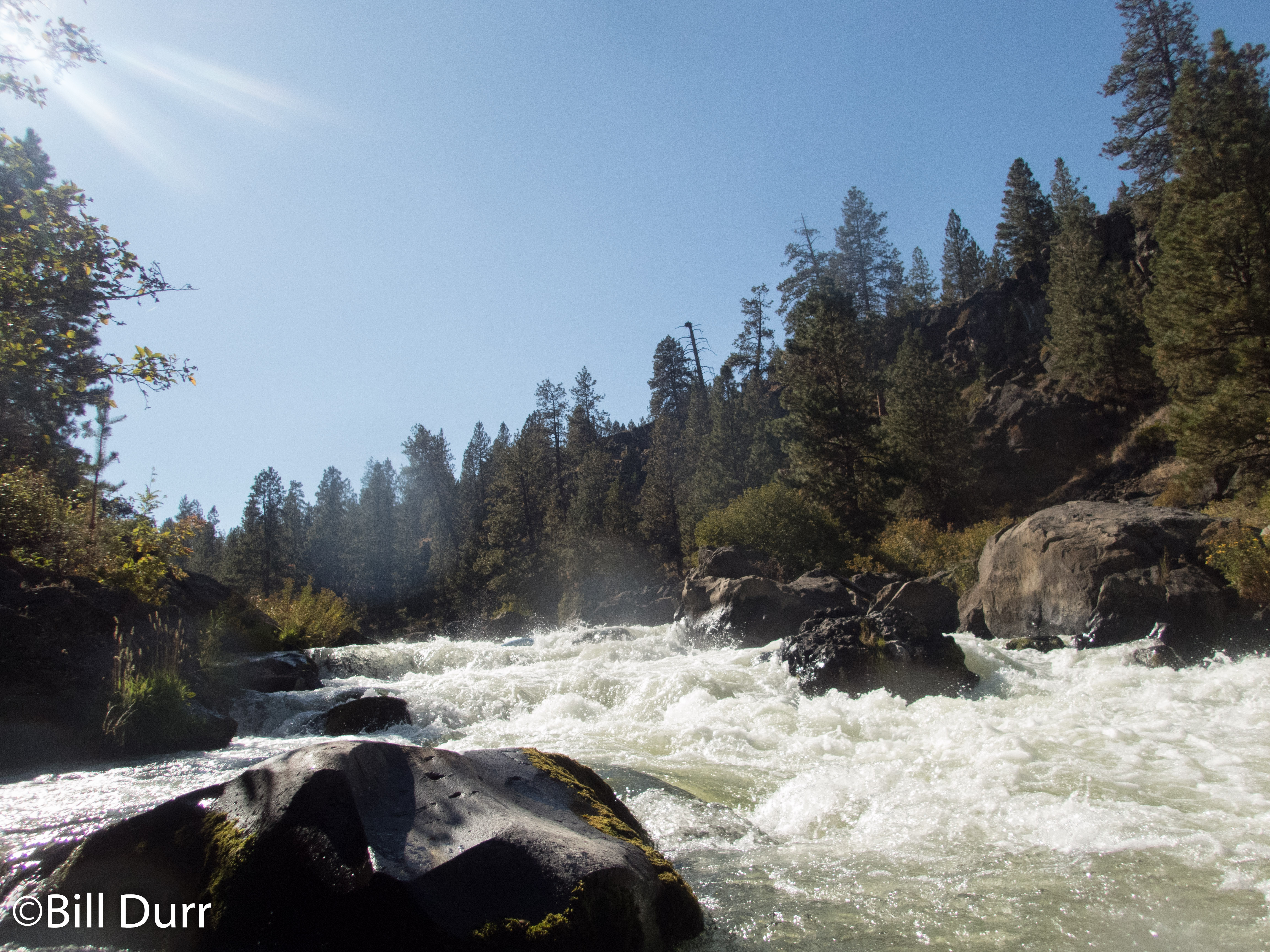
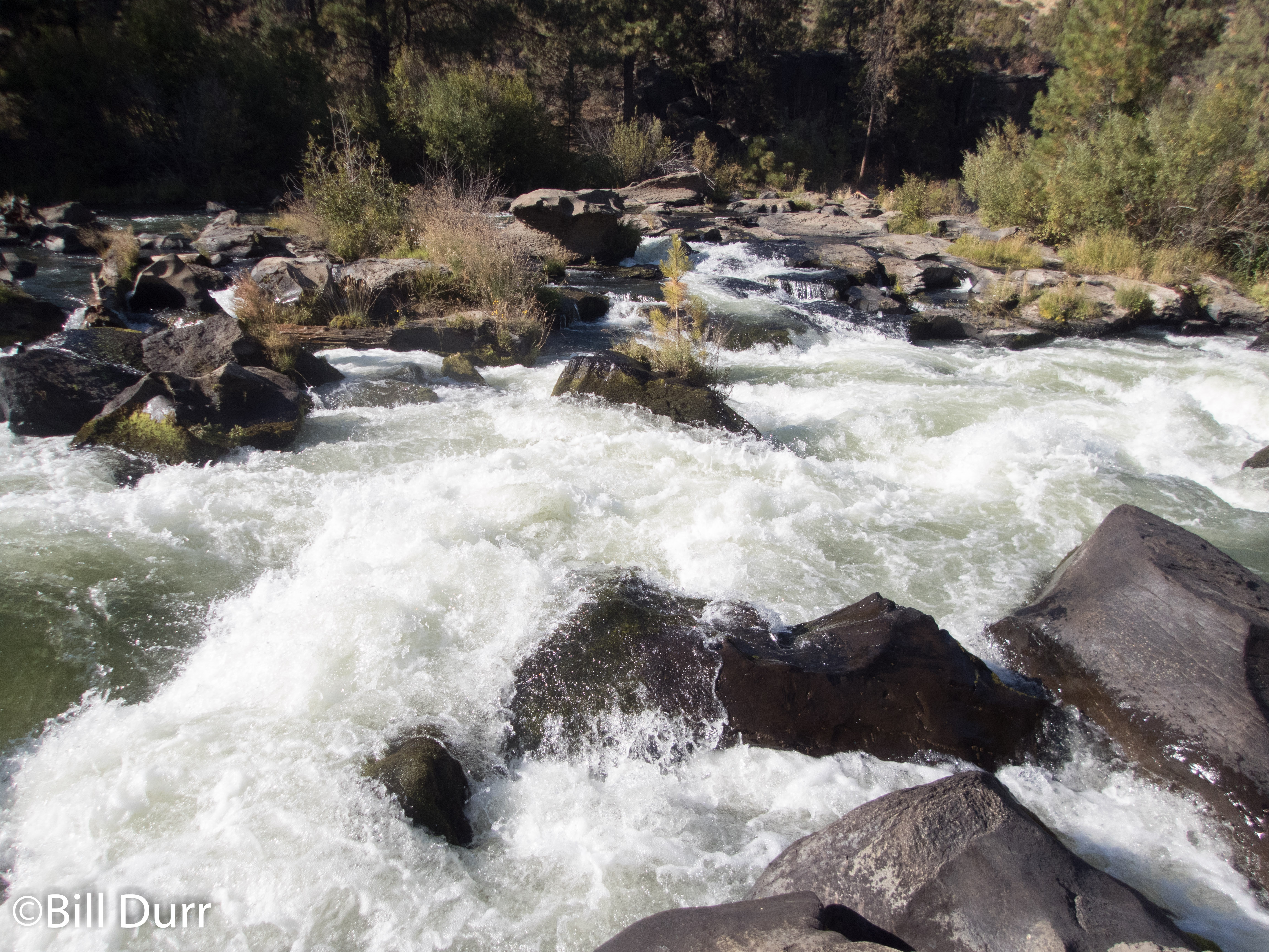
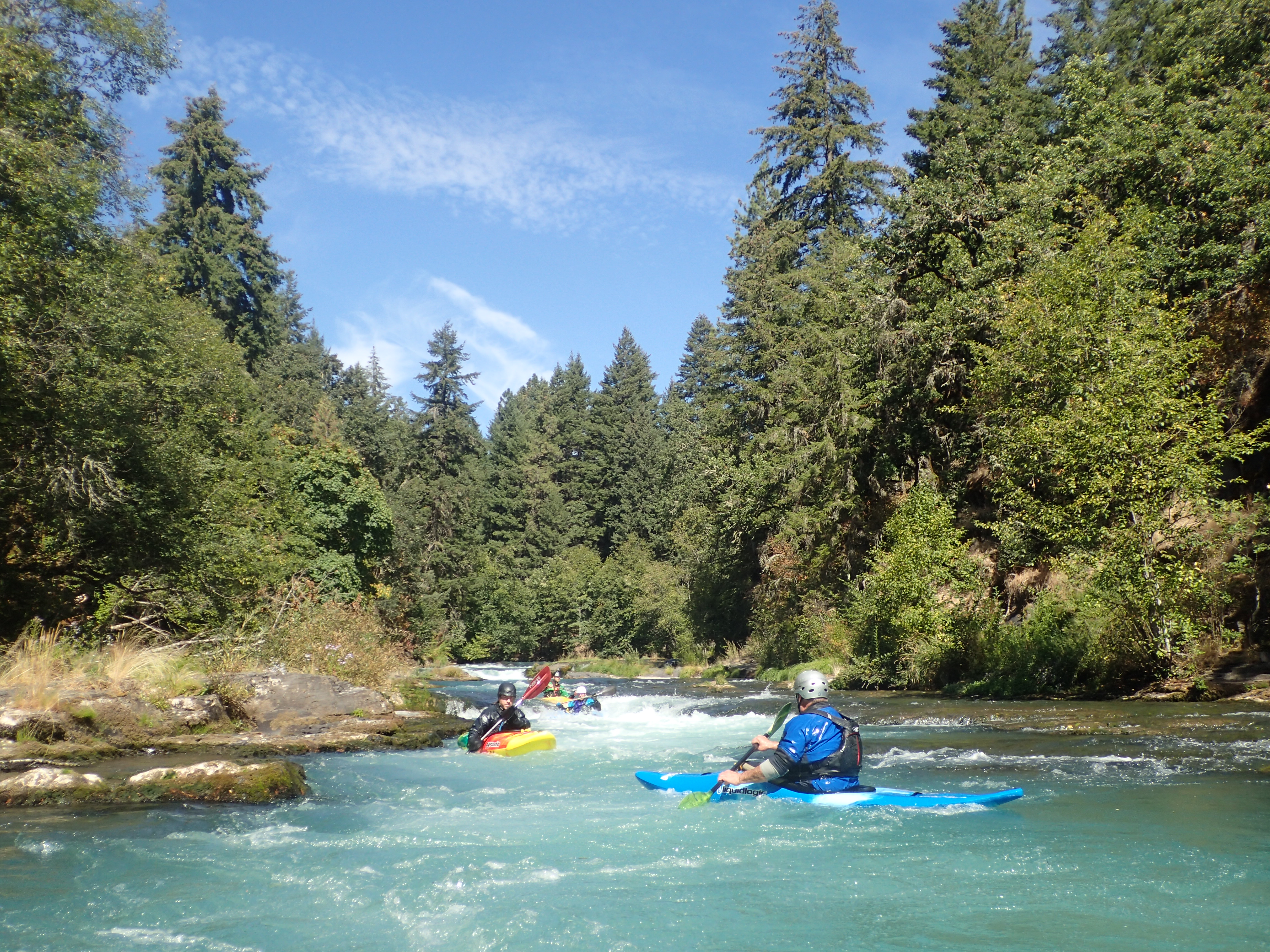
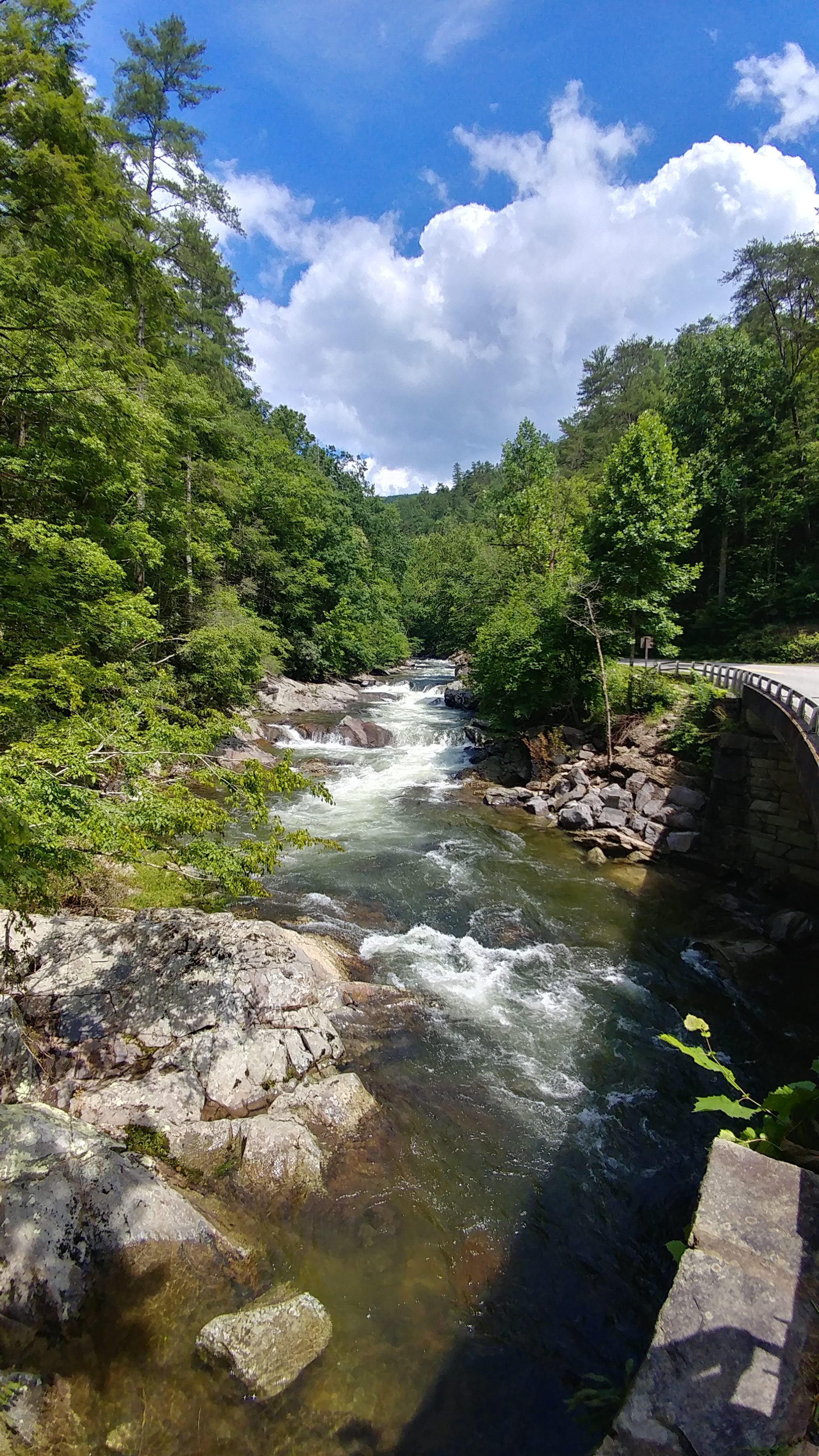
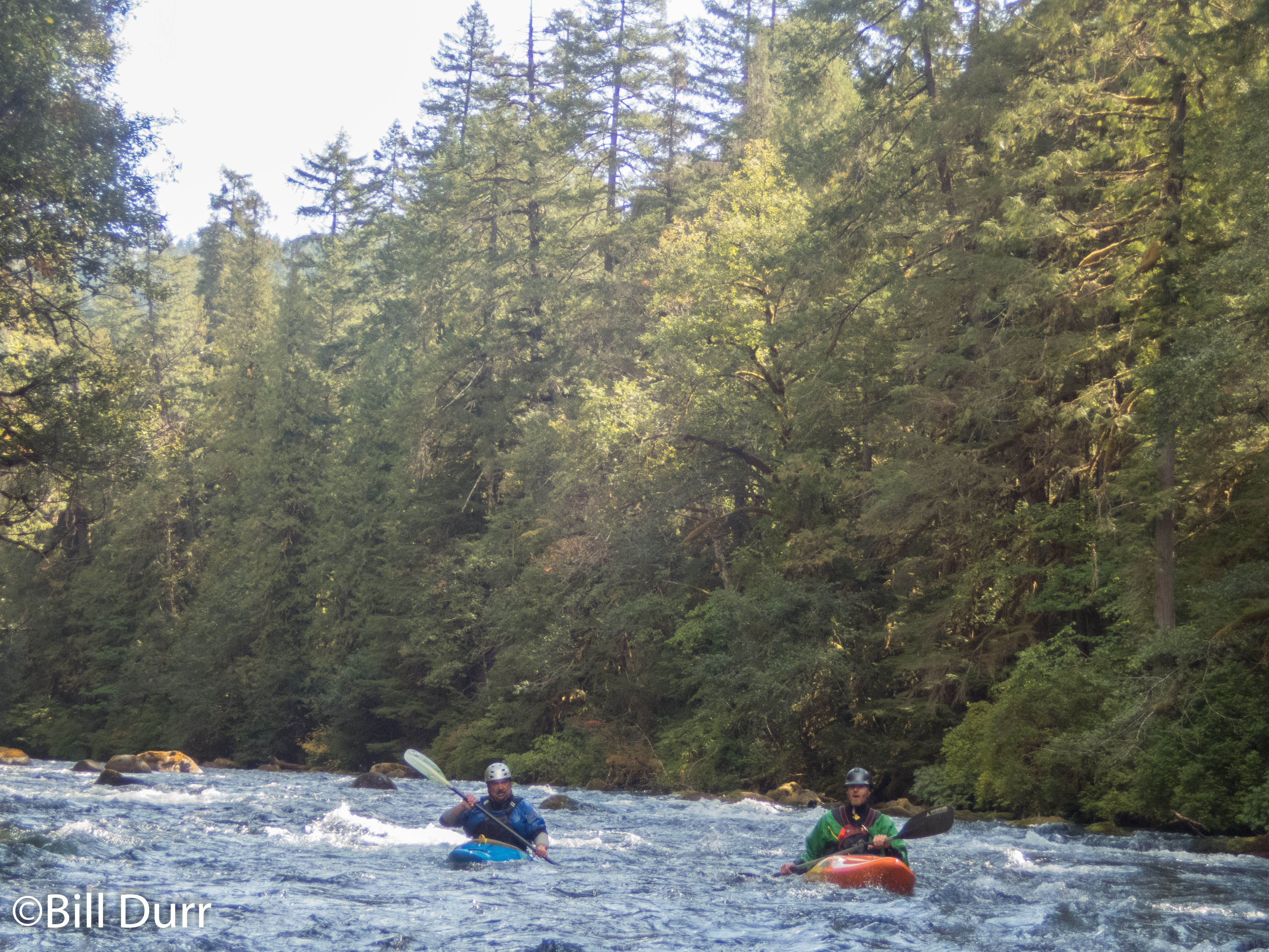
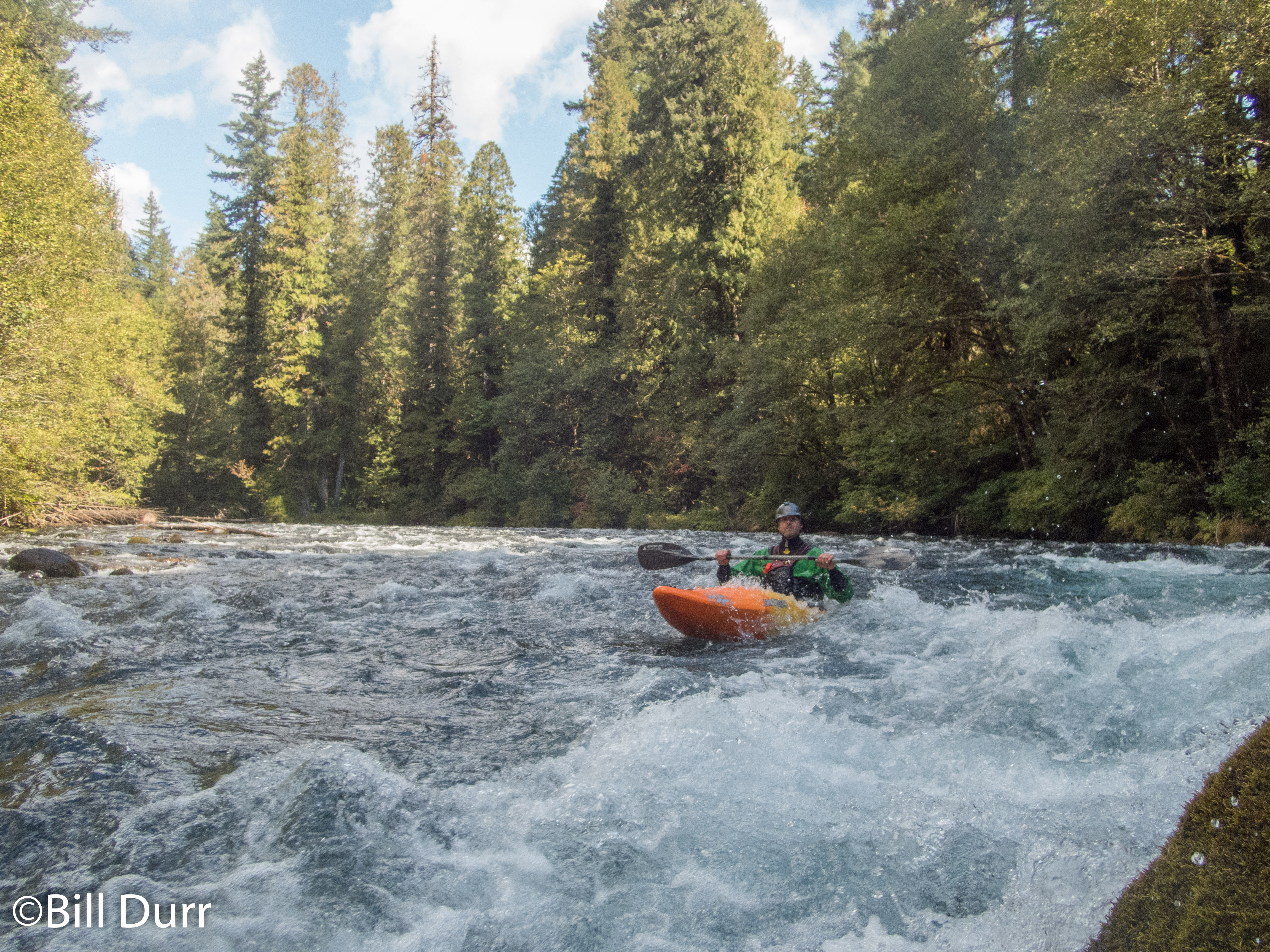
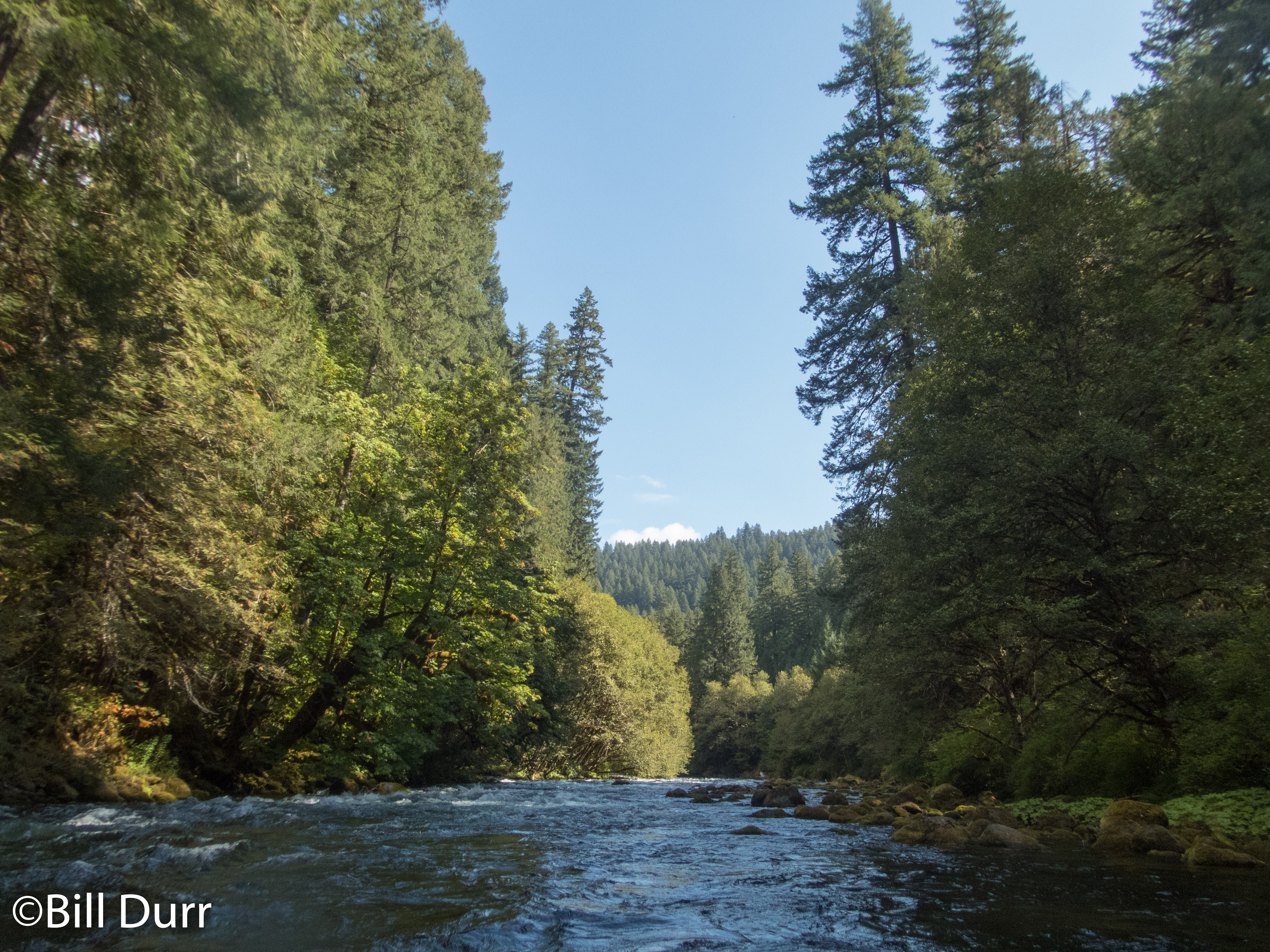
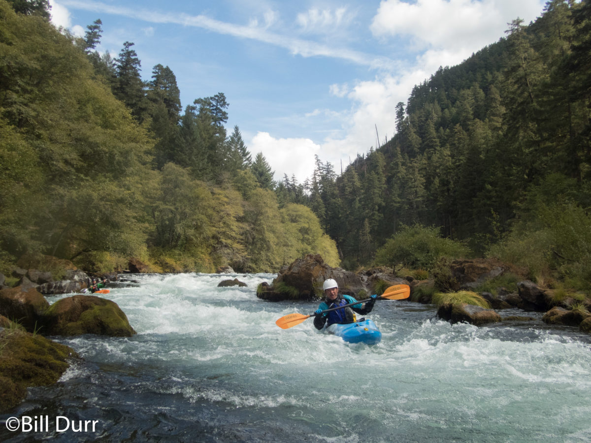
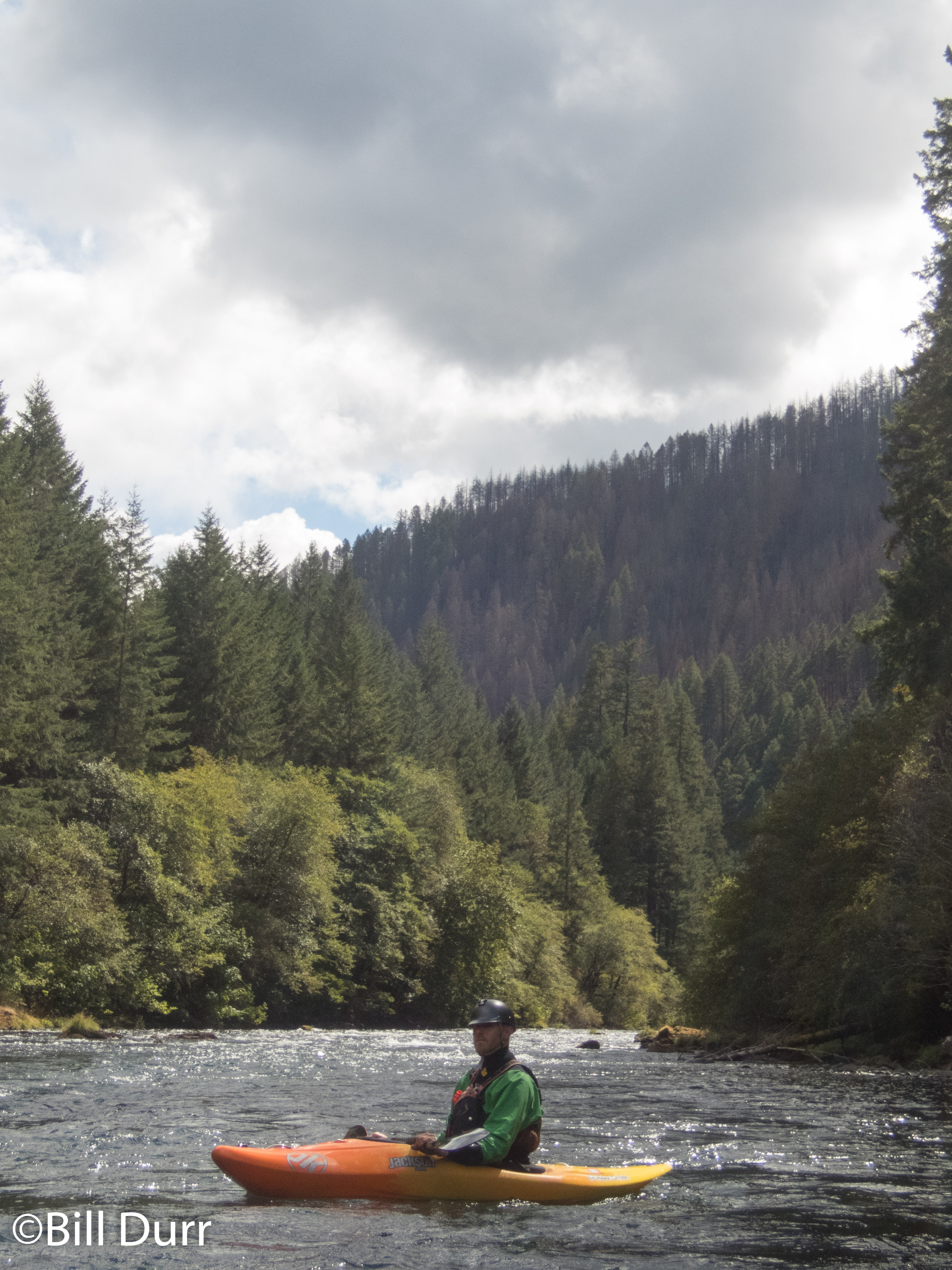
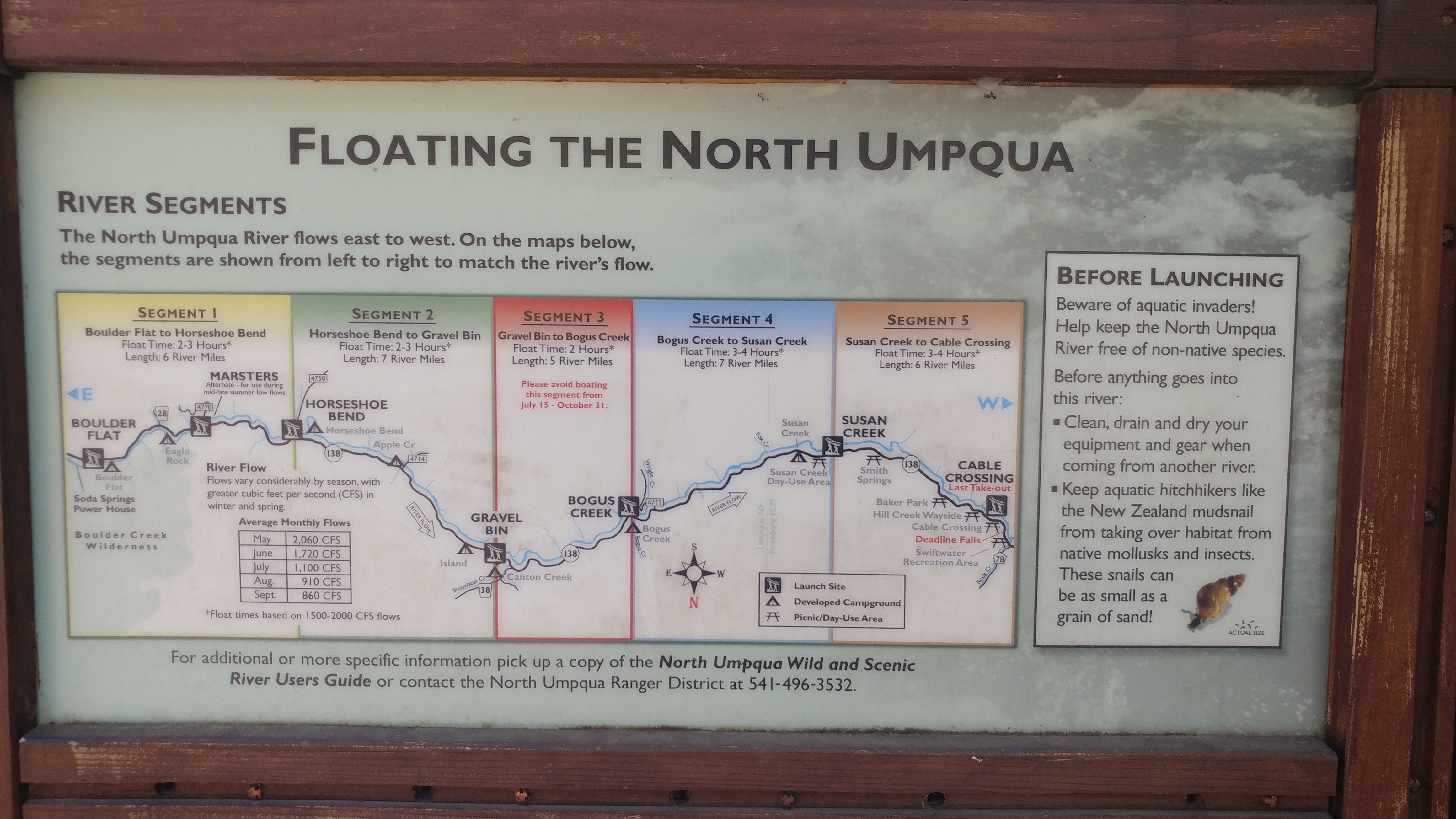
After taking our time and grabbing some photos we continued on into the Umpqua National Forest. Eventually our road came to the North Umpqua and continued alongside until we got to the takeout. The entire run is semi roadside and there are many access points. You can easily choose how much of the river you’d like to do and AW lists it as 25 miles. We ended up doing a little above Horseshoe Bend to Gravel Bin. The run is a good class III section through a pretty canyon. The rapids are nice and the flats between them are moving. This run was definitely a little more relaxed than what we had been paddling up until now. Even though it might not be the most difficult, it makes up for it in beauty. It easily could be something that you paddle just for the view.
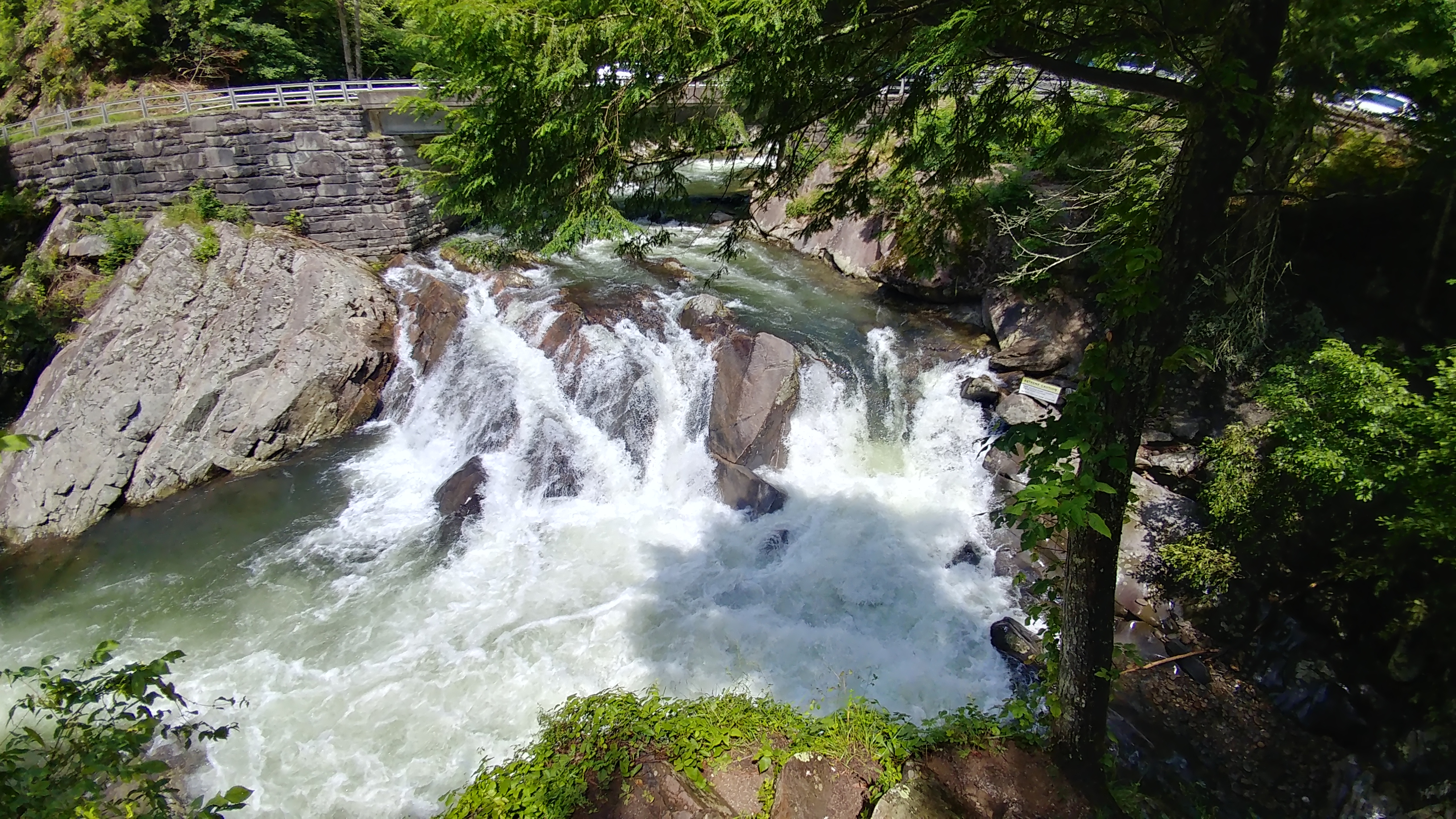
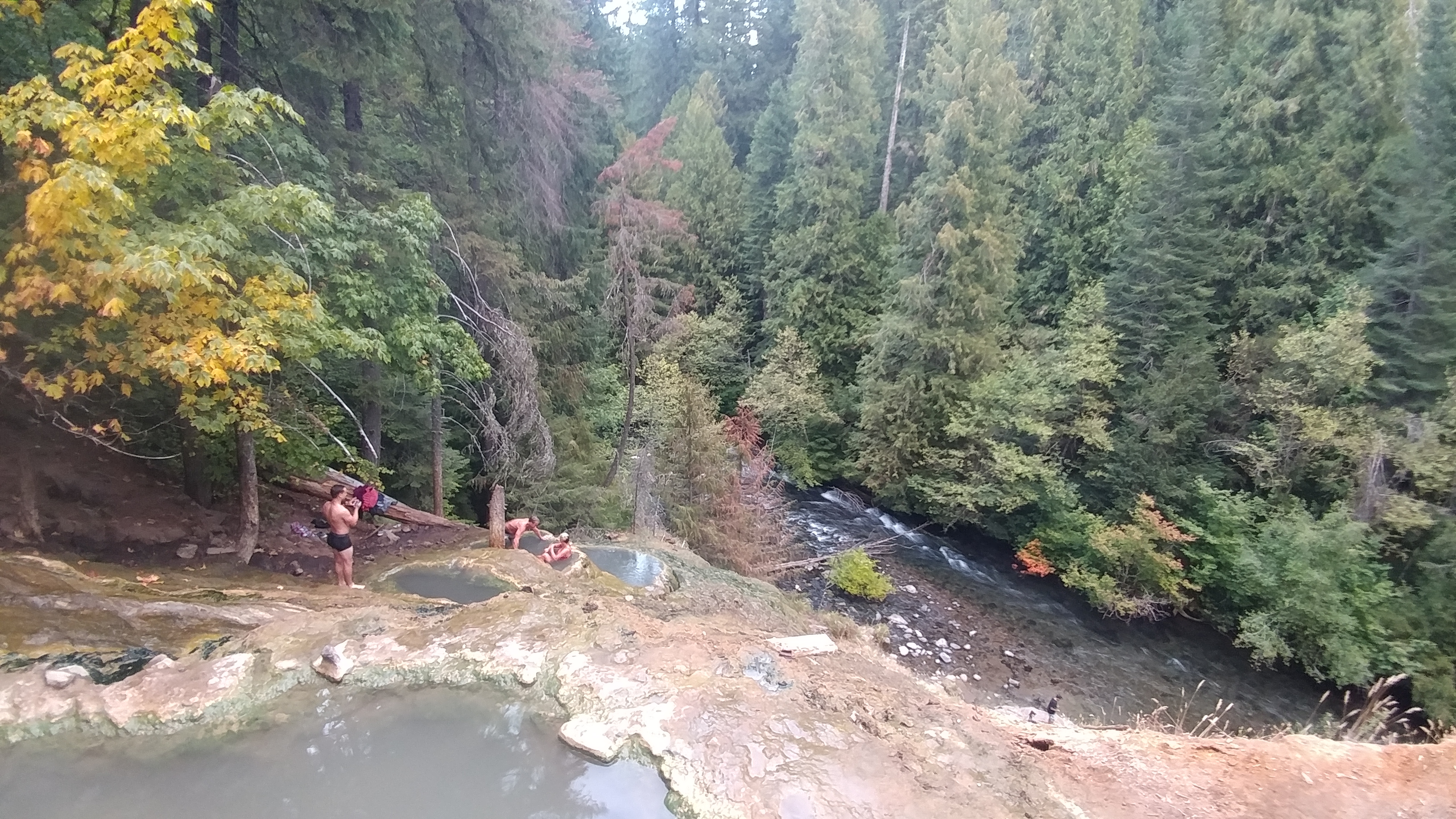
There were a couple interesting rapids that definitely would have been more fun with some extra water. We had 833cfs, which seemed to be standard for this time of year. Though all the signage at the takeout talked of flows of 1500-2000 cfs. The real draw of the run is the hot springs afterwards. When we got there we discovered it was very popular even thought it was a weekday evening. The pot we started out in was just luke warm and we had to wait a bit to go to a warmer one. The next to free up was the very top one. The was the hottest and where the water first entered into the system. It was difficult to stay in this one for long. Eventually we were able to sit in the covered pool which was the perfect temperature.
Umpqua Hot Springs
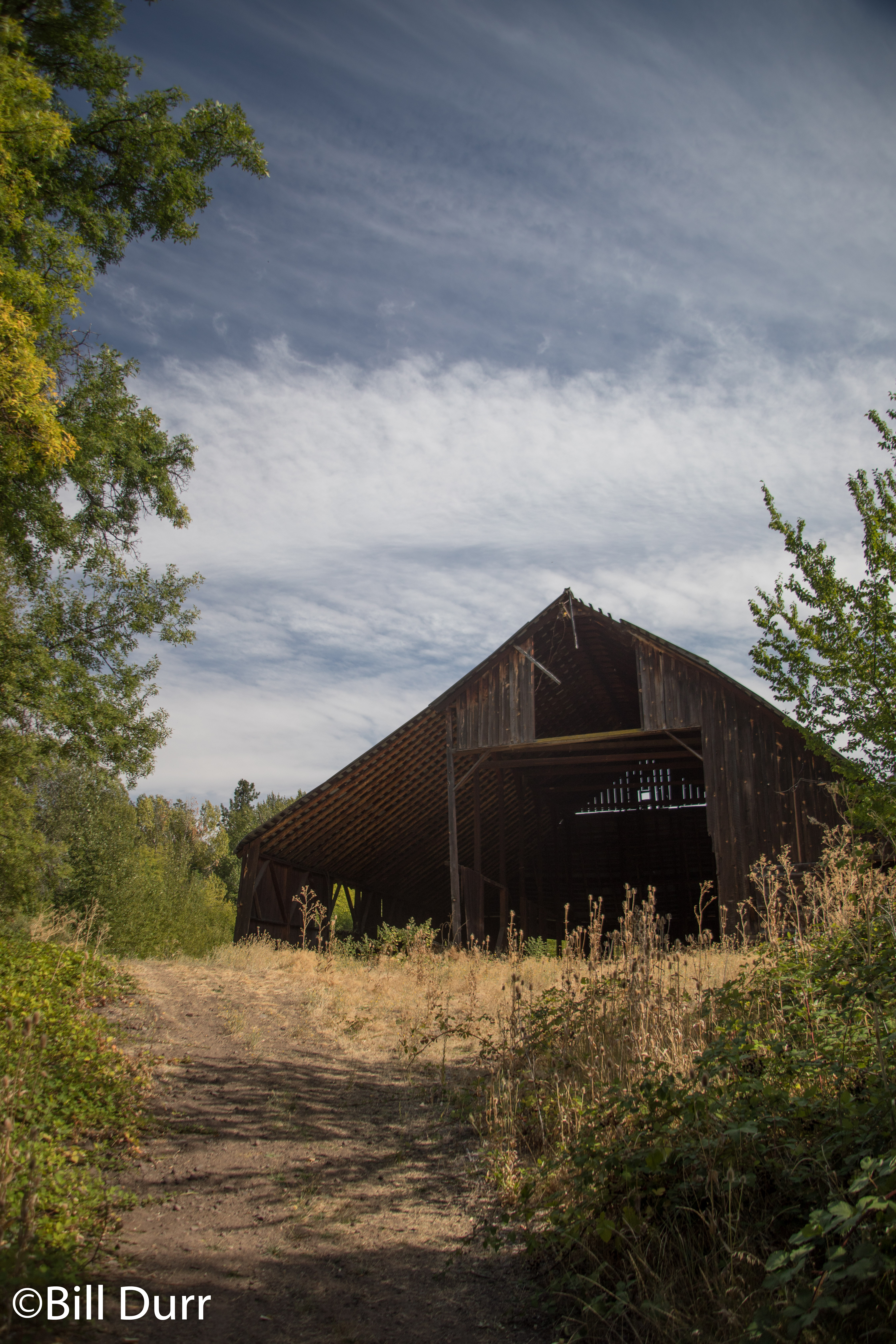
We ended up spending a good amount of time at the hot springs. Because of this we left significantly later than we had wanted to. Our plan had been to drive the 3-4 hours back to White Salmon that evening. However, as time moved on we realized this probably was not realistic. As we left too late to really find food many places, we diverted to Roseburg to find some dinner. Ended up stopping at Elmers Restaurant. Chose it mostly because it would still be open. They stayed open til 10, most closed at 9, and we were getting into Roseburg at about 8:40. The food was good, so things worked out well. We then headed north on I-5 towards Eugene in search of a place to stay the night. Baker Bay Campground and Marina ended up being the location. We set up in the dark and hoped we didn’t make too much noise for the other people there
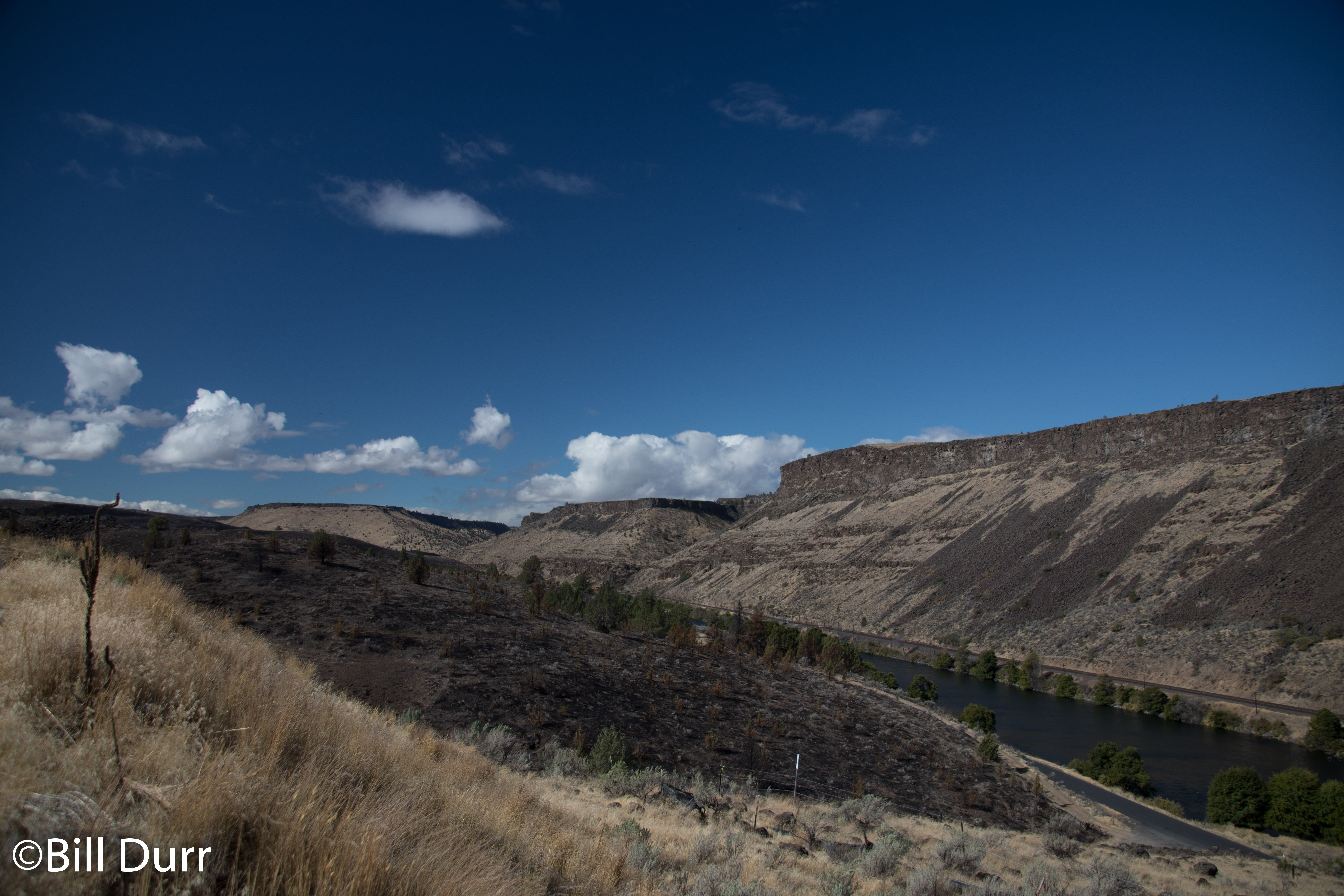
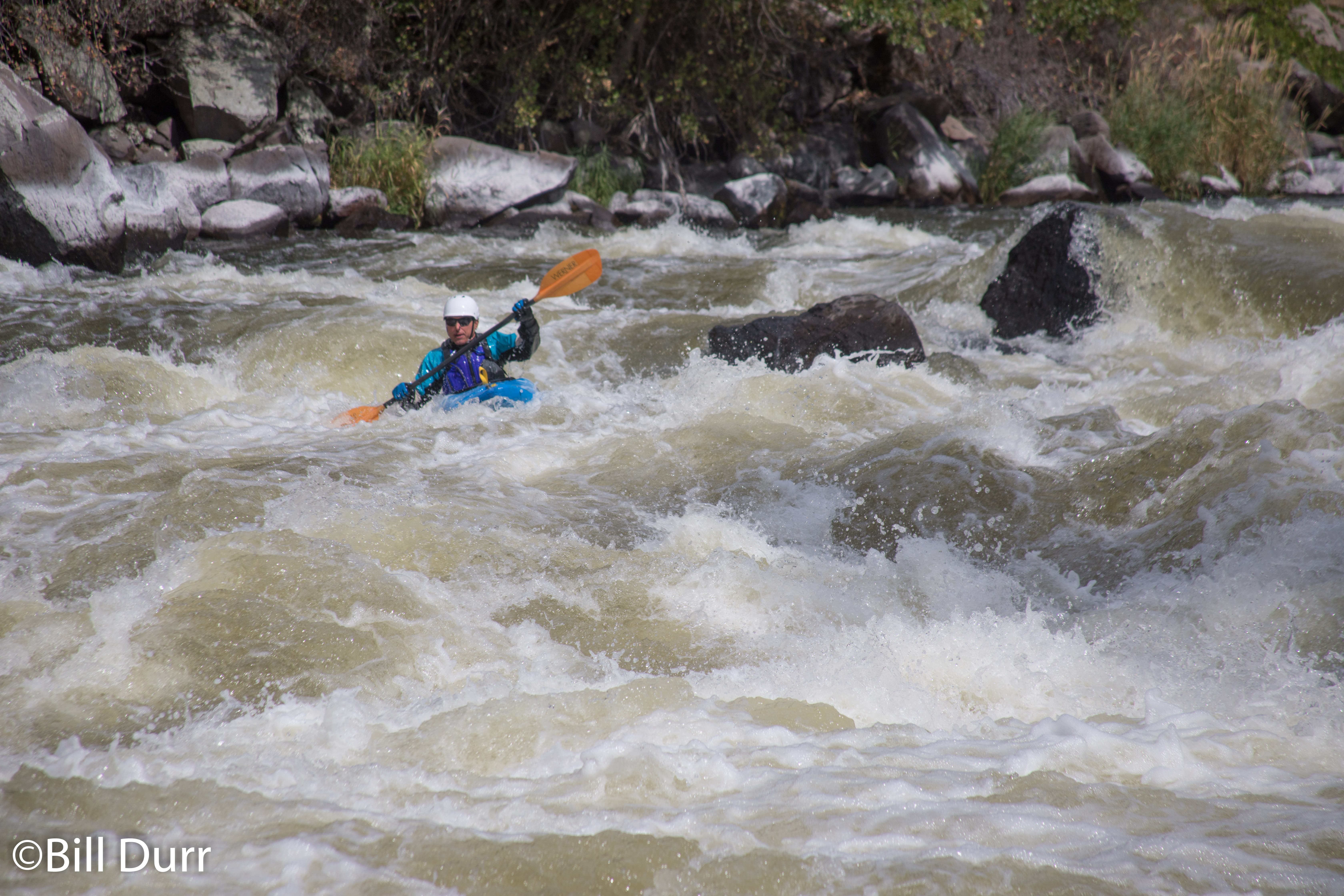
On our third day we started out with breakfast at the Black Bear diner in Klamath Falls. Didn’t know it was a chain when choosing it, but the food was good and a decent price. Afterwards we started our driver down to the boarder of Oregon and California to paddle the Klamath. The trip down to the access points was definitely an adventure. As you get closer the road gets progressively more difficult and eventually you’re slowly making the descent from the canyon rim down to the river. Anyone who thinks the road to the Cheat is bad needs to reconsider. The trek is truly to the next level. I would not want to try to drive down this road during the muddy season.
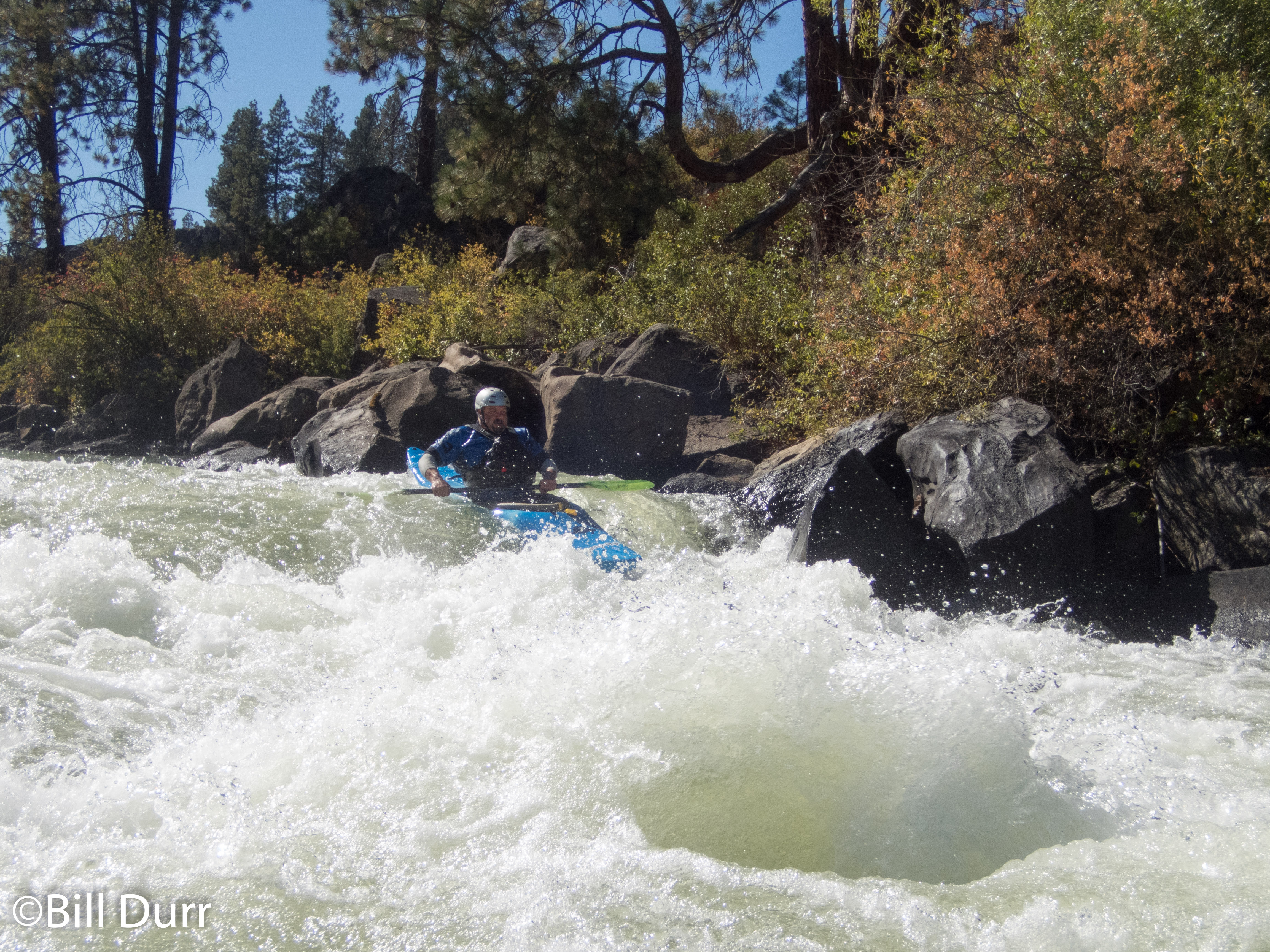
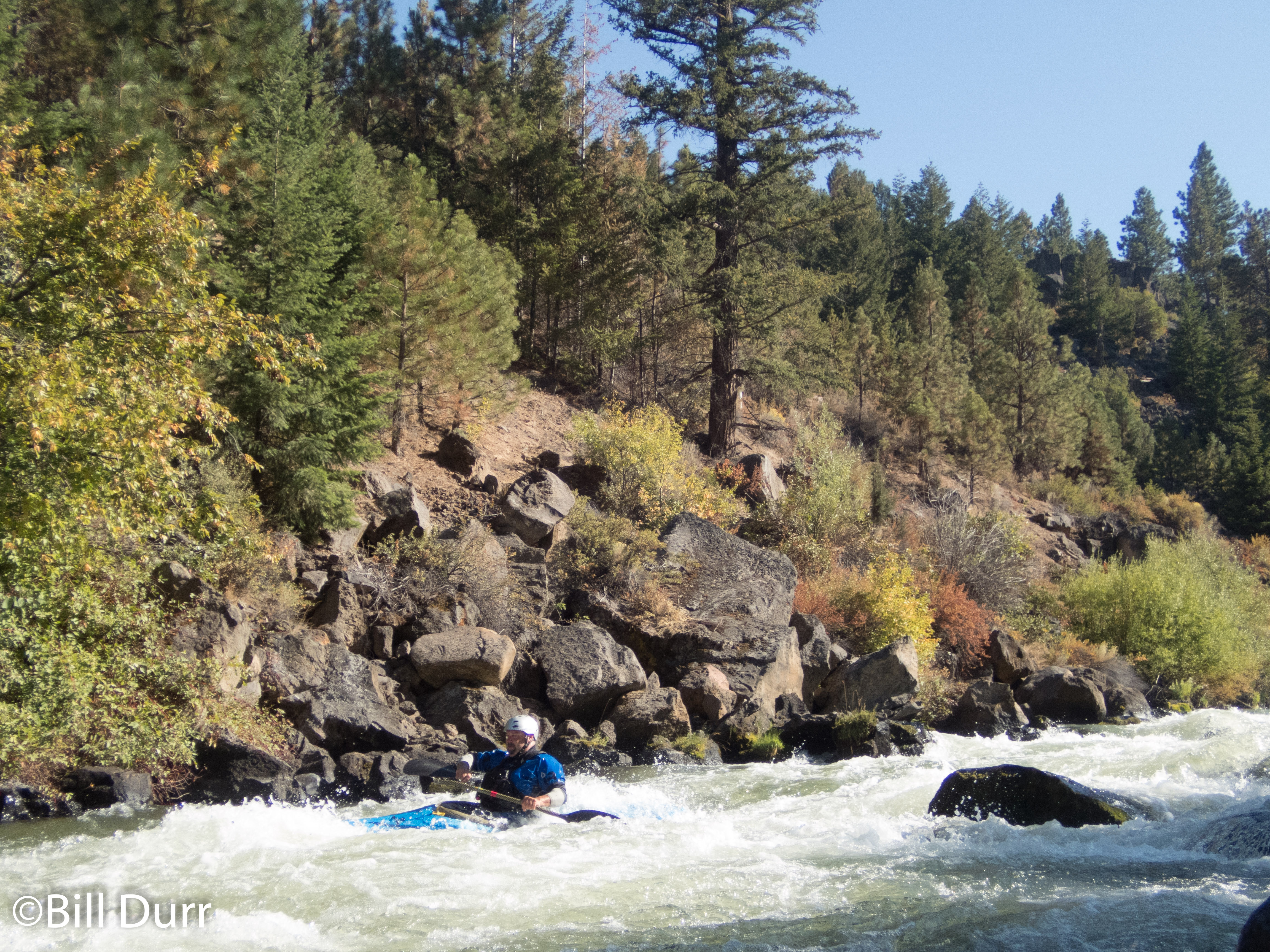
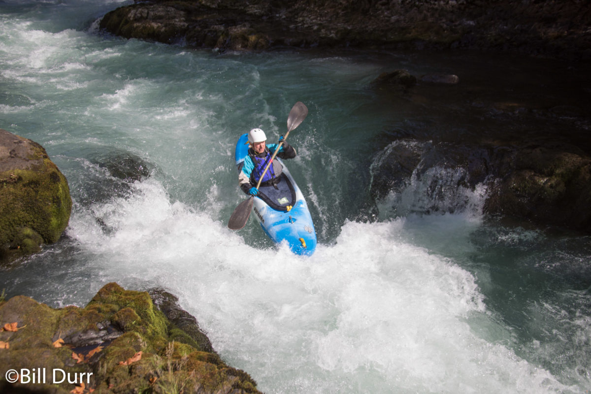
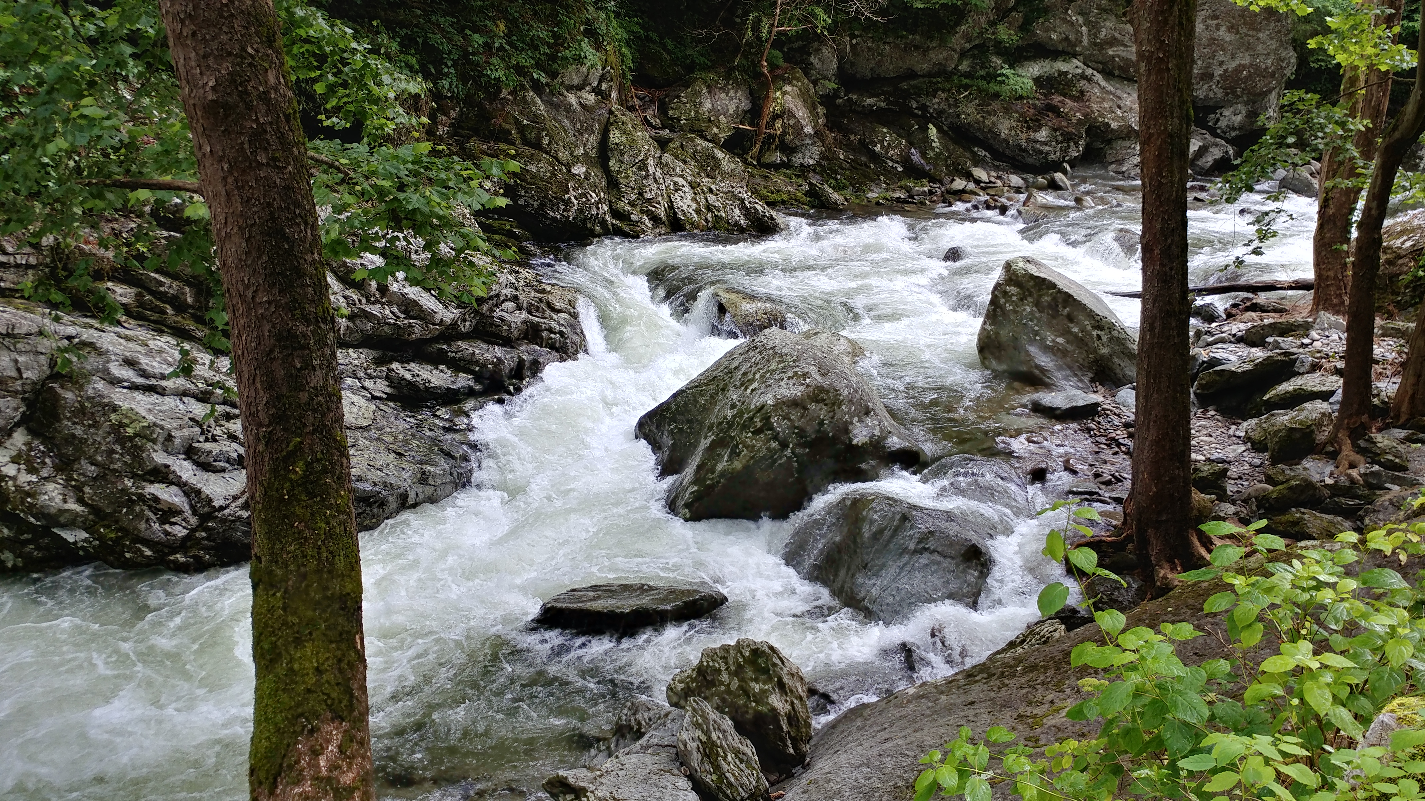
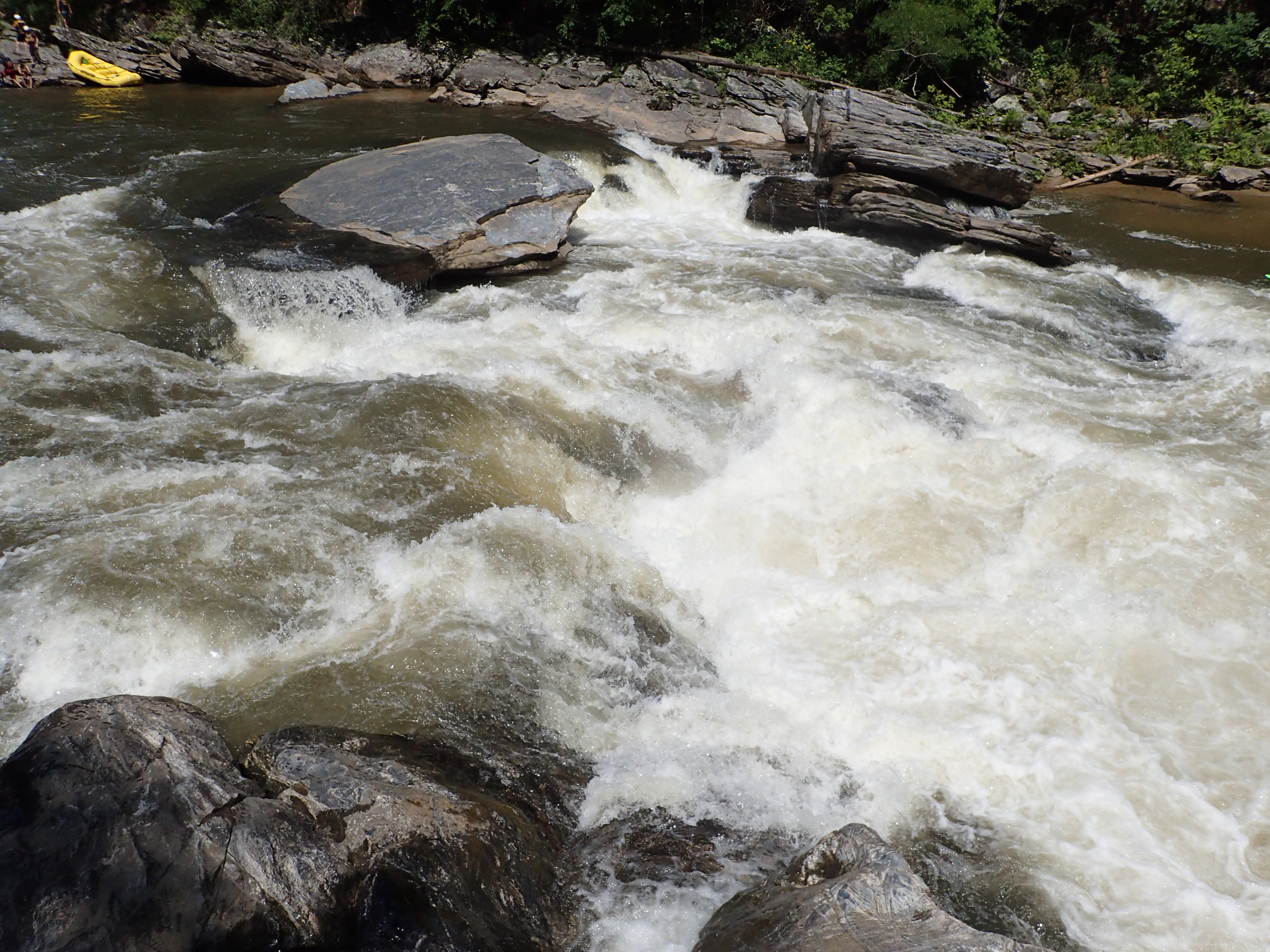
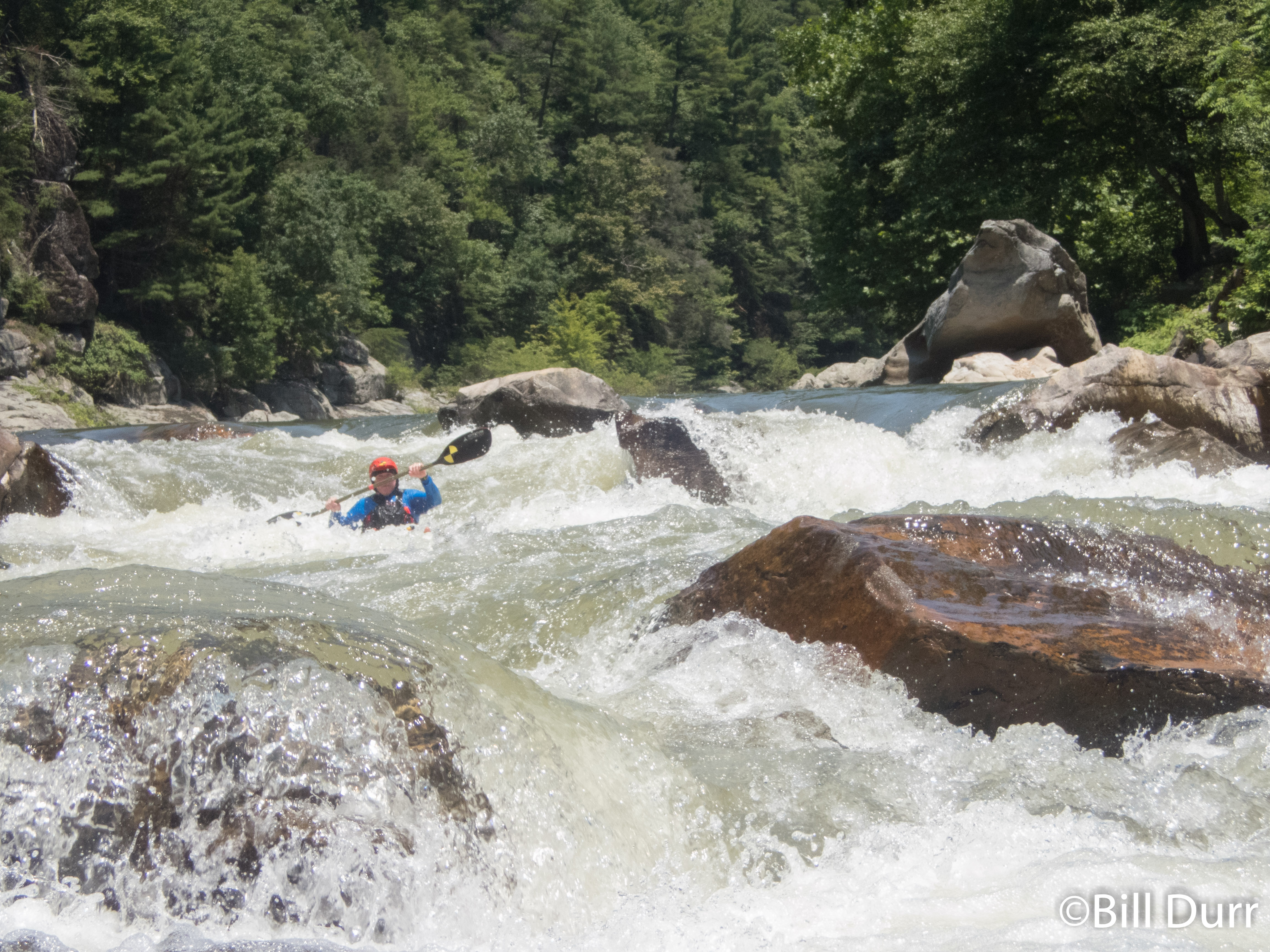
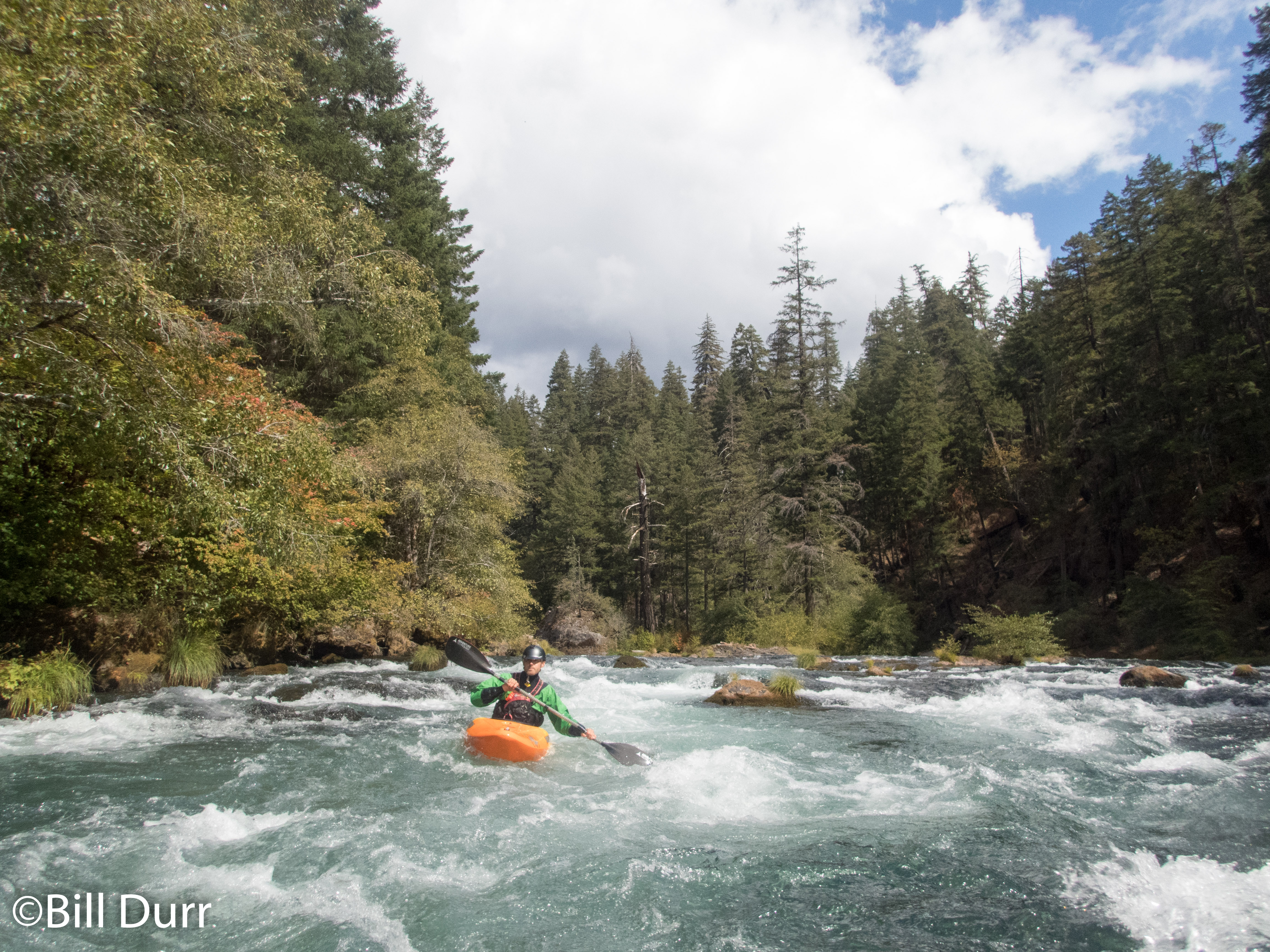
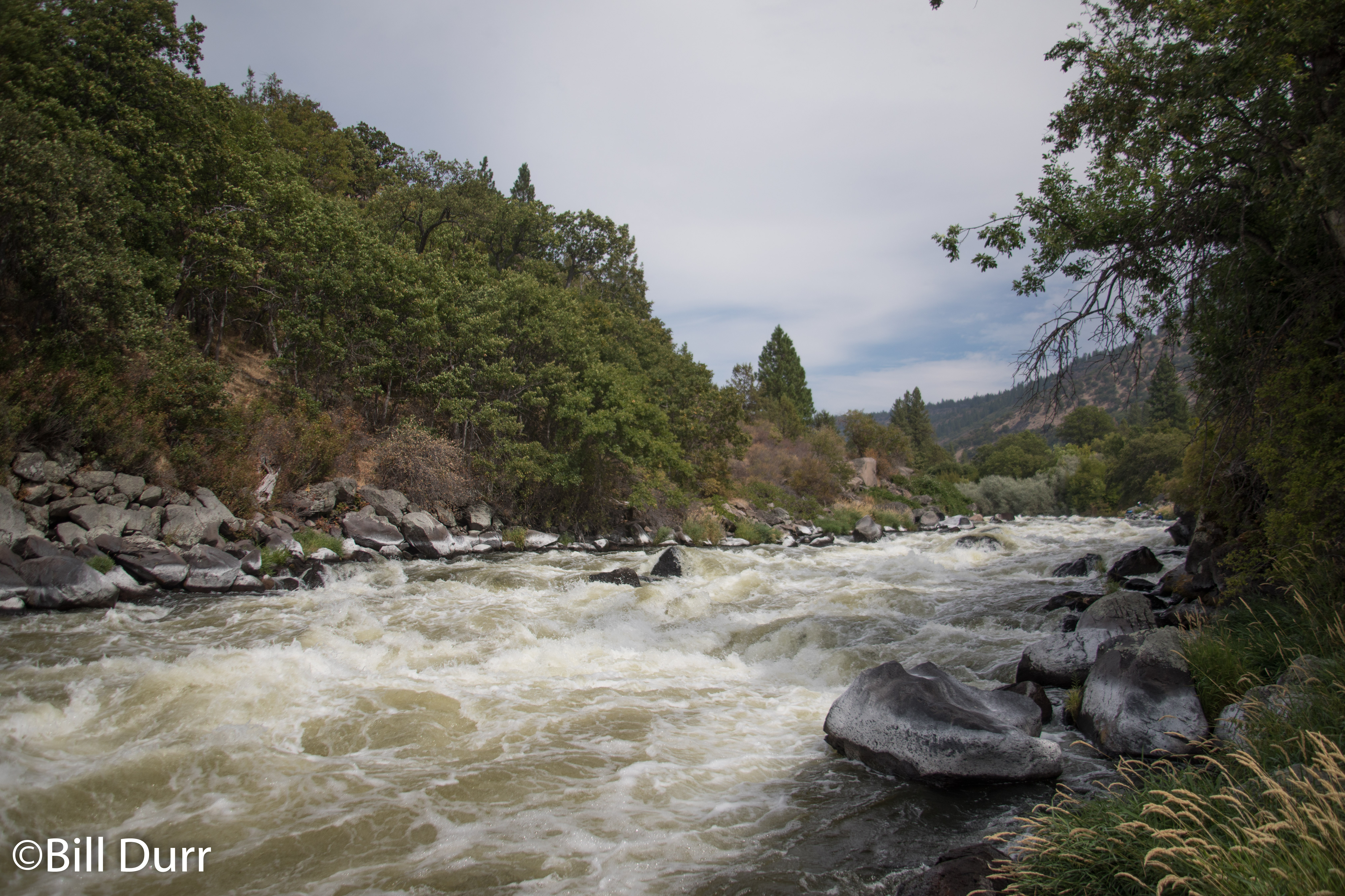
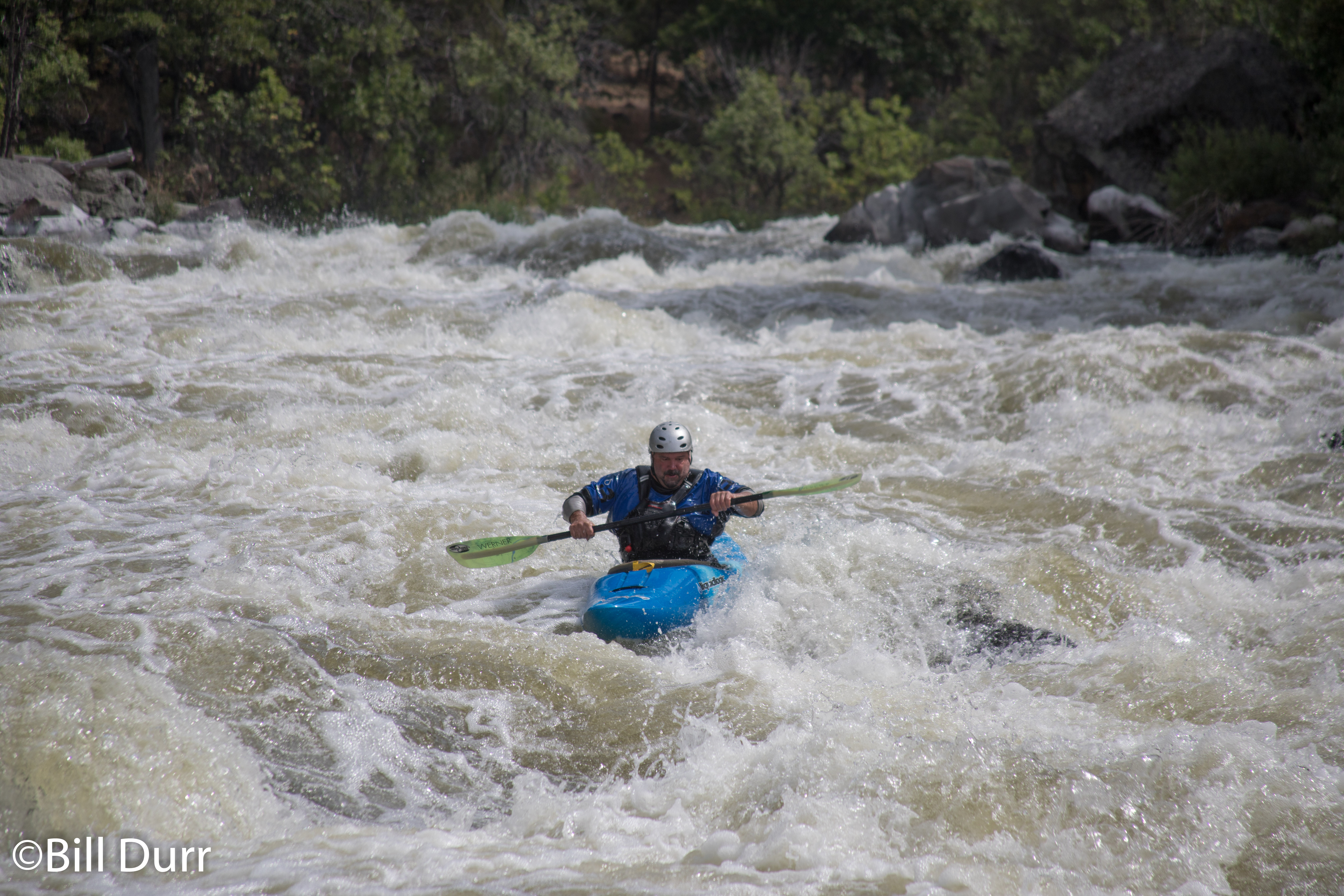
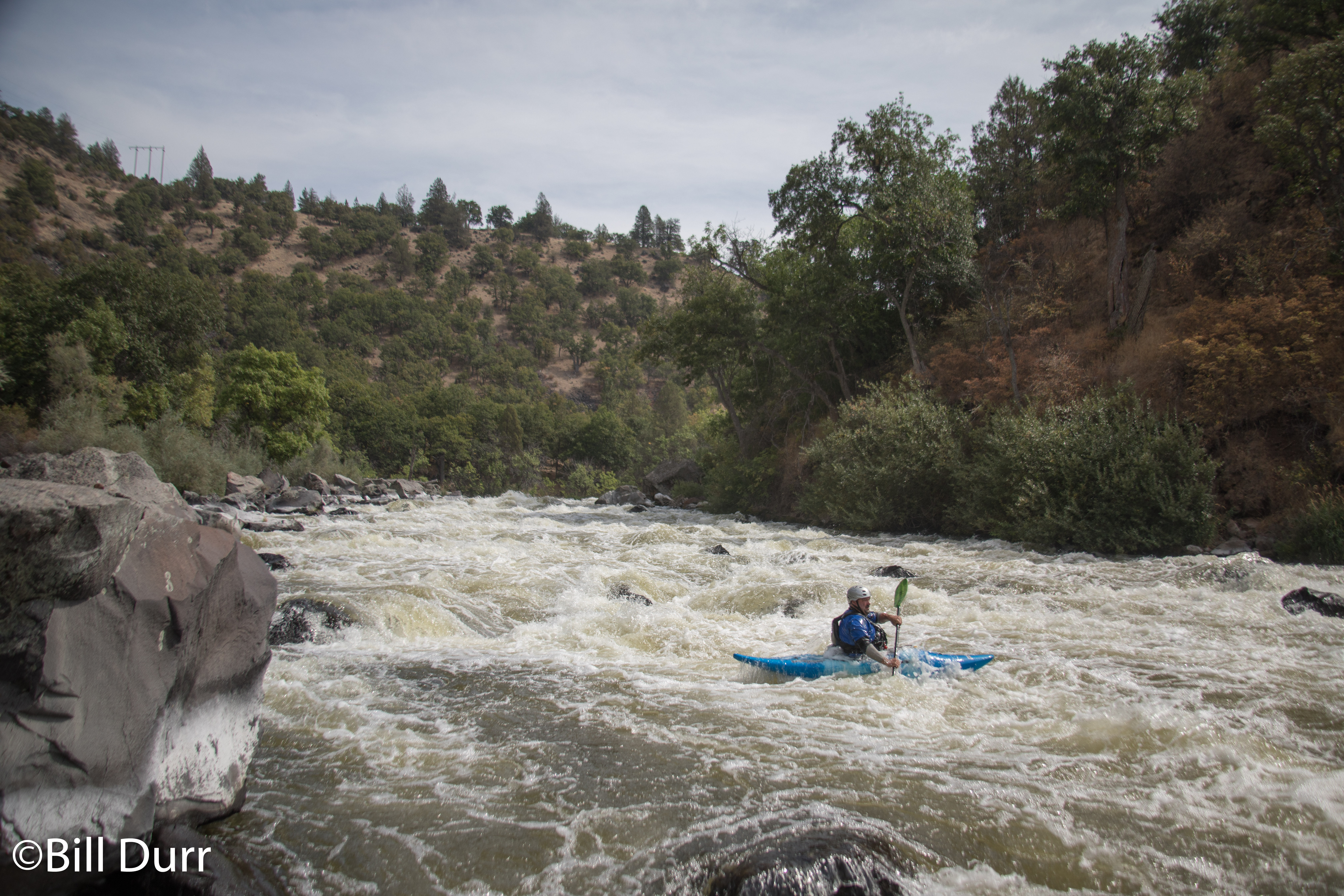
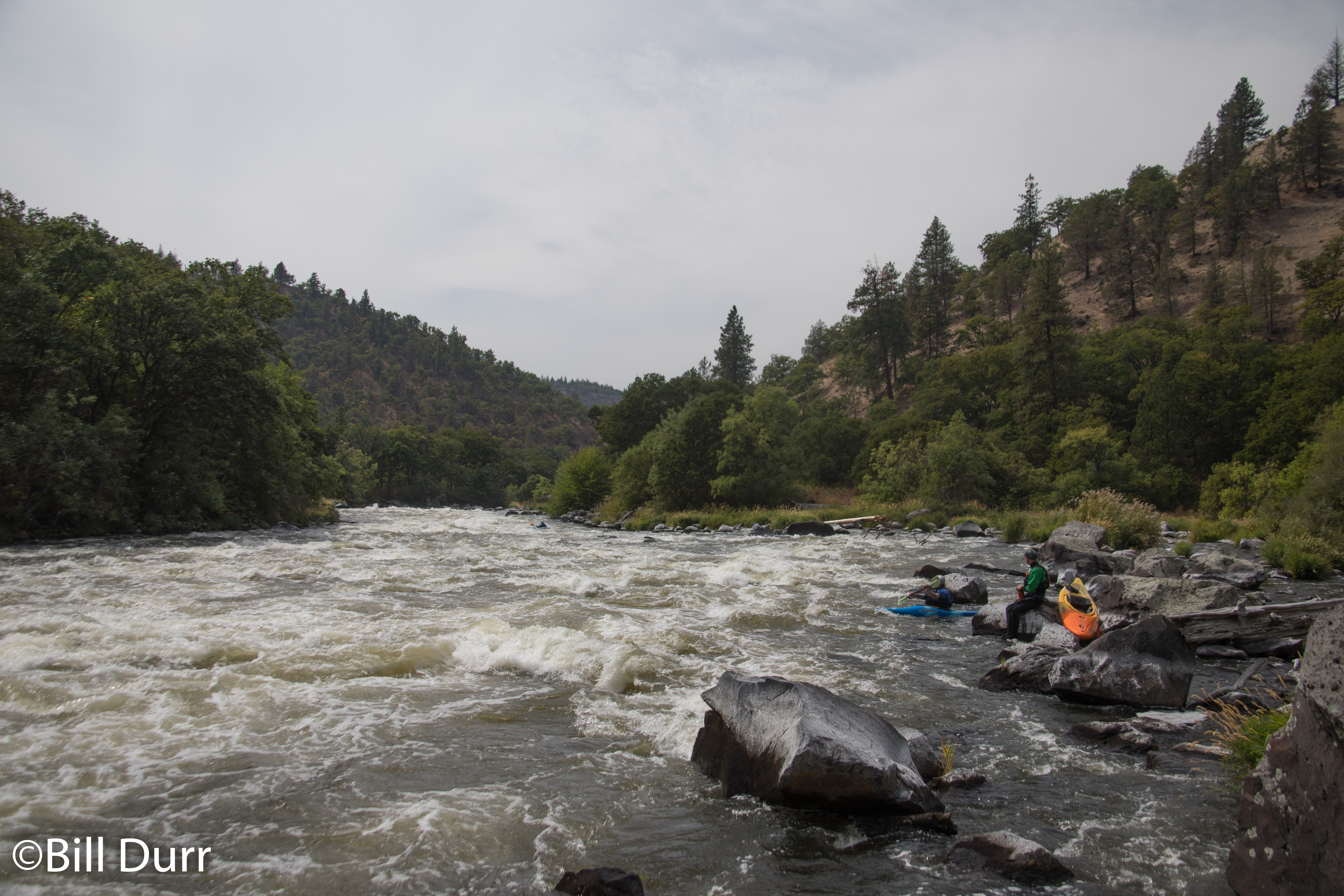
We put in at Frain Ranch to cut off the first 5 miles, and about two hours of total shuttle time. This also puts you in immediately above the first rapid, Caldera. It’s an impressive rapid, quite long, and busy the whole way down. There was a stoppage up top to scout and I decided to bounce down and find a good spot to take photos from. Even though I went a decent length, it was still only half way down the rapid. There were two nice big rocks that made pour overs for you to thread through and big holes to dodge. Thus we were right into the meat of the run, with plenty of excitement to be had. All of us decided to dodge the rocks except Matt, who thought boofing the top one was a good idea. I wish I had, but I was still off put by the sharp rocks on this coast.
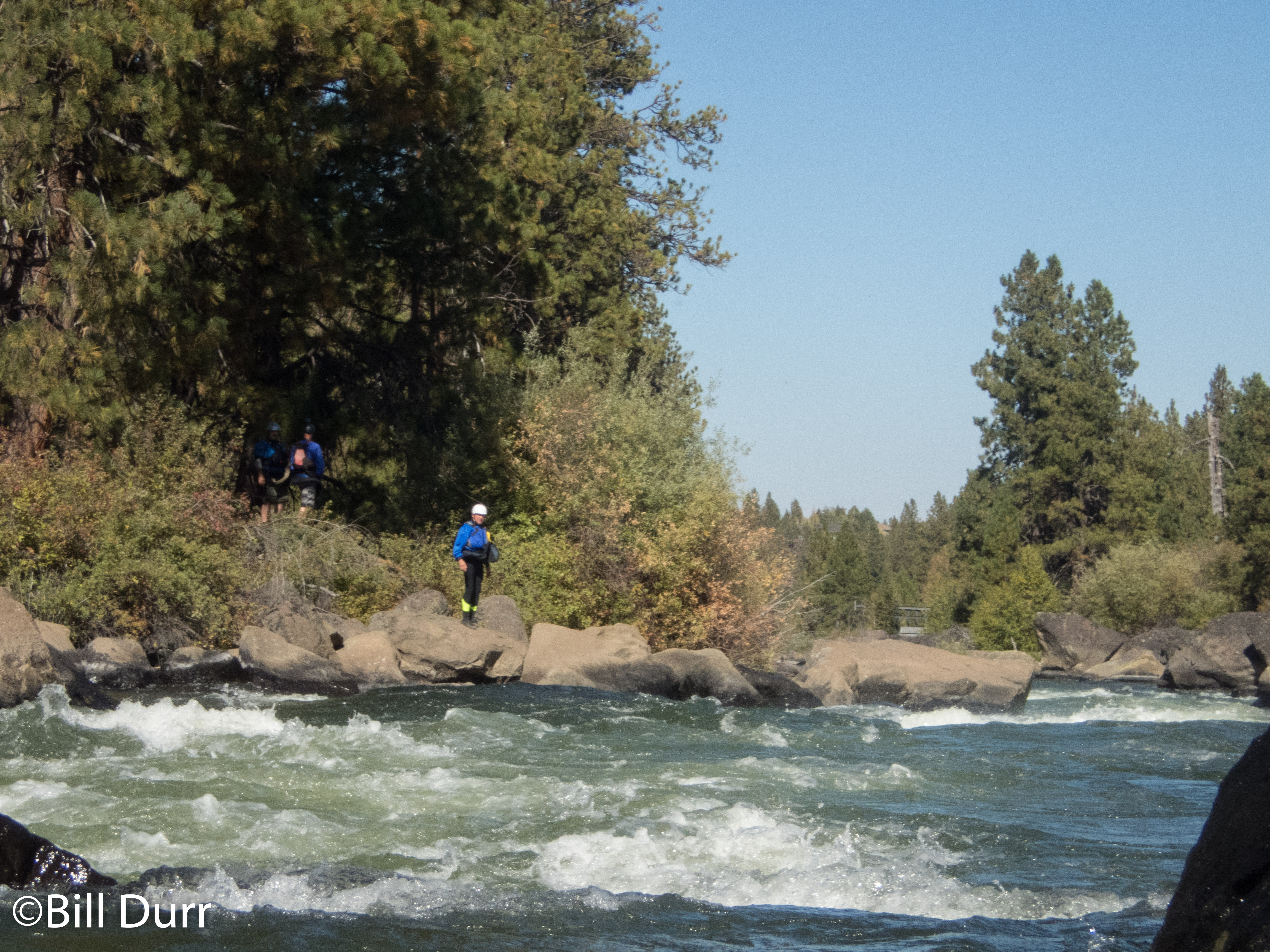
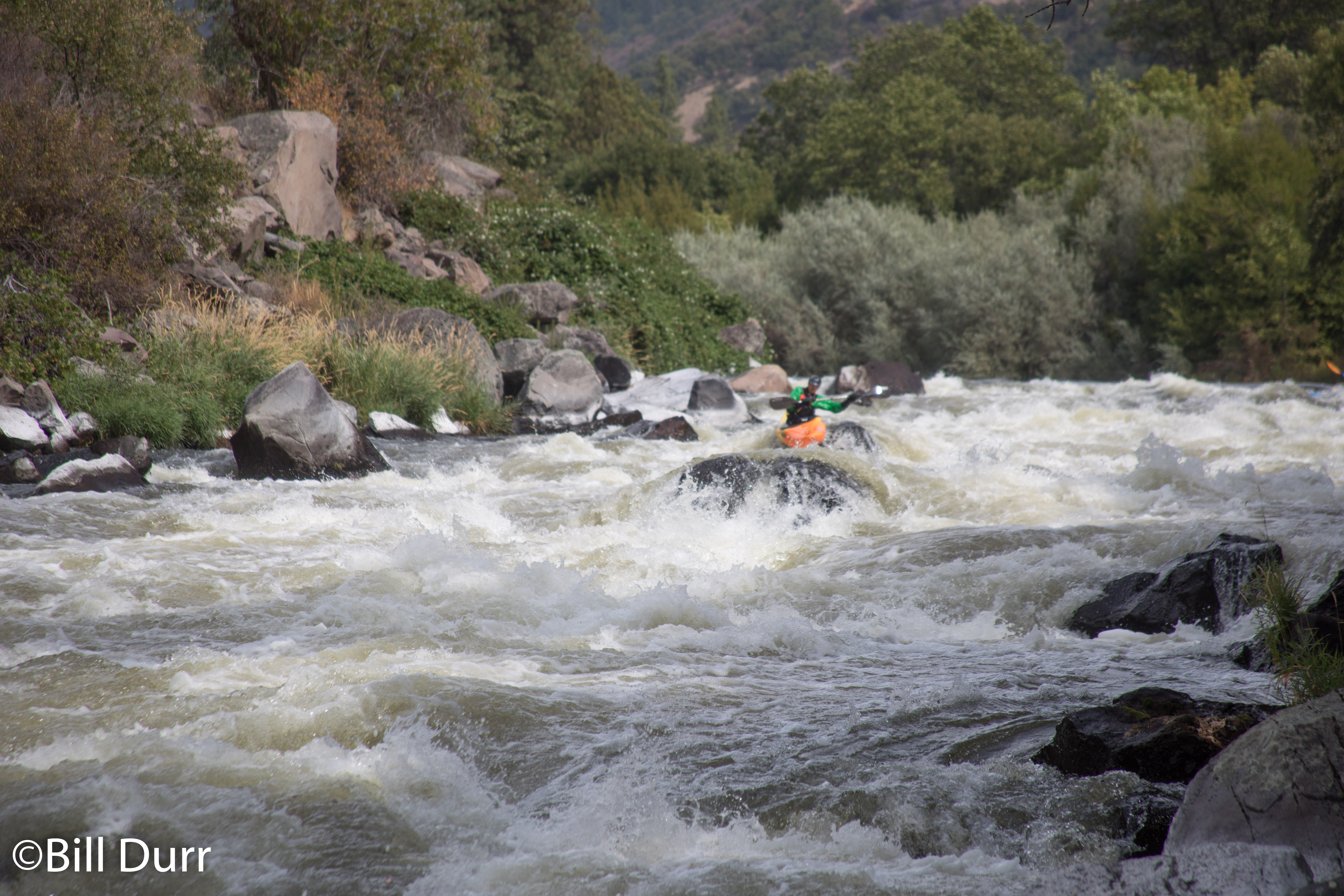
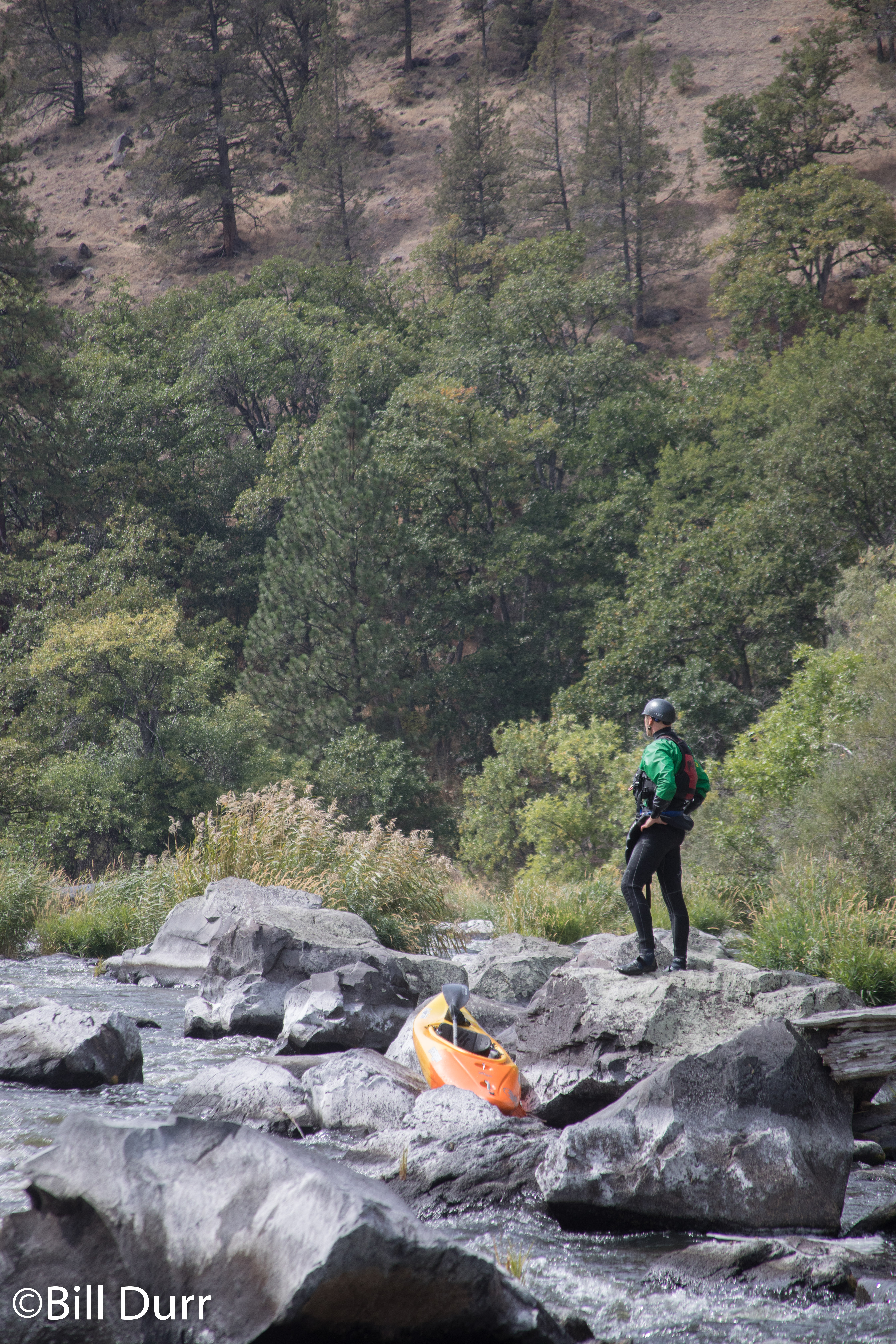
As we headed down, the beautiful canyon and difficult rapids continued. All were fun and the excitement kept up. We eventually got to Hells Corner, a nice large multi-stage class IV rapid. From the top where it drops off you are unable to see down the rapid as it’s blocked by a large boulder/pourover on the left and a smaller one to the right. I eddy hopped down as far as I could without entering to see if I could see a line from my boat. The lower position allowed me to see a between the boulders from right to left, that I could chain with what I saw slightly higher. I dropped in and threaded through the boulders to see a nice line to an eddy river right. Made my way over to it and jumped out to grab some photos.
Upon getting out of my boat I found that the rapid continued for quite some time, and I was probably only about a third of the way down at most. The river turned to the left at the bottom of this segment, with the busy water continuing until it turned back to the right and out of sight. No where in this did it seem like the rapid was beginning to let up. Matt came down after I had set up to grab photos and joined me on the shore to set safety. Once David had finished scouting, Todd came down to join us. Then David ran the rapid and blew right past us. We had no idea what the rest of the rapid looked like, and Todd continued on with David as Matt and I jumped into our boats.
Around the next corner was some nice 3/4ish run out and a nice eddy or two before the next rapid. The good class 3+ rapids continued as we went further down the river. In one of the rapids I ended up finding the FU rock. The river gave me the finger. I hit a nice pointy rock why rocketing down a rapid, giving my boat a little extra rocker. Eventually we came to the end of a very awesome run, thoroughly enjoying it. Before fetching the car from the put in we went further downstream to hunt for a hot spring we saw on the map. We eventually found it, but all that was there was a bunch of tall grass, and a concrete cap.
While the hot spring was a bust, there were plenty of blackberry bushes in the area. We also learned that taking out at access point 5 or 6 would probably be better. You get to paddle a couple more good rapids and there is no drive off the “road” to the river. We then made the trek back up out of the canyon and to Klamath Falls. On the way back we did some searching and discovered that the falls the town got its namesake from had been flooded under a dam. When back in town we stopped at Klamath Basin Brewing Company, which had a nice selection of beers on tap.
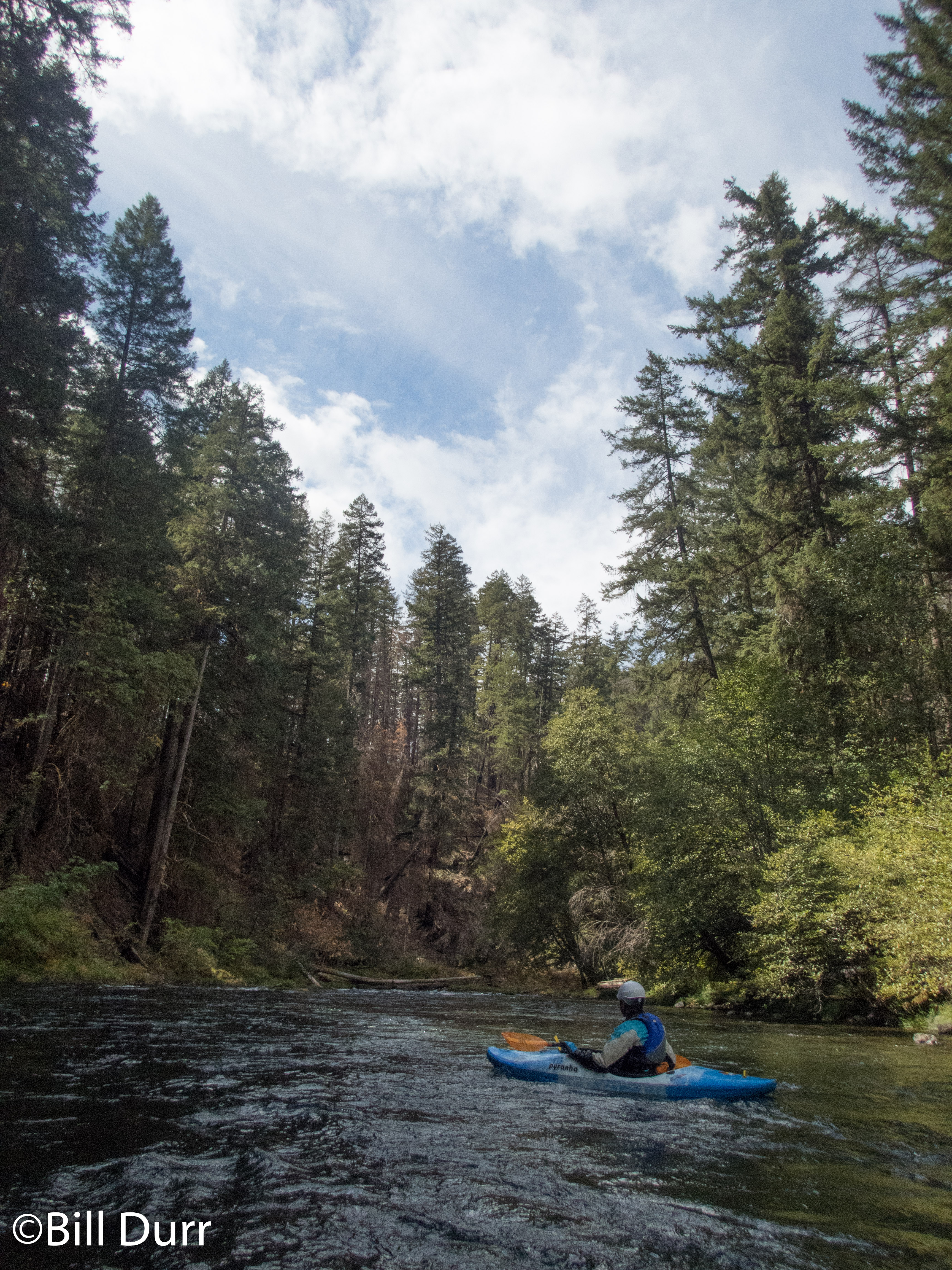
Woke up for day two and packed up for a couple days down through Oregon. The night before we had decided that the best option was to head south to follow the water as it was generally dry where we were. The eventual destination chose was the Klamath with a stop along the was to boat in Bend, Oregon. We were drawn in by the Deschutes which runs through downtown Bend. We had mostly finished up packing and Todd and I headed over to the Outdoorplay warehouse to see if I could find a replacement backband for my boat. They luckily had one in stock and were willing to help me out and sell me one direct from their warehouse. While acquiring the needed supplies a double rainbow appeared over the Columbia River, signs it would be a good day.
Deschutes River south of Warm Springs on US-26
That being done we headed back to the highway to meet back up with Dave and Matt. Once we had gathered them we proceeded to route 97 to head south, through nothingness and on to Bend. We passed through a small town in the desert that was at the upper reaches of the Deschutes. Around this time Todd and I realized we were running low on gas and this was probably the last gas station for a while (about 47 miles). We conferred and Dave though we could make it and the gas would be cheaper so we continued on. As the gauge decreased our apprehension increased. Relief came when we neared the town but is was short lived as the engine cut out about two miles outside of town. After a short wait Dave and Matt had a gas can and we were mobile again and heading to Bend.
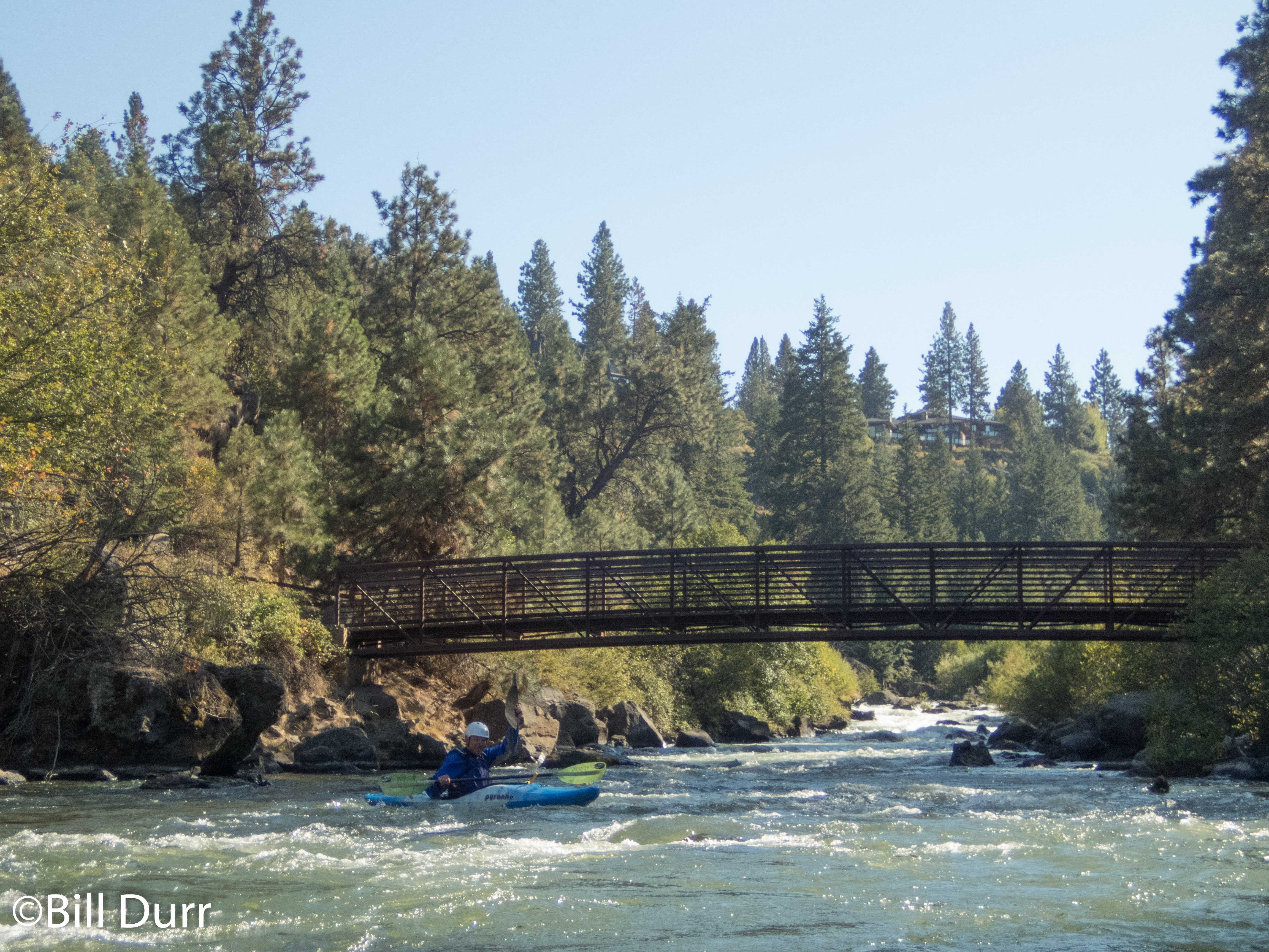
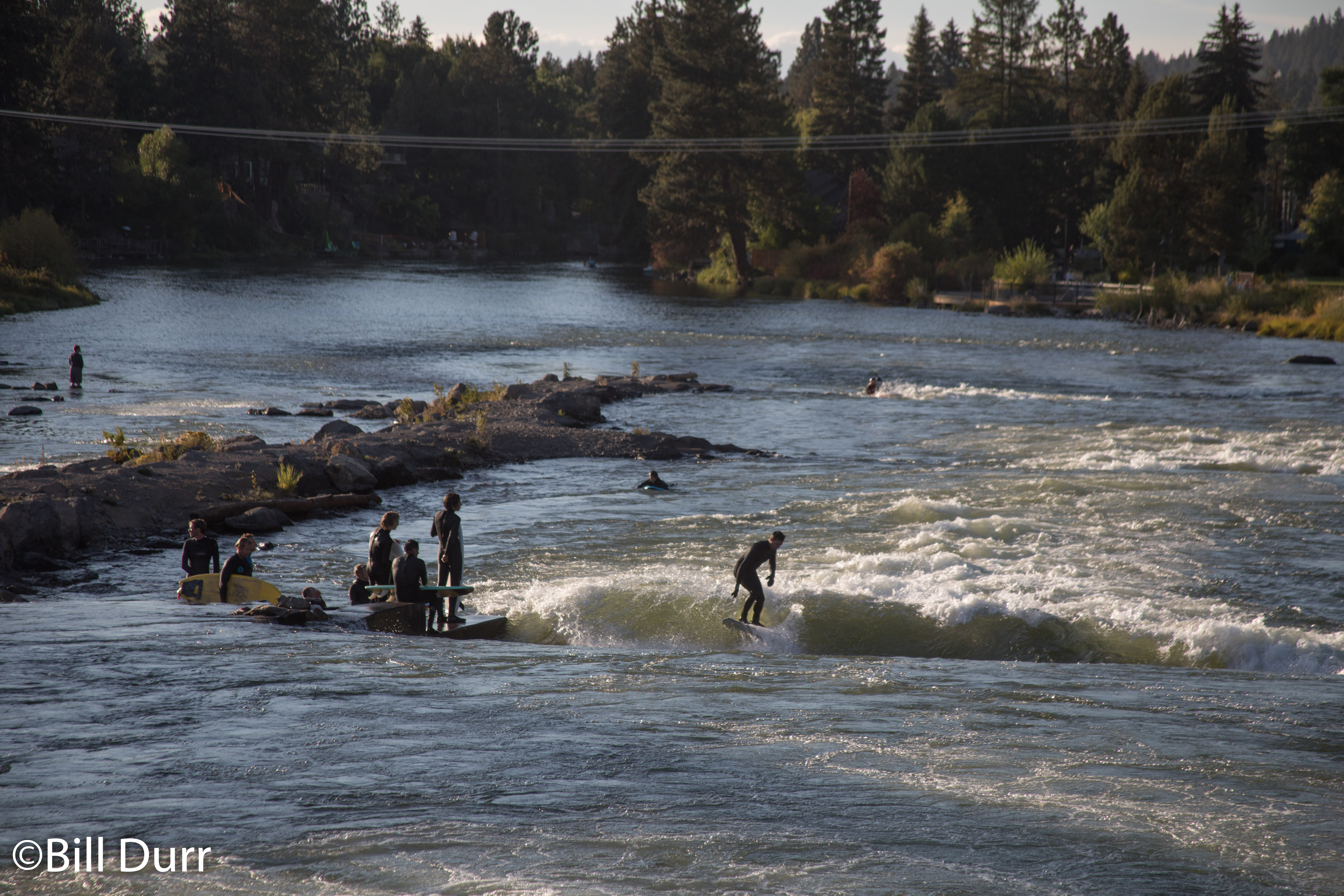
We pulled into Bend and shortly after leaving the highway we got to the take out. The water was flat and there were a multitude of people on SUPs. Upon getting to the put in, we discovered our chosen access point (a park, for the shortcamp variant) had been paved over to build a development along the river. After some deliberation we decided to follow a fence at the edge of the development down to the river. The hike was a bit of a painful traipse through bushes and brambles. Once on the river we were greeted by signs warning of dangerous falls and a trail on the other side of the fence that looked like a proper access point.
Scouting Playtime
Todd at the bottom of Playtime
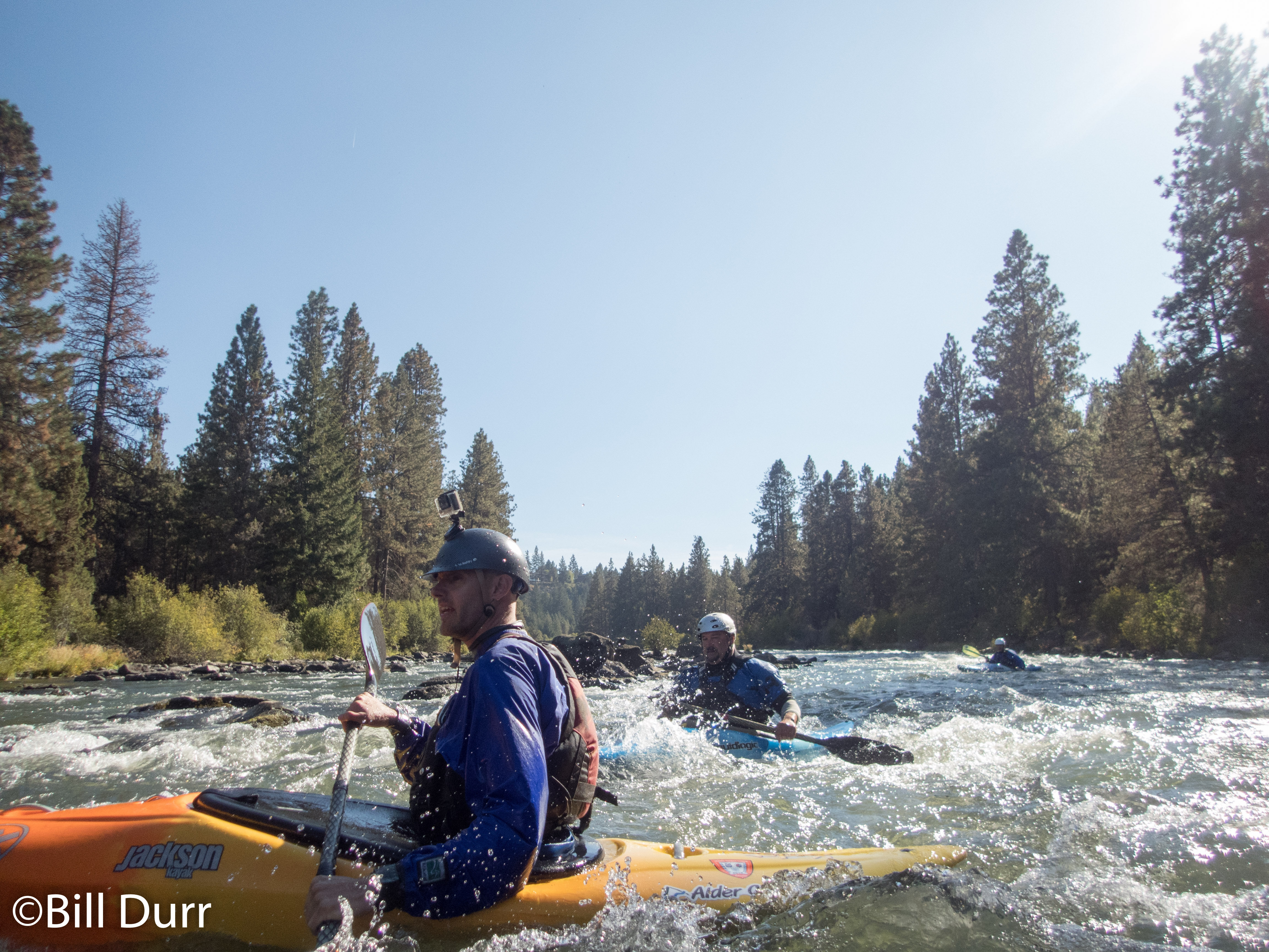
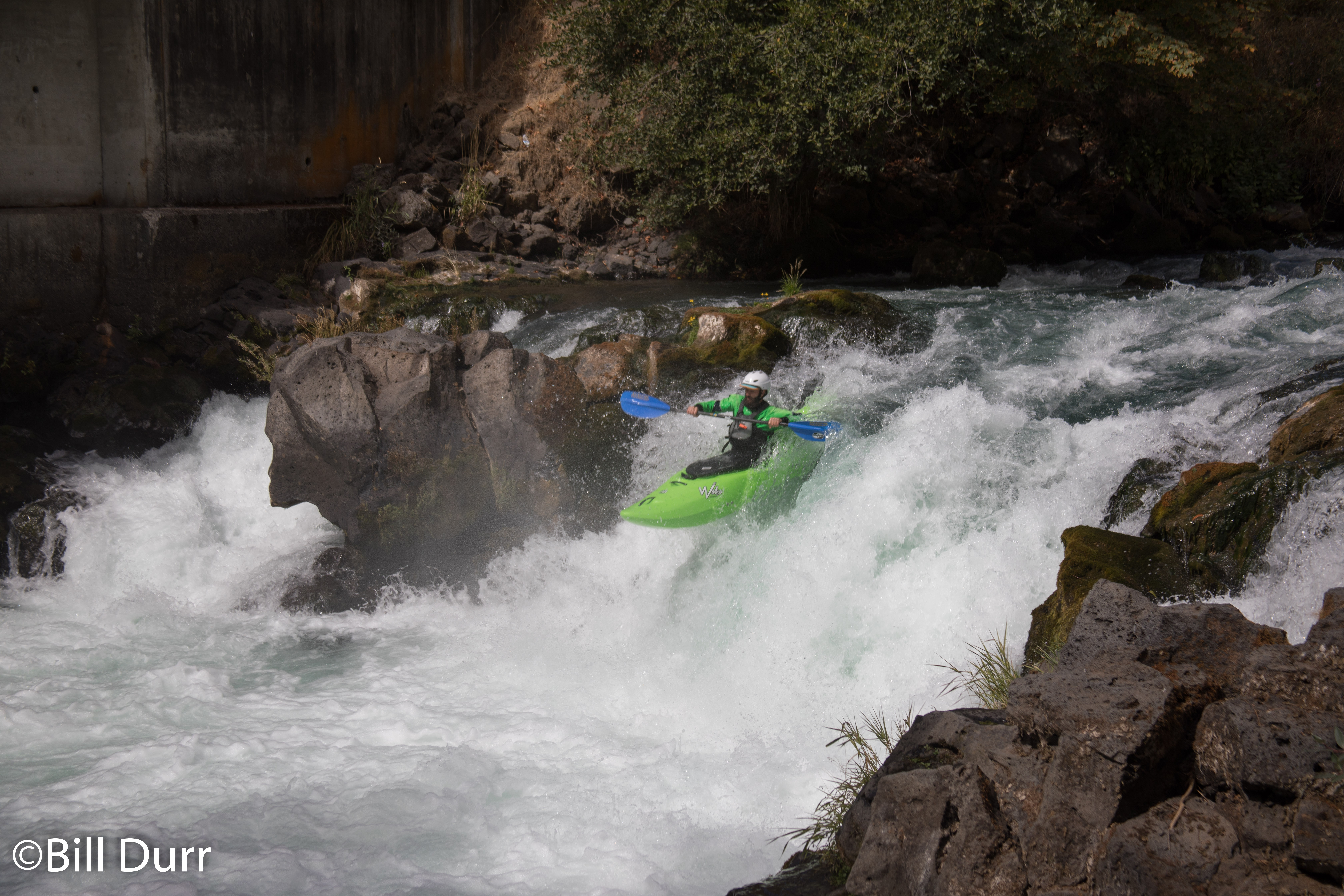
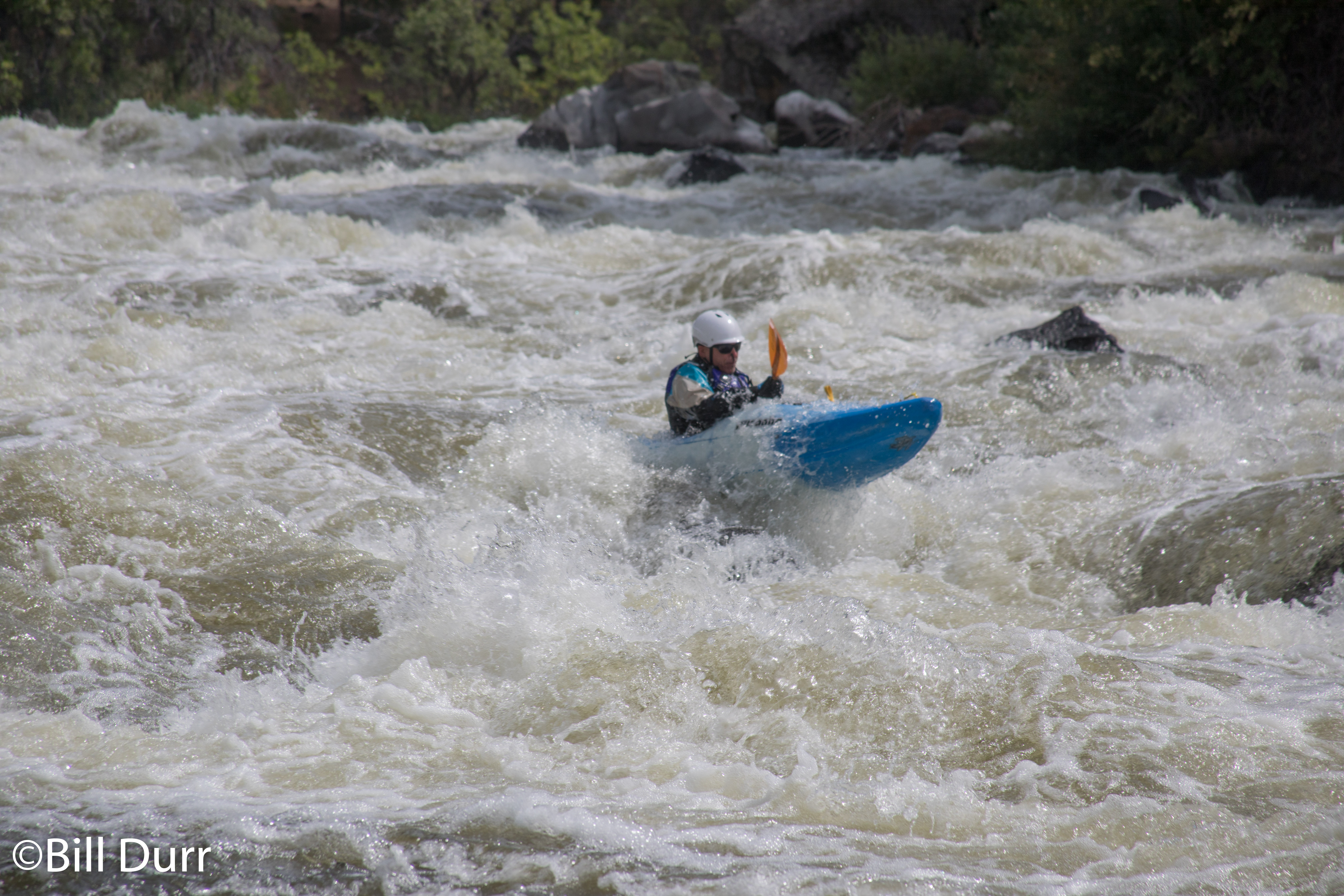
The river narrowed to a nice gorge and we came to the entrance rapid which was a series of drops with nice size holes that one could eddy hop down. Our initial impression was that it seemed a little bigger than class IV. After a short bit of moving flat we came to an intake structure and drop. After a bit we decided to go down the left side. I felt it was good to go this route as I could see down it from my boat. I ended up drying out on a rock as I cut my way back to the center. As soon as I hit the main flow I got rocketed forward at full speed. Missed the eddy I wanted to catch below a little tree on a rock and had to run the second half of the rapid. Todd’s line was even less clean. He got hung up on a rock, then flipped by another in the second half.
After this rapid came a fairly busy and difficult boulder garden. Dodged down and the second half was particularly busy. It had a number of holes one after another to weave through. David got flipped towards the end, and during one role attempt got knocked back down by a hole just as he was coming up. After a swim and recovery it was discovered that his paddle had broken. While not in two, it was still less than ideal to use. Todd decided to use it and in the next rapid it broke and he started to C1. At the next rapid it was decided that we should break out the break down. It turned out to be a one of the friendlier rapids, though still probably more than one would want with one blade.
Looking back at Marioland
100%
That turned out to be the last rapid and we made our way to the take out where we were once again greeted by a gaggle of SUPers. David ran quickly to get a new paddle at the kayak shop in town. Once we had collected everything, we headed there as well. We asked one of the guys there about the rapids and learned that the line we had take in the second rapid, which we now know is Dammit, was not the standard line. The drop in the middle is clean and people typically boof down the first part and the rest is clean. With this new knowledge we headed to take a peek at the whitewater park. Had a series of waves, one nice and glassy with a number of surfers. A lone kayaker was having fun on the bottom wave.
Whitewater park, lone kayaker in the distance
After grabbing dinner at Zydeco, we continued to head south on US-97. During dinner we decided that it was best to modify our plan and head to Klamath Falls instead of Crater Lake to camp as it would be 10 degrees warmer at night. After some time we rolled into the KOA, set up camp, and headed to sleep.
This year some friends were going out to the Pacific Northwest to paddle. I dithered for a bit on if I’d go and ended up deciding almost last minute to join. For a bit leading up to the trip the big question was how I’d get a boat out there. A couple days before the trip I did some lurking on craigslist and managed to find a used RPM Max for a good price. The guy was nice and I ended up with a boat waiting for me when I got off the plane.
Flew in too late to get to paddle anything, or really see much on the drive out to the cabin. So I was very impressed the first day, getting to see all the scenery as we drove around to set shuttle for the run of the day. The cabin is on the White Salmon and shuttle was short. After dropping a car at the take out and heading to the putin to start, I realized that I had forgot my dry top at the cabin. People reported that it would be cold, and I decided to go back and get it. Luckily it was a short drive and I was very happy with the decision. The water was some of the coldest end of summer water I’ve been in. Additionally it was a clear aqua color I’ve never seen.
The White Salmon was a beautiful run mostly in the class III realm. This stretches for a few miles until you reach Husum Falls which is about three quarters of the way through the run. This was a nice drop that did not look like a great place to get worked. As I got out to scout, the backband of my boat broke. I hadn’t quite gotten the boat dialed in and had been feeling a little off all the way down to Husum Falls. This seemed like a bit of a bad omen. We had caught up to another group of boaters there and got to watch there lines. Their first member didn’t have a clean line and did a nice back ender, and the rest were clean.
Husum Falls
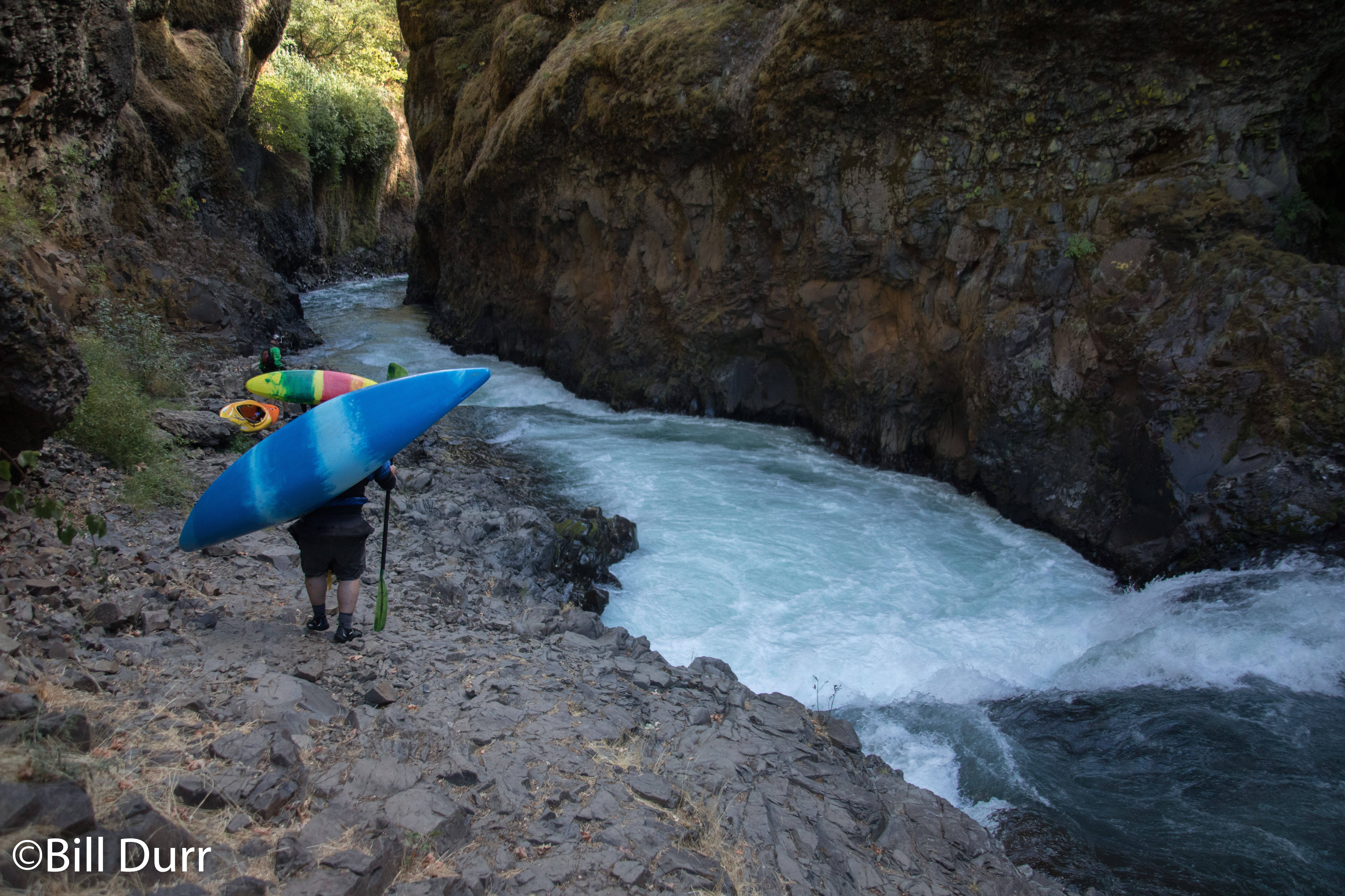
Todd, Joe, and I decided to run it and all had clean lines. Below Husum Falls things calm back down into the class III range. There was a small surf wave in one spot, and the stream remained mostly secluded until we drew near to the former dam site, where cabins started appearing. The cabins start to thin out and canyon wall start to appear. The rapids start to pick up and rock walls build up on the sides. In this area you eventually pass by the site of the old Condit Dam. Not much is left here. We could only find one cement slab. The canyon walls continue to grow and eventually you get to Steelhead rapid. We all portaged this and it did not look like a great place to be. I definitely did not have the boat to run it and there was decent potential for a nasty swim.
Another year, another great Week of Rivers with the Carolina Canoe Club. Got in a few new runs, not as many as I had hoped but really happy to have gotten on the Little in the Smokies. Always is good to get to see old friends and make new ones. I was happy the initial big rain that flooded out Smokey Mountain Meadows didn’t prevent WOR from happening, though am disappointed it wasn’t a bit wetter.
1600cfs release, stick gauge at beginning of middle said 3ft, a guide estimated 3000cfs
5.6mi
Most of the highlights of my week were the new runs. In addition to those, I did manage a couple really nice runs on rivers I had already seen. Managed to get both the Tellico and Ocoee in the same day. Just barely made it to the Ocoee with enough time, but the late start worked out good. Got to see it above normal release levels and it felt to have a bit more of a Gauley feel to it.
Little: Sinks to Elbow
Above sinks
It was truly a treat to get on this run, which was one that has been on my list for a few years. On a previous Week of Rivers I attempted to organize a trip out to it, but ended up spending an hour in the morning trying to contact the Park Service only to determine the road was closed. This year everything lined up and a trip was launched and it was well worth it. The area is very scenic and worth the trip just to check it out. The rapids are arranged such that the difficult ones are at the beginning and end, and it calms down in the middle.
Sinks
You start off at Sinks, which ends up being one of the most difficult rapids on the run. When we got there I had decided to walk up to run the lead in rapids, which are decently stout on their own. They add some good obstacles to mess you up before you even get to the main event. We wandered around scouting out everything. The whole time I was on the fence as to if I’d run it. While preparing, another boater from our area, Tim, showed up and he had just finished up his run. He told us that the move here was to throw a delayed boof and not to pencil in. To which my thought was, “my boat has one move, and this is pencil in.”
After some deliberation I decided I’d run it and a couple others were going to join me. As the instigator, I had the honor of running it first. Lined everything up, went down the chute, waited for my time, and pulled. Ended up getting down without any problems, and somehow managed to have the best line of our crew.
The pace keeps up for a little bit after sinks and the overall feel of the river is decently tight class IV creek for a little. There’s some nice gradient and some good boogie. Eventually you get to a spot where you come close to the road and then as the river veers away the intensity increases again. You work your way through a boulder garden of nice difficulty that will keep you on your toes. After this things calm down for a little, moving more towards the class 3ish realm. They start to pick up again, with a really nice smear boof. Then when you get to the end you come to the Elbow
The Elbow
When you get to the Elbow, you cannot quite see into the crux of the rapid from the water. We had met a local at the put in and he had lead us down. Our group was a little large and had split in two. We caught up to everyone at the Elbow. He told us a line and David and I decided to run with only that info and what we could see. While we ran it successfully, neither of us had a clean line as we did not get far enough to the left. I was flipped by the reactionary coming off the wall and washed past the undercut.
Big Laurel Creek
The rain that almost flooded out Smokey Mountain Meadows provided a little bit of a treat in the remaining flows that we found. I had the chance to get on Big Laurel, a nice class 3 intro to creeking kind of run that dumps you into the French Broad a little above the two good rapids. Other’s had run this on Saturday when I was driving down and I had heard good things from them. During the morning meeting I stepped up and announced a trip. There was overwhelming response and our group had to split up. Big Laurel has a number of good fun drops that can provide challenge to those stepping it up or new and fun for everyone else. Until you get to the French Broad it’s in a nice little canyon through the woods. We had an excellent crew, all of which had no issues with the run, though there was one gear malfunction. We even managed to pick up a swimmer from another group and get them down the rest of the run without any swims.
Chattooga, Section 4
While Section 4 is one I’ve run many times before, the quality of the run and scenery is so high, I cannot resist. Though the lake paddle out always makes me have second thoughts. Most times I have paddled it, the level has been around 1.6ft. Last year I had the opportunity to run it around 2ft and the level was great. This year the Chattooga watershed got a bunch of rain while we were there and I was able to run it at 2.15ft, the highest I’ve seen it at.
The hole that is Sock em Dog
I have to say that somewhere in the 2ish range is the sweet spot. Both that time and this were great. Everything was padded nicely, especially Corkscrew. At this level the line is very nice and you just float over everything. A nice sneak opens up far right at Crack in the Rock. I have much thanks to the photographer I was talking to at Corkscrew for telling me about it. I decided to run Sock em Dog, and unfortunately didn’t have a great line. At this level the boof starts disappearing, and places you in a big hole. I botched things a little and went down a little notch, landing right in the hole. Got a good working and swam out of it.
Nolichucky
In an earlier Week of Rivers, some had gone to the Noli at lower water and reported it to be lame. Due to this and it’s distance, I had not prioritized going to it. A few years passed and they went back at better levels and discovered it to be good. This year it presented me with the chance to see it for myself. I found it to be a wonderful run and definitely worth the current campaign to get it designated Wild and Scenic. It’s a spectacular part of the country.
People keep asking me to help them buy / pick out a laptop. I decided to write up my advice on it so I no longer have to repeat it to people.
First off when buying a laptop, one has to decide between three trade-offs being cost, performance, and build quality. You can only have two, never all three. cost is inversely related to the other two factors. Whenever you increase performance or build quality you will increase cost. I am viewing this as an inverse relationship because people typically want to keep costs down, a higher cost is considered a bad thing. This brings me to how I go about purchasing a laptop. When I start looking around, I start off with the specs and build quality I desire and try to tweak them to bring the cost of the laptop down. What most people seem to do is say “Whats the best laptop I can get for X”. This is the opposite of the process I follow and starts off with choosing a price and seeing the most one can get out of it.
Laptops fall into a couple of different cost brackets that roughly equate to power/build. They start off at around $350, with minimal specs and quality. These are commodity machines that will only really last about a year. Next comes laptops that range from about $450 – $550. Still commodity machines, but they will last you 1.5 – 2 years and be a bit more powerful. This bracket is typically the price range people ask me to recommend a laptop in. Both of the mentioned types of machines are only really good for things like browsing the web or editing documents in office suites. (But not doing data manipulation in them. I’m looking at you, people who use spreadsheet software to manipulate/analyze data.) They will do an ok job of watching videos on youtube or DVDs, however they will have issues with HD content. This will be based on how much you spend, although the lower end systems are getting better at handling HD. These laptops are not meant for doing real work, computation, or playing games. They will be however serve as a fine remote terminal for running software on a power system to do real work. IE something over Citrix, SSH, or some similar technology.
Then we come to the two brackets of machines that are meant for doing actual work (I am not saying that writing papers isn’t actual work, just that its not computationally intensive) and playing games. First we start off with the systems that run from about $700 – $850. These will last you about 1.5 – 2.5 years and will be able to play games, watch HD video, and do work that needs some number crunching power. Then you have the high end machines that range from $1000 – $2000 and will last you about 2 – 3 years. They will be able to run computations quicker and play games on middle to max settings. This bracket is where I typically end up purchasing a laptop from.
Now some notes on buying better hardware and getting better quality. First off stay with Intel chips. While they cost more they have much better performance and are more efficient. AMD chips used to have a better price/performance ratio but it hasn’t been that way in a while. Look for a machine that has a hinge that is the whole length of the clamshell portions or is metal. Get dedicated graphics if you can, they are always better than the integrated stuff. Areas where you can save some money by going with the lesser option and upgrading after the fact are RAM and the disk drive. However price the upgrade cost against the cost the manufacturer has, sometimes it is cheaper to get the part from the manufacturer. A metal laptop will last longer than one made from plastic, however there are not many companies that make these. A good alternative is a machine that meets MIL specs, like the Lenovo ThinkPads.
Laptops can last anywhere from 1 – 5 years, depending on all sorts of factors. Since they are mobile they will undergo more wear and tear. Things that wear out over time are the hinges, disk drive, fans, battery, and cables. Based on usage these will go sooner or later. Backblaze has gathered some good statistics on how long hard drives last http://blog.backblaze.com/2013/11/12/how-long-do-disk-drives-last/. Expect drives to go quicker then they did because the drives will be bounced around.
I am also asked about what brand to purchase. I am currently a fan of Lenovo ThinkPads and Asus, previously I also liked HPs. Lifehacker has some good info comparing build quality and customer service http://lifehacker.com/computer-manufacturers-ranked-how-to-pick-a-laptop-tha-1467145338. If you’re looking for something that will last forever, get a ToughBook. They cost more and have lesser specs, but are build to last. Apple machines have decent quality but cost about twice as much as they should. Avoid things from Dell.
Drove up to Keene on Friday and setup camp so we could get a decent start the next morning. We spent the night around the fire and fell asleep to the sounds of waterfalls. Awoke the next morning to discover the place we decided to camp was really nice. Had a great swimming hole behind it.
The morning go off to a slow start. It took a while for the group to get going. Mike and I went into Keene and grabbed some coffee at Noonmark Diner and then went over to The Mountaineer. Sadly they didn’t have any good deals on gear. We then headed to the trailhead to see if the rest of our group had started off. Got there and discovered that everyone had already started up the mountain. Mike and I started off and ran into a couple of people along the way. We discovered that we were not too far behind the rest of our group. Ran into the rest of the group after a trail junction for a campsite at a lake that the trail went past.
The group stopped at the lean-to for a break. Another group had already claimed the leanto so we decided to grab one of the campsites near by. The area had a treasure chest that was made for an Eagle project for a scout from a local troop. Lunch was made at back at the lean-to, which was along side of a small stream. We had a potato, cheese, and summer sausage dish. It ended up being a little bit soupy but still tasted great. Rich and Matt decided they wanted to set up a tent because it looked like there might be some impending rain on the horizon. Mike, Jenna, Matt’s friend Amy, and I decided to start heading up the trail instead.
Part of the way up the mountain the trail opened up to a large smooth rock that had a little water flowing down it. We met a group of people resting on the rock, they turned out to be the group who had gotten the lean-to. They were an outing group from a college in Vermont going on their first event for the semester. We decided to stop and take a break for a little while and talked with them. We lost Matt’s friend, but while waiting Rich and Nick caught up to us. They informed us that Matt was hiking with Amy.
From the outing club we learned that the rock paralleled the trail for a while up the mountain. Most of us decided to take the rock up. Nick choose to take the trail. We used this to help us keep track of where the trail was. When the rock started narrowing and it was getting harder to stay in touch with Nick we broke right from the rock. This ended up being a great spot to head back to the trail as it wasn’t too far away and it was starting to turn more right. The trail was slightly worse for going upwards than the rock. At one point while hiking up, I felt a sharp pain on my calf. At first I though it was just a pointy stick, but then looked down and discovered that I had been stung by a wasp. Looking around I found the wasp nest was a hole in the base of a stump in the middle of the trail. Warned the rest of the group about its existence.
Jenna and I had broken away from the group and eventually got to a trail junction. The trees had begun to thin and it was starting to become windy. We waited for Mike to catch up with us and then for Rich and Nick. Tried to get Rich to head down the wrong trail to the other side of the mountain, but he didn’t fall for it. Took advantage of the stop to put on some warmer clothes in preparation for the windy summit. Once ready we headed out, but we decided to not wait for Matt and Amy.
Knew that we were getting near the summit, due to the thinning trees and the fact that we passes some signs about entering an alpine zone. The top was covered in very short trees and some boulders. We were afforded some nice views of the surrounding Adirondacks. We could see Elk lake and the other mountains in the Dix range that we did on the snowshoe from hell. Celebrations begun once we got to the large rock outcropping that had a survey marker on top of it.
Rich had carried up two bottles of champagne. One quickly ended up poured all over him, but it was hard to tell how much got on him and how much was blown away in the wind. The second bottle was passed around and shared among the group. A couple had also hiked up to the top and we included them in our festivities. The bottle of honey whiskey was then broken out and we took turns taking shots. Mike commented that Rich started out his quest for the 46 with the weather in similar conditions. He started with Cascade and the wind was strong enough you could lean into it and use it to support one’s self. The conditions on top of Dix were similar this day and Rich completed his quest by leaning into the wind. Plenty of photos were taken as we romped around the rocky summit and took shelter behind it. Mike started reminiscing about how he conquered the 46 and started pointing out different mountains and stories were shared.
After a good deal of time on the top once everyone started getting cold (and half the bottle of whiskey was gone) we decided to start heading down. The hope was we might finish our decent before sunset. We found Matt and Amy when we got to the edge of the summit, surprised they made it to the summit. Jenna and I broke away from the group and made our way down quickly. We got to the lean-to before dark and found the outing club preparing their dinner. I sat down in the clearing in front of the lean-to and started to make some quesadillas while waiting for the others. Rich, Nick, and Mike showed up around a half hour to 45 minutes after we got to the lean-to, just as it was starting to get dark.
Prepared them some quesadillas while Rich and Mike started preparing dinner. We had mac and cheese with onions and summer sausage. For desert Jenna had brought some delicious oreo brownies that she had made. We were very surprised that the outing club had already headed to sleep in their lean-to. After dinner, Jenna, Mike, and I decided to hike out because of obligations in the morning. Got in a nice night hike out to the cars back on the main road.
Woke up early so we could catch the YARTS bus back into Yosemite. Went and got breakfast at the Breakfast Club since the hotel breakfast stunk. Place had good baked goods. Spent some time here before we wandered over to the bus stop to wait. Rich got McDonald’s. The bus ride was pretty uneventful and consisted mostly of reading.
Once back at Yosemite, we grabbed some lunch and looked around the shop. We then went and visited the exhibits that we did not check out when we were first here. Started with the Ansel Adams gallery. It was less impressive than I expected and was mostly there to sell prints of his work and of some modern photographers. The next thing we went to was the Yosemite museum. It had some interesting displays on various aspects of the park. Ranging from the geology, to the effort to establish it, to how peoples’ visits over the years have change. Also watched a movie on the ‘Spirit of Yosemite’. Honestly wouldn’t have gone to see it if we didn’t have 3 hours to sit around. Turned out to be good.
Grabbed another YARTS bus, this time headed to Merced. Even leaving the park the views were impressive. The bus ride once again was filled with reading. At one point during the ride, Rich and I started talking a bit. Some grumpy old man complained that we were talking and that he wanted to rest. Last time I checked you were allowed to talk in public places like buses. From Merced we took the Amtrak train back to San Francisco. The train was packed and the car we ended up in didn’t have properly working air conditioning.
We got back to San Francisco late, and just barely ended up getting into an Indian resturant before they closed to get dinner. Decided to stay at a different hostel because the first one wasnt that great. Ended up just down the street at the Hosteling International San Francisco Downtown Hostel. The place was much nicer than the previous hostel, this one was actually maintained.
Today we woke up in Mammoth mountain. We followed our typical morning schedule of taking about two hours to get up and out of bed. When we awoke we talked about what to do for the day. There had been some question of what to do for the day. None of us were willing to wake up early this day to catch the bus to Yosemite. Ended up reserving the room for another day so we had somewhere to say in Mammoth Lakes.
The free breakfast provided by the hotel was pretty lame. Some orange juice, coffee, and small muffins and donuts. So, we went in search of food for the day. I personally wanted to get lunch but we ended up wandering into a place that was still serving breakfast. I got french toast and a Bloody Mary to eat. We spent some time time there eating, Rich got nothing to eat. After this we headed up to the village portion of town to check out the Octoberfest that was happening today. It ended up being more lame than we expected it to be. It was quite small and the beer they had was overpriced. Our boredom led us back to the hotel, and we went across the street to the hot tub (our hotel’s hot tub was closed for maintenance and they had a deal with the neighboring hotel). It turned out to be more of a lukewarm pool than a hot tub.
After this we returned to our room and watched some movies on TV until we went to go and get dinner. Ended up stopping at a place we passed by the day before, Base Camp Cafe. Turned out to have some really great food there. Had a good sandwich and some of Mammoth Brewing Co Epic IPA. After dinner Rich and I went to a bar for another beer while Mike went back to the room and packed for a bit. When Rich and I returned, the three of us played a couple rounds of ERF. The neighbors complained that we were “playing basketball”, so we had to stop playing cards. We then got some rest before our long day of travel ahead.
![PNW day 3: Klamath [Hell’s Corner]](https://www.billdurr.com/wp-content/uploads/2018/09/2T2A0424-1-1200x800.jpg)

![PNW Day 2: Deschutes [Meadowcamp]](https://www.billdurr.com/wp-content/uploads/2018/09/P9100003-1-1200x900.jpg)